
| Memorials | : | 2 |
| Location | : | Krabbendijke, Reimerswaal Municipality, Netherlands |
| Coordinate | : | 51.4315990, 4.1067807 |
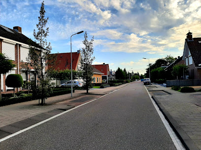
| Description | : | General Cemetery Krabbendijke. Have not yet found since when the cemetery is in use. The oldest headstone dates from 26-05-1883. The majority of the headstones date from the twentieth century. |
frequently asked questions (FAQ):
-
Where is Krabbendijke General Cemetery?
Krabbendijke General Cemetery is located at Dorpsstraat 97 Krabbendijke, Reimerswaal Municipality ,Zeeland , 4413 CDNetherlands.
-
Krabbendijke General Cemetery cemetery's updated grave count on graveviews.com?
2 memorials
-
Where are the coordinates of the Krabbendijke General Cemetery?
Latitude: 51.4315990
Longitude: 4.1067807
Nearby Cemetories:
1. Begraafplaats Memento Mori
Waarde, Reimerswaal Municipality, Netherlands
Coordinate: 51.4202400, 4.0657000
2. Kruiningen General Cemetery
Kruiningen, Reimerswaal Municipality, Netherlands
Coordinate: 51.4488400, 4.0277900
3. Yerseke General Cemetery
Yerseke, Reimerswaal Municipality, Netherlands
Coordinate: 51.4949200, 4.0455800
4. Begraafplaats De Boschburg
Yerseke, Reimerswaal Municipality, Netherlands
Coordinate: 51.4970586, 4.0475950
5. Schore Algemene Begraafplaats
Schore, Kapelle Municipality, Netherlands
Coordinate: 51.4658500, 3.9969800
6. Kloosterzande General Cemetery
Kloosterzande, Hulst Municipality, Netherlands
Coordinate: 51.3644390, 4.0211730
7. Willibrorduskerk v.m.
Ossenisse, Hulst Municipality, Netherlands
Coordinate: 51.3888248, 3.9803445
8. Algemene begraafplaats Graauw
Graauw, Hulst Municipality, Netherlands
Coordinate: 51.3288902, 4.1029752
9. Biezelinge Algemene Begraafplaats
Biezelinge, Kapelle Municipality, Netherlands
Coordinate: 51.4777300, 3.9575600
10. H. Catharina Church Cemetery
Hengstdijk, Hulst Municipality, Netherlands
Coordinate: 51.3467612, 3.9979042
11. Wemeldinge Algemene Begraafplaats
Wemeldinge, Kapelle Municipality, Netherlands
Coordinate: 51.5126200, 3.9883100
12. Kapelle French Military Cemetery
Kapelle, Kapelle Municipality, Netherlands
Coordinate: 51.4877370, 3.9482423
13. Het Oude Woensdrechtse kerkhof
Woensdrecht Municipality, Netherlands
Coordinate: 51.4307391, 4.2992280
14. Oude Begraafplaats
Sint Maartensdijk, Tholen Municipality, Netherlands
Coordinate: 51.5510907, 4.0775650
15. Hoedekenskerke Waardweg Cemetery
Hoedekenskerke, Borsele Municipality, Netherlands
Coordinate: 51.4224100, 3.9129400
16. Hoedekenskerke Old Churchyard
Hoedekenskerke, Borsele Municipality, Netherlands
Coordinate: 51.4235320, 3.9121413
17. Rooms Katholieke Begraafplaats Terhole
Terhole, Hulst Municipality, Netherlands
Coordinate: 51.3168364, 4.0360870
18. Algemene Begraafplaats
Tholen Municipality, Netherlands
Coordinate: 51.5379869, 4.2241721
19. Sint-Gertrudiskerk
Bergen op Zoom, Bergen op Zoom Municipality, Netherlands
Coordinate: 51.4944526, 4.2878751
20. Lenshoekdijk Old
's-Gravenpolder, Borsele Municipality, Netherlands
Coordinate: 51.4554900, 3.9012800
21. 's-Gravenpolder Algemene Begraafplaats
's-Gravenpolder, Borsele Municipality, Netherlands
Coordinate: 51.4556100, 3.9003500
22. Begraafplaats Vogelwaarde
Vogelwaarde, Hulst Municipality, Netherlands
Coordinate: 51.3241630, 3.9851875
23. Kloetinge General Cemetery
Kloetinge, Goes Municipality, Netherlands
Coordinate: 51.4971500, 3.9232100
24. RK Begraafplaats
Nieuw-Borgvliet, Bergen op Zoom Municipality, Netherlands
Coordinate: 51.4770025, 4.3055294