
| Memorials | : | 15 |
| Location | : | Shawell, Harborough District, England |
| Coordinate | : | 52.4123910, -1.2055290 |
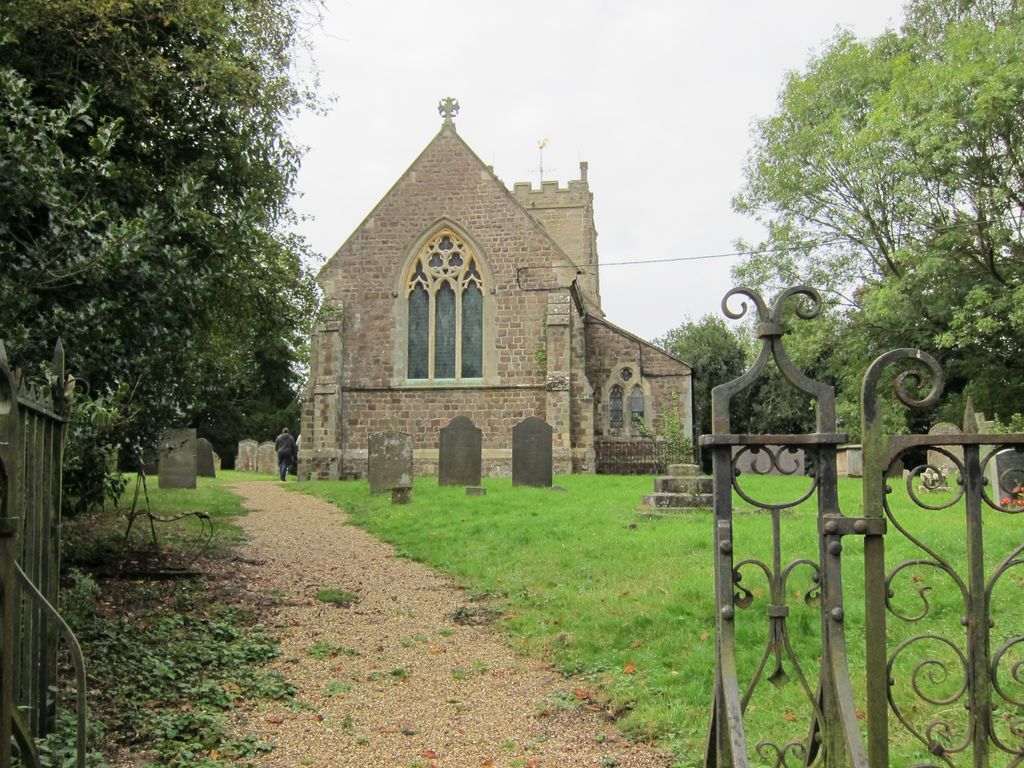
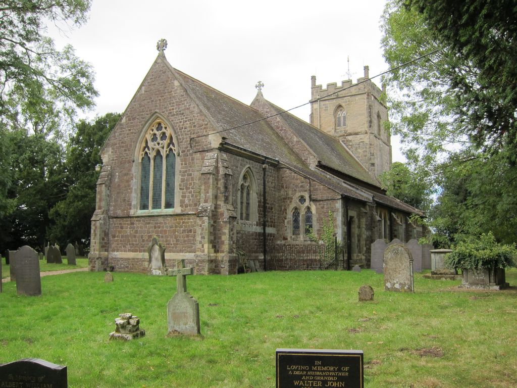
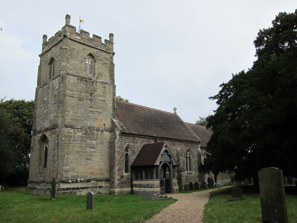
| Description | : | Shawell is a small village in the Harborough district of Leicestershire, less than a mile from the M1 and M6 motorways. The church of All Saints is grade II listed. It has a 15th century tower, with the rest rebuilt in 1865-6 by William Smith. It has a ground floor ring of six bells. |
frequently asked questions (FAQ):
-
Where is All Saints Churchyard?
All Saints Churchyard is located at Church Lane Shawell, Harborough District ,Leicestershire , LE17 6ALEngland.
-
All Saints Churchyard cemetery's updated grave count on graveviews.com?
15 memorials
-
Where are the coordinates of the All Saints Churchyard?
Latitude: 52.4123910
Longitude: -1.2055290
Nearby Cemetories:
1. St. Thomas Churchyard, Catthorpe
Catthorpe, Harborough District, England
Coordinate: 52.3986350, -1.1900710
2. Swinford cemetery
Swinford, Harborough District, England
Coordinate: 52.4088297, -1.1695096
3. St Mary's Churchyard
Cotesbach, Harborough District, England
Coordinate: 52.4371220, -1.2085910
4. All Saints Churchyard
Swinford, Harborough District, England
Coordinate: 52.4099260, -1.1642830
5. All Saints Churchyard
Lilbourne, Daventry District, England
Coordinate: 52.3919370, -1.1778810
6. Clifton-Upon-Dunsmore Cemetery
Clifton upon Dunsmore, Rugby Borough, England
Coordinate: 52.3857800, -1.2197400
7. Lilbourne Burial Ground
Lilbourne, Daventry District, England
Coordinate: 52.3885400, -1.1792400
8. Holy Trinity Churchyard
Churchover, Rugby Borough, England
Coordinate: 52.4229460, -1.2506850
9. St. Mary's Churchyard
Clifton upon Dunsmore, Rugby Borough, England
Coordinate: 52.3830220, -1.2208600
10. St. Michael & All Angels Churchyard
Rugby Borough, England
Coordinate: 52.3920240, -1.2540180
11. Greenhaven Woodland Burial Ground
Lilbourne, Daventry District, England
Coordinate: 52.3881390, -1.1545970
12. St Leonard Churchyard
Misterton, Harborough District, England
Coordinate: 52.4510630, -1.1818140
13. St Nicholas' Churchyard
Stanford on Avon, Harborough District, England
Coordinate: 52.4045560, -1.1362100
14. Saint Mary's Churchyard
Lutterworth, Harborough District, England
Coordinate: 52.4554750, -1.2023830
15. St. Nicholas's Churchyard
Stanford-on-Avon, Daventry District, England
Coordinate: 52.4045020, -1.1359770
16. Whinfield Cemetery
Rugby, Rugby Borough, England
Coordinate: 52.3718560, -1.2353290
17. St. John's Baptist Churchyard
Hillmorton, Rugby Borough, England
Coordinate: 52.3659310, -1.2113290
18. Clifton Road Cemetery
Rugby, Rugby Borough, England
Coordinate: 52.3722330, -1.2483020
19. St. Andrew's Churchyard
Rugby, Rugby Borough, England
Coordinate: 52.3726220, -1.2612630
20. St. Andrew's Churchyard
Clay Coton, Daventry District, England
Coordinate: 52.3871456, -1.1290185
21. Watts Lane Cemetery
Rugby, Rugby Borough, England
Coordinate: 52.3592560, -1.2133530
22. St Botolph's Churchyard
Rugby, Rugby Borough, England
Coordinate: 52.3895850, -1.2864420
23. Rugby School Chapel
Rugby, Rugby Borough, England
Coordinate: 52.3703890, -1.2639150
24. St Mary Churchyard
Bitteswell, Harborough District, England
Coordinate: 52.4679220, -1.2105000