
| Memorials | : | 0 |
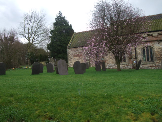
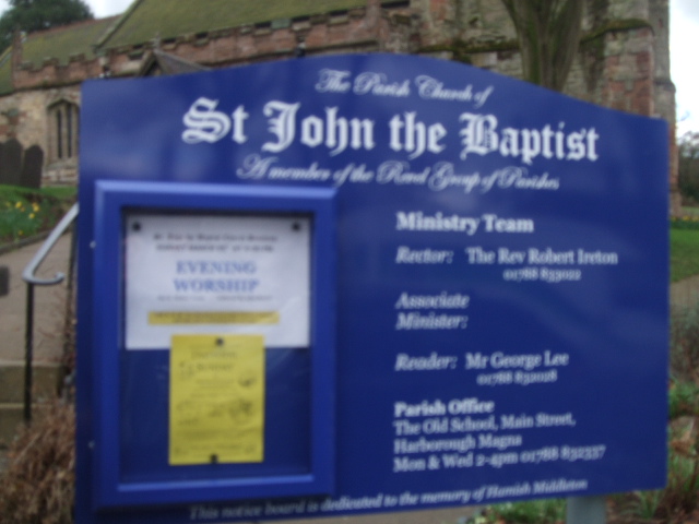
| Location | : | Brinklow, Rugby Borough, England |
| Coordinate | : | 52.4130320, -1.3590600 |
frequently asked questions (FAQ):
-
Where is St John the Baptist Churchyard?
St John the Baptist Churchyard is located at Brinklow, Rugby Borough ,Warwickshire ,England.
-
St John the Baptist Churchyard cemetery's updated grave count on graveviews.com?
0 memorials
-
Where are the coordinates of the St John the Baptist Churchyard?
Latitude: 52.4130320
Longitude: -1.3590600


Nearby Cemetories:
1. Brinklow Cemetery
Brinklow, Rugby Borough, England
Coordinate: 52.4161320, -1.3556710
2. Congregational Chapel Burial Ground
Stretton under Fosse, Rugby Borough, England
Coordinate: 52.4290070, -1.3381370
3. St Peter's Churchyard
Church Lawford, Rugby Borough, England
Coordinate: 52.3832600, -1.3355600
4. Harborough Magna Cemetery
Harborough Magna, Rugby Borough, England
Coordinate: 52.4094260, -1.3021660
5. All Saints Church
Harborough Magna, Rugby Borough, England
Coordinate: 52.4092160, -1.3007650
6. St. Edith Churchyard
Monks Kirby, Rugby Borough, England
Coordinate: 52.4439800, -1.3192500
7. St Edith's Churchyard
Monks Kirby, Rugby Borough, England
Coordinate: 52.4444360, -1.3195900
8. St Margaret's Churchyard
Wolston, Rugby Borough, England
Coordinate: 52.3783460, -1.3996960
9. St. John's Churchyard
Long Lawford, Rugby Borough, England
Coordinate: 52.3835940, -1.3071930
10. Dyers Lane Cemetery
Wolston, Rugby Borough, England
Coordinate: 52.3742591, -1.3921321
11. All Saints Churchyard
Withybrook, Rugby Borough, England
Coordinate: 52.4574170, -1.3626220
12. St Joseph's Roman Catholic Cemetery
Monks Kirby, Rugby Borough, England
Coordinate: 52.4479540, -1.3111280
13. Saint James Parish Churchyard
Ansty, Rugby Borough, England
Coordinate: 52.4498190, -1.4132490
14. St Botolph's Churchyard
Rugby, Rugby Borough, England
Coordinate: 52.3895850, -1.2864420
15. St Andrew's Churchyard
Shilton, Rugby Borough, England
Coordinate: 52.4556900, -1.4071560
16. Shilton Cemetery
Shilton, Rugby Borough, England
Coordinate: 52.4560640, -1.4076450
17. St Bartholomew Churchyard
Binley, Metropolitan Borough of Coventry, England
Coordinate: 52.4031820, -1.4468110
18. Walsgrave-on Sowe Cemetery
Walsgrave on Sowe, Metropolitan Borough of Coventry, England
Coordinate: 52.4420000, -1.4498100
19. Croop Hill Cemetery
Rugby, Rugby Borough, England
Coordinate: 52.3701510, -1.2829420
20. St Mary Magdalene Wyken
Coventry, Metropolitan Borough of Coventry, England
Coordinate: 52.4236580, -1.4620770
21. Lentons Lane Cemetery
Coventry, Metropolitan Borough of Coventry, England
Coordinate: 52.4476000, -1.4469500
22. St Mary Magdalen
Coventry, Metropolitan Borough of Coventry, England
Coordinate: 52.4236750, -1.4621960
23. St Leonard's Churchyard
Ryton-on-Dunsmore, Rugby Borough, England
Coordinate: 52.3674940, -1.4338580
24. Barnacle Chapel Churchyard
Rugby Borough, England
Coordinate: 52.4590430, -1.4350380