
| Memorials | : | 10 |
| Location | : | Independence, Grayson County, USA |
| Coordinate | : | 36.6042160, -81.2484510 |
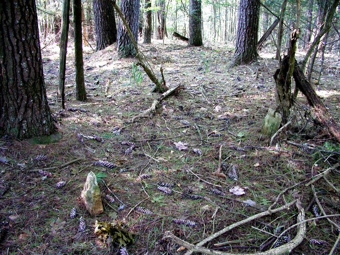
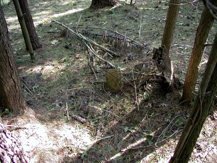
| Description | : | Directions: On Gold Hill Rd (Rt. 711) from old Gold Hill Baptist Church go 1/2 mi south and then left on an old community road about 1 mi through the woods toward Bridle Creek. The cemetery is on right of trail. (i.e., take old logging road to northeast about 1 mi). |
frequently asked questions (FAQ):
-
Where is Hash-Shaver Cemetery?
Hash-Shaver Cemetery is located at Route 711 Independence, Grayson County ,Virginia , 24348USA.
-
Hash-Shaver Cemetery cemetery's updated grave count on graveviews.com?
0 memorials
-
Where are the coordinates of the Hash-Shaver Cemetery?
Latitude: 36.6042160
Longitude: -81.2484510
Nearby Cemetories:
1. Gold Hill Cemetery - Old
Independence, Grayson County, USA
Coordinate: 36.6035900, -81.2601310
2. Silas Ward Family Cemetery
Bridle Creek, Grayson County, USA
Coordinate: 36.5944650, -81.2447570
3. Isom Cox Cemetery
Grayson County, USA
Coordinate: 36.5927590, -81.2487870
4. Rose Family Cemetery
Bridle Creek, Grayson County, USA
Coordinate: 36.6138220, -81.2401380
5. Gold Hill Cemetery
Independence, Grayson County, USA
Coordinate: 36.6074630, -81.2640310
6. James P. Hash Cemetery
Independence, Grayson County, USA
Coordinate: 36.6074630, -81.2640310
7. A B Cox Cemetery
Fox, Grayson County, USA
Coordinate: 36.6154450, -81.2567280
8. Bridle Creek Cemetery
Independence, Grayson County, USA
Coordinate: 36.6177260, -81.2445850
9. Enoch W. Cox Family Cemetery
Elk Creek, Grayson County, USA
Coordinate: 36.5900000, -81.2500000
10. Grace Freewill Baptist Church Cemetery
Independence, Grayson County, USA
Coordinate: 36.6187458, -81.2531391
11. Osborne Fort Cemetery
Bridle Creek, Grayson County, USA
Coordinate: 36.6009430, -81.2295110
12. Jacob G Kirk Cemetery
Bridle Creek, Grayson County, USA
Coordinate: 36.6043810, -81.2725240
13. Reed Cox Cemetery
Bridle Creek, Grayson County, USA
Coordinate: 36.6174390, -81.2661810
14. Oak Grove Cemetery
Independence, Grayson County, USA
Coordinate: 36.6232986, -81.2324982
15. Bachelors Ward Cemetery
Independence, Grayson County, USA
Coordinate: 36.6261920, -81.2388380
16. Alexander Phipps Cemetery
Bridle Creek, Grayson County, USA
Coordinate: 36.6269490, -81.2557980
17. Grayson County Poor Farm Cemetery
Independence, Grayson County, USA
Coordinate: 36.6240130, -81.2650110
18. Charlie Bryant Family Cemetery
Bridle Creek, Grayson County, USA
Coordinate: 36.6275740, -81.2637970
19. Ward-Sexton Cemetery
Independence, Grayson County, USA
Coordinate: 36.6260000, -81.2296000
20. Ruth Howell Gravesite
Cox Mill, Grayson County, USA
Coordinate: 36.5906680, -81.2195970
21. Saddle Creek Church Cemetery
Independence, Grayson County, USA
Coordinate: 36.6227989, -81.2241974
22. Jesse Cox Cemetery
Fox, Grayson County, USA
Coordinate: 36.6061920, -81.2821810
23. Riley Ward Family Cemetery
Grayson County, USA
Coordinate: 36.5777750, -81.2564670
24. Coxs Chapel Cemetery
Independence, Grayson County, USA
Coordinate: 36.5792007, -81.2285995