
| Memorials | : | 541 |
| Location | : | Hawkinge, Shepway District, England |
| Coordinate | : | 51.1163710, 1.1578030 |
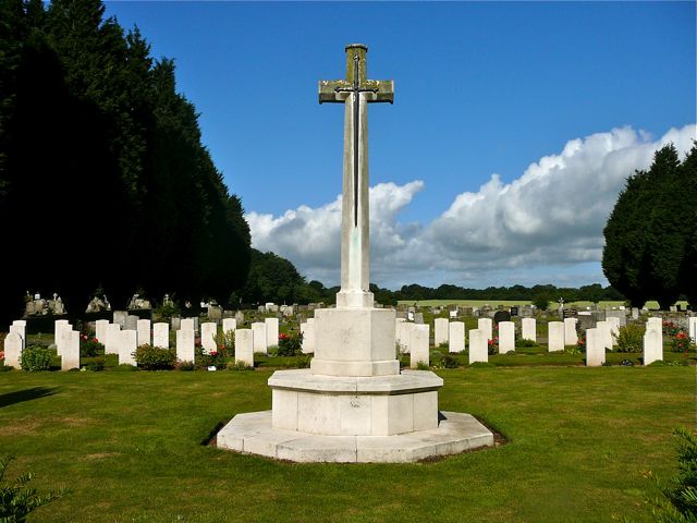
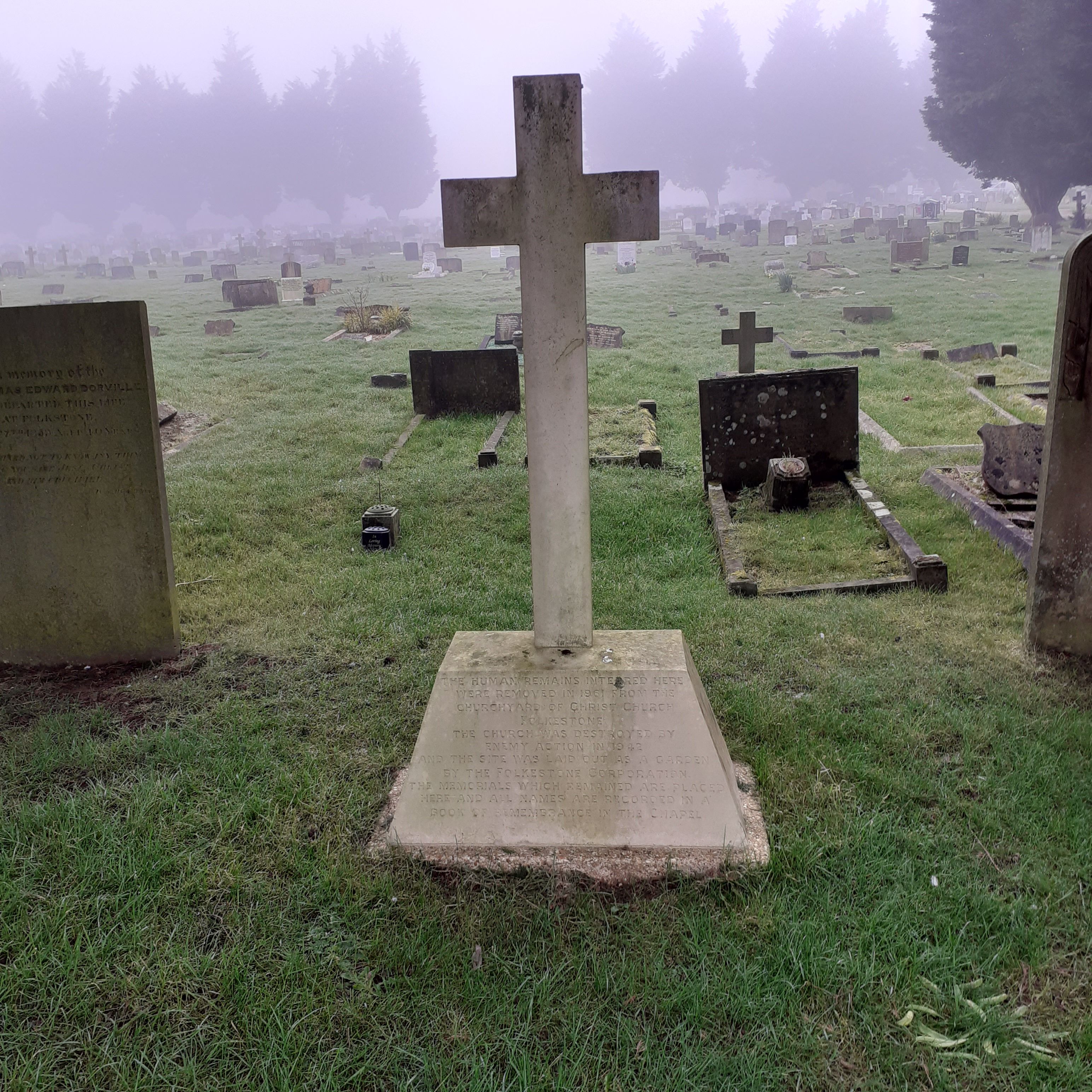
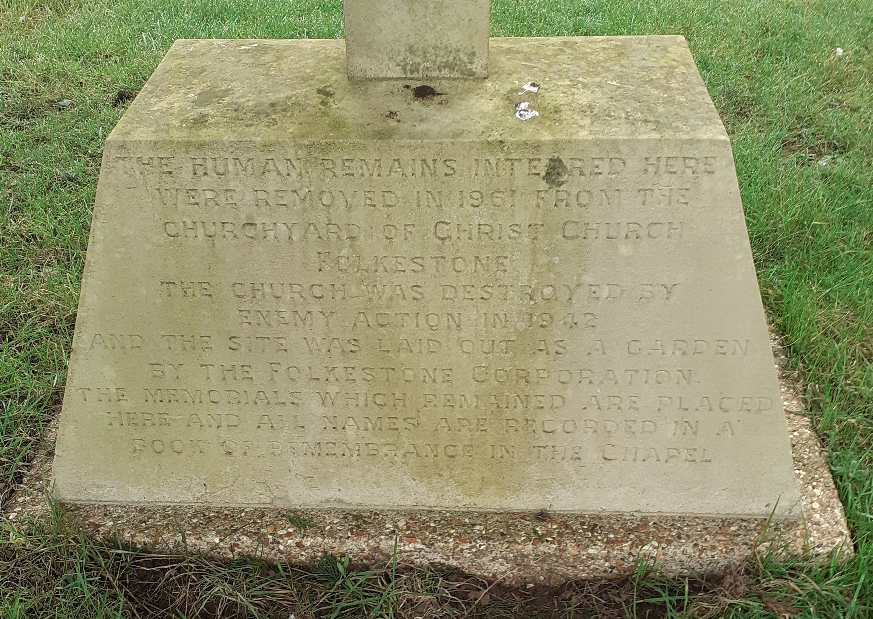
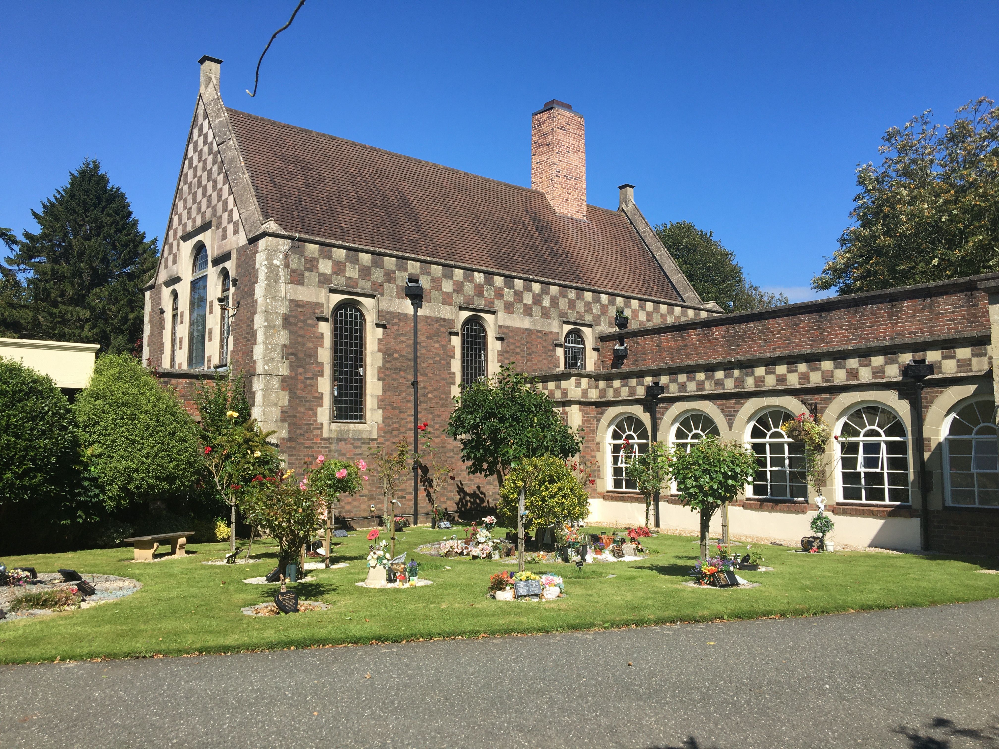
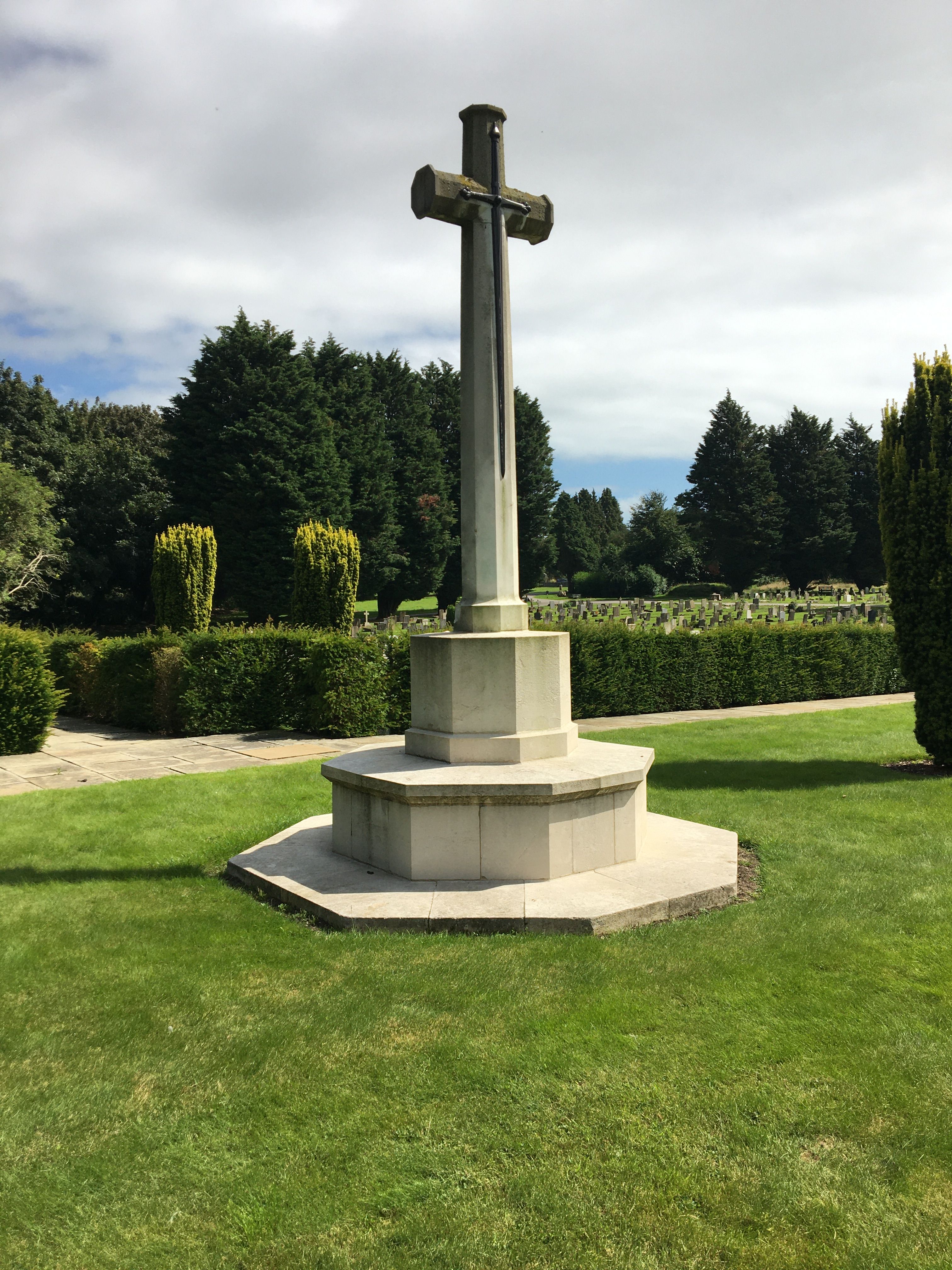
| Description | : | Formerly known as Folkestone New Cemetery, Hawkinge is now the main cemetery for the Shepway area. It is close to the site of an aerodrome of great strategic importance in WW2 which was used as a refuelling base for operations in France and the evacuation from Dunkirk in 1940. The aerodrome was a fighter squadron base, and was so badly damaged by German bombing and machine guns that it had to be abandoned for a while after the Battle of Britain. Because of the closeness of the cemetery to the airfield, there are 95 graves of British and Allied servicemen,... Read More |
frequently asked questions (FAQ):
-
Where is Hawkinge Cemetery and Crematorium?
Hawkinge Cemetery and Crematorium is located at Aerodrome Road Hawkinge, Shepway District ,Kent , CT18 7AGEngland.
-
Hawkinge Cemetery and Crematorium cemetery's updated grave count on graveviews.com?
506 memorials
-
Where are the coordinates of the Hawkinge Cemetery and Crematorium?
Latitude: 51.1163710
Longitude: 1.1578030
Nearby Cemetories:
1. St. Oswald's Churchyard
Paddlesworth, Shepway District, England
Coordinate: 51.1149760, 1.1348910
2. St Michael the Archangel Churchyard
Hawkinge, Shepway District, England
Coordinate: 51.1130600, 1.1819210
3. St. Martin's Churchyard
Acrise, Shepway District, England
Coordinate: 51.1372970, 1.1346610
4. Cheriton Road Cemetery
Folkestone, Shepway District, England
Coordinate: 51.0846000, 1.1615100
5. St John the Baptist Churchyard
Folkestone, Shepway District, England
Coordinate: 51.0858580, 1.1760900
6. St. Nicholas Churchyard
Newington, Shepway District, England
Coordinate: 51.0942900, 1.1156300
7. National Battle of Britain Memorial
Capel-le-Ferne, Dover District, England
Coordinate: 51.0984880, 1.2059130
8. Bradstone Baptist Burial Ground
Folkestone, Shepway District, England
Coordinate: 51.0830220, 1.1803570
9. St. Peter's Church Cemetery
Swingfield, Shepway District, England
Coordinate: 51.1464500, 1.1908500
10. St. Martin Churchyard
Cheriton, Shepway District, England
Coordinate: 51.0857570, 1.1247500
11. St Michael & All Angels Churchyard
Folkestone, Shepway District, England
Coordinate: 51.0821600, 1.1820300
12. Folkestone Friends Burial Ground
Folkestone, Shepway District, England
Coordinate: 51.0825560, 1.1856030
13. St Peter Churchyard
Folkestone, Shepway District, England
Coordinate: 51.0813050, 1.1882080
14. Christ Church Graveyard
Folkestone, Shepway District, England
Coordinate: 51.0776520, 1.1735470
15. Holy Trinity Church
Folkestone, Shepway District, England
Coordinate: 51.0767190, 1.1674100
16. St. Mary and St. Eanswythe Churchyard
Folkestone, Shepway District, England
Coordinate: 51.0787740, 1.1817510
17. St. Mary's Churchyard
Capel-le-Ferne, Dover District, England
Coordinate: 51.1149650, 1.2235540
18. St Paul's Church
Sandgate, Shepway District, England
Coordinate: 51.0744900, 1.1495700
19. Elham Burial Ground
Elham, Shepway District, England
Coordinate: 51.1497940, 1.1115020
20. St Anthony Churchyard
Alkham, Dover District, England
Coordinate: 51.1360930, 1.2226440
21. Shorncliffe Military Cemetery
Folkestone, Shepway District, England
Coordinate: 51.0754204, 1.1270230
22. St Mary and St Ethelburga Churchyard
Lyminge, Shepway District, England
Coordinate: 51.1262670, 1.0869770
23. St. Mary the Virgin Churchyard
Elham, Shepway District, England
Coordinate: 51.1521870, 1.1118610
24. Spring Lane Cemetery
Hythe, Shepway District, England
Coordinate: 51.0783450, 1.1134600