
| Memorials | : | 1 |
| Location | : | Ninfield, Wealden District, England |
| Coordinate | : | 50.8848760, 0.4224590 |
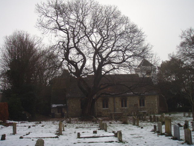
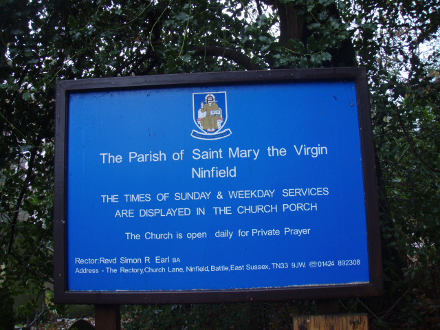
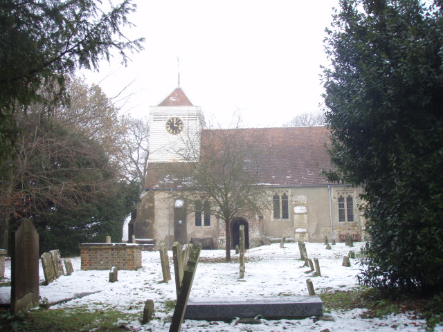
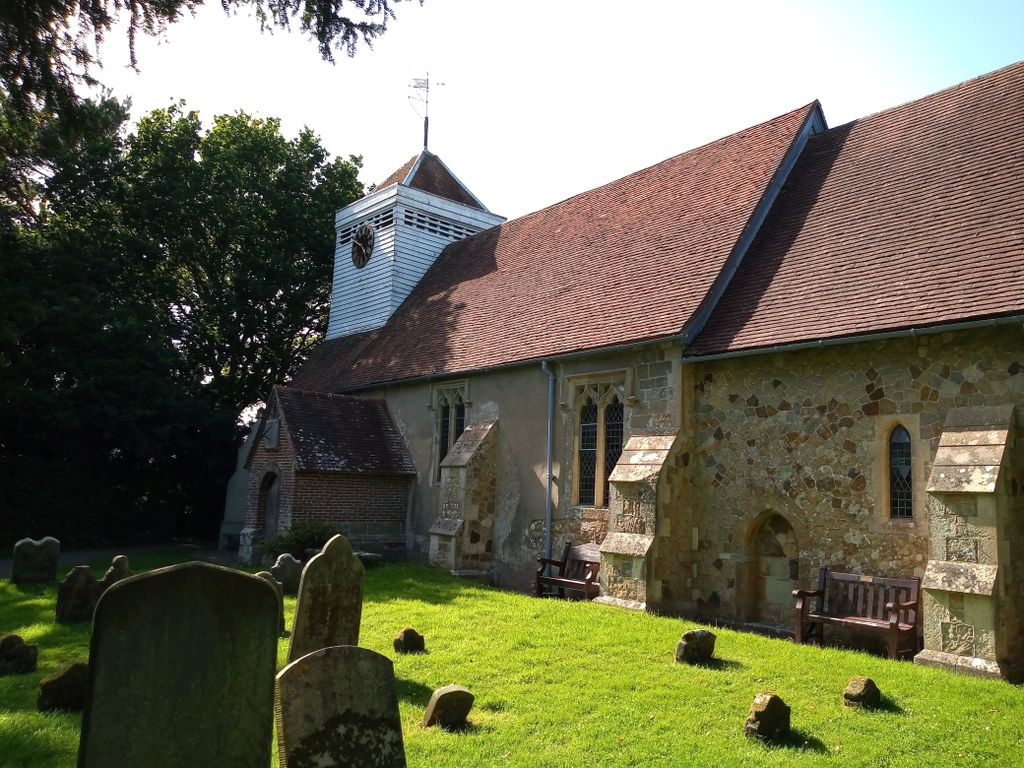
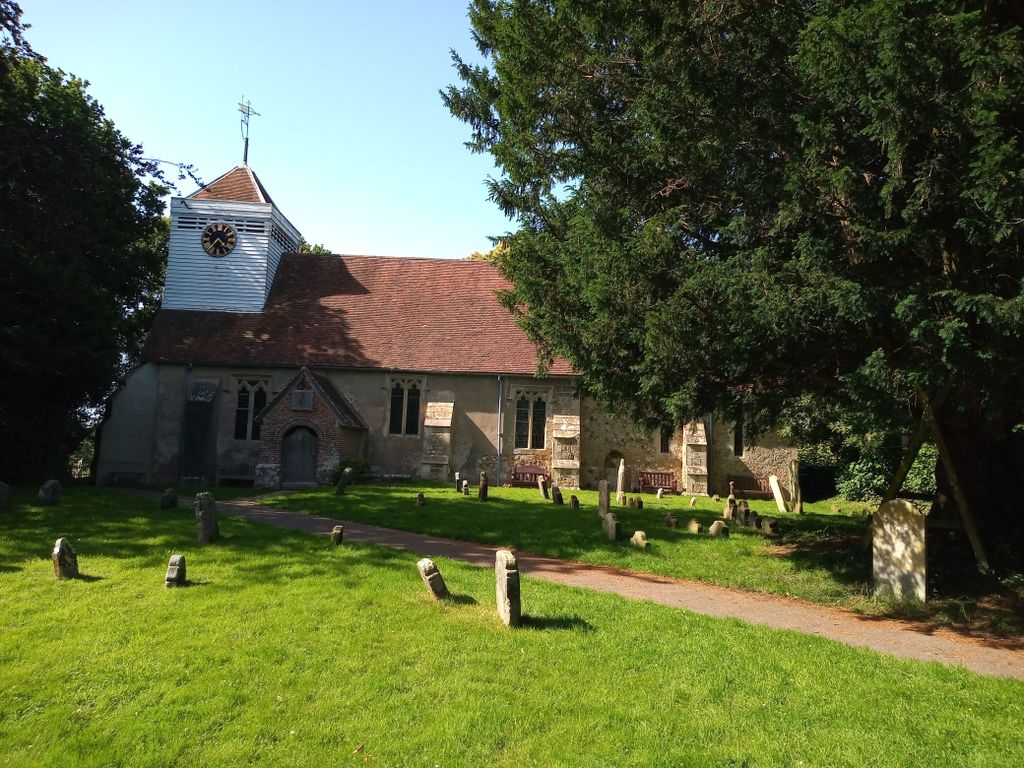
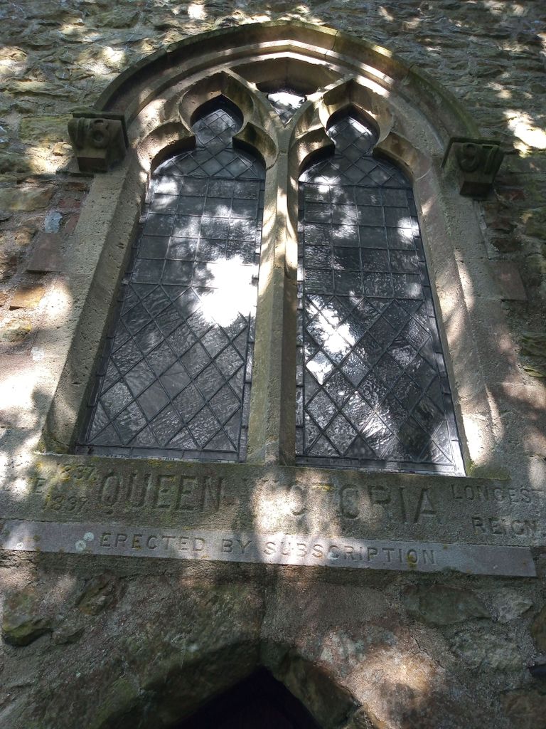
| Description | : | Ninfield is a village and civil parish in the Wealden District of East Sussex, England. The village is situated 4 miles (6.4 km) north of Bexhill-on-Sea, at the junction of two roads: the A269 from Bexhill to Battle and the A271 to Hailsham. There are two churches in Ninfield: the parish church dedicated to St Mary the Virgin; and the Methodist church. added by Wertypop. |
frequently asked questions (FAQ):
-
Where is St. Mary the Virgin Churchyard?
St. Mary the Virgin Churchyard is located at Church Lane Ninfield, Wealden District ,East Sussex ,England.
-
St. Mary the Virgin Churchyard cemetery's updated grave count on graveviews.com?
1 memorials
-
Where are the coordinates of the St. Mary the Virgin Churchyard?
Latitude: 50.8848760
Longitude: 0.4224590
Nearby Cemetories:
1. St. Laurence Churchyard
Catsfield, Rother District, England
Coordinate: 50.8938230, 0.4563190
2. St. Peter's Churchyard
Ashburnham, Rother District, England
Coordinate: 50.9056730, 0.4014650
3. Bexhill Cemetery
Bexhill-on-Sea, Rother District, England
Coordinate: 50.8587980, 0.4517460
4. St. Oswald Anglican Churchyard
Hooe, Wealden District, England
Coordinate: 50.8576960, 0.3899300
5. St Oswald Churchyard
Hooe, Wealden District, England
Coordinate: 50.8575970, 0.3895850
6. St Michael the Archangel Churchyard
Penhurst, Rother District, England
Coordinate: 50.9235920, 0.4092830
7. St. Mark's Churchyard
Bexhill-on-Sea, Rother District, England
Coordinate: 50.8456760, 0.4372000
8. Crowhurst Churchyard
Crowhurst, Rother District, England
Coordinate: 50.8838070, 0.4968630
9. Battle Abbey
Battle, Rother District, England
Coordinate: 50.9144940, 0.4875140
10. St. Mary Magdalene Churchyard
Wartling, Wealden District, England
Coordinate: 50.8581820, 0.3539830
11. St Mary the Virgin Churchyard
Battle, Rother District, England
Coordinate: 50.9150690, 0.4883620
12. St. John the Evangelist Churchyard
Bodle Street Green, Wealden District, England
Coordinate: 50.9041214, 0.3465680
13. St. Peter's Churchyard
Bexhill-on-Sea, Rother District, England
Coordinate: 50.8460530, 0.4787950
14. Battle Cemetery
Battle, Rother District, England
Coordinate: 50.9155800, 0.4935500
15. Ebenezer Baptist Chapel
Bodle Street Green, Wealden District, England
Coordinate: 50.9102250, 0.3438700
16. St John The Baptist Churchyard
Mountfield, Rother District, England
Coordinate: 50.9404170, 0.4512760
17. All Saints Churchyard
Herstmonceux, Wealden District, England
Coordinate: 50.8678627, 0.3330980
18. Herstmonceux Free Church
Herstmonceux, Wealden District, England
Coordinate: 50.8855160, 0.3278300
19. St Mary Magdalene Churchyard
Whatlington, Rother District, England
Coordinate: 50.9365900, 0.5042980
20. St. Leonard Churchyard
Hollington, Hastings Borough, England
Coordinate: 50.8743230, 0.5379840
21. St. Giles' Churchyard
Dallington, Rother District, England
Coordinate: 50.9470960, 0.3585090
22. All Saints Churchyard
Mountfield, Rother District, England
Coordinate: 50.9558449, 0.4685820
23. St. Thomas A. Becket Churchyard
Brightling, Rother District, England
Coordinate: 50.9638440, 0.3961020
24. St Nicholas Churchyard
Pevensey, Wealden District, England
Coordinate: 50.8196250, 0.3367080