
| Memorials | : | 0 |
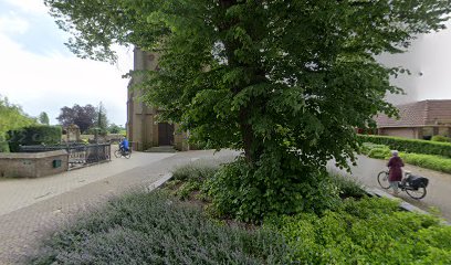
| Location | : | Herwen, Rijnwaarden Municipality, Netherlands |
| Coordinate | : | 51.8844900, 6.1035900 |
frequently asked questions (FAQ):
-
Where is Herwen Roman Catholic Churchyard?
Herwen Roman Catholic Churchyard is located at Herwen, Rijnwaarden Municipality ,Gelderland ,Netherlands.
-
Herwen Roman Catholic Churchyard cemetery's updated grave count on graveviews.com?
0 memorials
-
Where are the coordinates of the Herwen Roman Catholic Churchyard?
Latitude: 51.8844900
Longitude: 6.1035900
Nearby Cemetories:
1. Tolkamer General Cemetery
Tolkamer, Rijnwaarden Municipality, Netherlands
Coordinate: 51.8610900, 6.0814200
2. Friedhof Bimmen
Bimmen, Kreis Kleve, Germany
Coordinate: 51.8588737, 6.0695000
3. Zevenaar Roman Catholic Cemetery
Zevenaar, Zevenaar Municipality, Netherlands
Coordinate: 51.9289700, 6.0732300
4. Joodse Begraafplaats
Zevenaar Municipality, Netherlands
Coordinate: 51.9310110, 6.0825120
5. Joodse Begraafplaats Arnhemseweg
Zevenaar Municipality, Netherlands
Coordinate: 51.9308280, 6.0700100
6. Didam Protestant Cemetery
Didam, Montferland Municipality, Netherlands
Coordinate: 51.9360100, 6.1345300
7. Beek Roman Catholic Churchyard
Beek, Montferland Municipality, Netherlands
Coordinate: 51.9078300, 6.1895100
8. Algemene Begraafplaats 't Heijlige Lant
Duiven, Duiven Municipality, Netherlands
Coordinate: 51.9452663, 6.0353131
9. Friedhof Griethausen
Sinstorf, Harburg, Germany
Coordinate: 51.8213100, 6.1664800
10. Saint Bonifacius
Niel, Kreis Kleve, Germany
Coordinate: 51.8261350, 6.0182900
11. Roman Catholic Cemetery
Duiven, Duiven Municipality, Netherlands
Coordinate: 51.9495185, 6.0238638
12. Kilder Roman Catholic Cemetery
Kilder, Montferland Municipality, Netherlands
Coordinate: 51.9373400, 6.2321900
13. Zeddam Protestant Cemetery
Zeddam, Montferland Municipality, Netherlands
Coordinate: 51.9078900, 6.2566400
14. Friedhof Nütterden
Kranenburg, Kreis Kleve, Germany
Coordinate: 51.7904340, 6.0629380
15. Friedhof Emmerich
Emmerich, Kreis Kleve, Germany
Coordinate: 51.8393300, 6.2479200
16. Jüdischer Friedhof
Emmerich, Kreis Kleve, Germany
Coordinate: 51.8370156, 6.2535498
17. NH Begraafplaats De Pinkel
Rheden, Rheden Municipality, Netherlands
Coordinate: 52.0087450, 6.0354830
18. Velp Old Protestant Cemetery
Velp, Rheden Municipality, Netherlands
Coordinate: 51.9927300, 5.9816100
19. Doesburg Begraafplaats
Doesburg, Doesburg Municipality, Netherlands
Coordinate: 52.0152462, 6.1396174
20. Begraafplaats Het Witte Kerkje
Ubbergen, Berg en Dal Municipality, Netherlands
Coordinate: 51.8361166, 5.9018954
21. Groesbeek Canadian War Cemetery and Memorial
Groesbeek, Berg en Dal Municipality, Netherlands
Coordinate: 51.7982900, 5.9321900
22. Rheden Heiderust General Cemetery
Rheden, Rheden Municipality, Netherlands
Coordinate: 52.0083600, 6.0077900
23. Doetinchem General Cemetery, Loolaan
Doetinchem, Doetinchem Municipality, Netherlands
Coordinate: 51.9716500, 6.2851300
24. Reichswald Forest War Cemetery
Kleve, Kreis Kleve, Germany
Coordinate: 51.7406464, 6.0824242