
| Memorials | : | 0 |
| Location | : | Tolkamer, Rijnwaarden Municipality, Netherlands |
| Coordinate | : | 51.8610900, 6.0814200 |
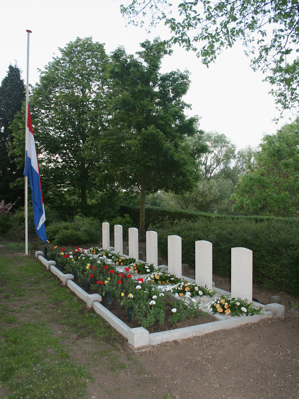
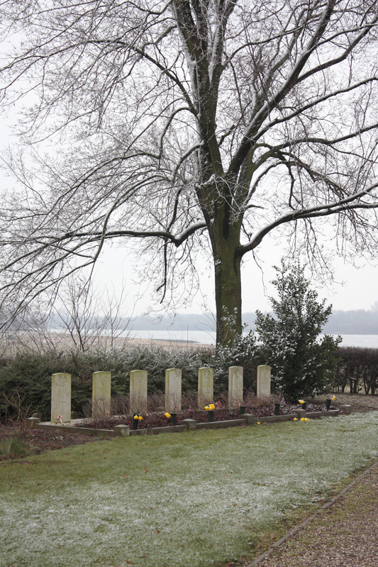
| Description | : | The village of Tolkamer in the commune of Herwenen-Aerdt is 20 kilometres south-east of Arnhem on the north bank of the Rhine. The cemetery is about 1 kilometre west of the village on the bank of a canal, and is a small enclosure used for bodies washed ashore in the vicinity. Buried there are 7 airmen from Canada and the United Kingdom, casaulties of World War Two, and an unknown Canadian soldier. |
frequently asked questions (FAQ):
-
Where is Tolkamer General Cemetery?
Tolkamer General Cemetery is located at Tolkamer, Rijnwaarden Municipality ,Gelderland ,Netherlands.
-
Tolkamer General Cemetery cemetery's updated grave count on graveviews.com?
0 memorials
-
Where are the coordinates of the Tolkamer General Cemetery?
Latitude: 51.8610900
Longitude: 6.0814200
Nearby Cemetories:
1. Friedhof Bimmen
Bimmen, Kreis Kleve, Germany
Coordinate: 51.8588737, 6.0695000
2. Herwen Roman Catholic Churchyard
Herwen, Rijnwaarden Municipality, Netherlands
Coordinate: 51.8844900, 6.1035900
3. Saint Bonifacius
Niel, Kreis Kleve, Germany
Coordinate: 51.8261350, 6.0182900
4. Friedhof Griethausen
Sinstorf, Harburg, Germany
Coordinate: 51.8213100, 6.1664800
5. Zevenaar Roman Catholic Cemetery
Zevenaar, Zevenaar Municipality, Netherlands
Coordinate: 51.9289700, 6.0732300
6. Joodse Begraafplaats
Zevenaar Municipality, Netherlands
Coordinate: 51.9310110, 6.0825120
7. Joodse Begraafplaats Arnhemseweg
Zevenaar Municipality, Netherlands
Coordinate: 51.9308280, 6.0700100
8. Friedhof Nütterden
Kranenburg, Kreis Kleve, Germany
Coordinate: 51.7904340, 6.0629380
9. Beek Roman Catholic Churchyard
Beek, Montferland Municipality, Netherlands
Coordinate: 51.9078300, 6.1895100
10. Didam Protestant Cemetery
Didam, Montferland Municipality, Netherlands
Coordinate: 51.9360100, 6.1345300
11. Algemene Begraafplaats 't Heijlige Lant
Duiven, Duiven Municipality, Netherlands
Coordinate: 51.9452663, 6.0353131
12. Roman Catholic Cemetery
Duiven, Duiven Municipality, Netherlands
Coordinate: 51.9495185, 6.0238638
13. Friedhof Emmerich
Emmerich, Kreis Kleve, Germany
Coordinate: 51.8393300, 6.2479200
14. Jüdischer Friedhof
Emmerich, Kreis Kleve, Germany
Coordinate: 51.8370156, 6.2535498
15. Groesbeek Canadian War Cemetery and Memorial
Groesbeek, Berg en Dal Municipality, Netherlands
Coordinate: 51.7982900, 5.9321900
16. Begraafplaats Het Witte Kerkje
Ubbergen, Berg en Dal Municipality, Netherlands
Coordinate: 51.8361166, 5.9018954
17. Zeddam Protestant Cemetery
Zeddam, Montferland Municipality, Netherlands
Coordinate: 51.9078900, 6.2566400
18. Kilder Roman Catholic Cemetery
Kilder, Montferland Municipality, Netherlands
Coordinate: 51.9373400, 6.2321900
19. Reichswald Forest War Cemetery
Kleve, Kreis Kleve, Germany
Coordinate: 51.7406464, 6.0824242
20. Heilig Landstichting Burial Park
Heilig Landstichting, Berg en Dal Municipality, Netherlands
Coordinate: 51.8173600, 5.8907100
21. Joodse Begraafplaats
Nijmegen, Nijmegen Municipality, Netherlands
Coordinate: 51.8308300, 5.8836000
22. Rustoord Cemetery
Nijmegen, Nijmegen Municipality, Netherlands
Coordinate: 51.8305100, 5.8808600
23. Algemene Begraafplaats Stenenkruisstraat
Nijmegen, Nijmegen Municipality, Netherlands
Coordinate: 51.8395021, 5.8679939
24. Velp Old Protestant Cemetery
Velp, Rheden Municipality, Netherlands
Coordinate: 51.9927300, 5.9816100