
| Memorials | : | 0 |
| Location | : | Zevenaar Municipality, Netherlands |
| Coordinate | : | 51.9308280, 6.0700100 |
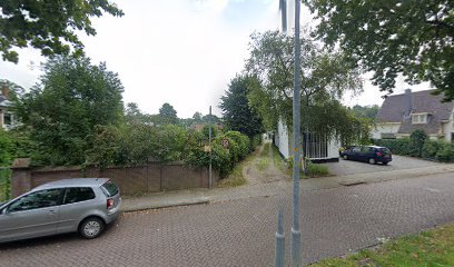
| Description | : | From 1861 until 1891, the Zevenaar community buried its dead in the section of the public cemetery on J. Perkstraat. In 1891, the community purchased ground for new cemetery on the Arnhemseweg. The two Jewish cemeteries are maintained by the municipality. |
frequently asked questions (FAQ):
-
Where is Joodse Begraafplaats Arnhemseweg?
Joodse Begraafplaats Arnhemseweg is located at Arnhemseweg Zevenaar Municipality ,Gelderland , 6901 DXNetherlands.
-
Joodse Begraafplaats Arnhemseweg cemetery's updated grave count on graveviews.com?
0 memorials
-
Where are the coordinates of the Joodse Begraafplaats Arnhemseweg?
Latitude: 51.9308280
Longitude: 6.0700100
Nearby Cemetories:
1. Zevenaar Roman Catholic Cemetery
Zevenaar, Zevenaar Municipality, Netherlands
Coordinate: 51.9289700, 6.0732300
2. Joodse Begraafplaats
Zevenaar Municipality, Netherlands
Coordinate: 51.9310110, 6.0825120
3. Algemene Begraafplaats 't Heijlige Lant
Duiven, Duiven Municipality, Netherlands
Coordinate: 51.9452663, 6.0353131
4. Roman Catholic Cemetery
Duiven, Duiven Municipality, Netherlands
Coordinate: 51.9495185, 6.0238638
5. Didam Protestant Cemetery
Didam, Montferland Municipality, Netherlands
Coordinate: 51.9360100, 6.1345300
6. Herwen Roman Catholic Churchyard
Herwen, Rijnwaarden Municipality, Netherlands
Coordinate: 51.8844900, 6.1035900
7. Tolkamer General Cemetery
Tolkamer, Rijnwaarden Municipality, Netherlands
Coordinate: 51.8610900, 6.0814200
8. Friedhof Bimmen
Bimmen, Kreis Kleve, Germany
Coordinate: 51.8588737, 6.0695000
9. Beek Roman Catholic Churchyard
Beek, Montferland Municipality, Netherlands
Coordinate: 51.9078300, 6.1895100
10. NH Begraafplaats De Pinkel
Rheden, Rheden Municipality, Netherlands
Coordinate: 52.0087450, 6.0354830
11. Velp Old Protestant Cemetery
Velp, Rheden Municipality, Netherlands
Coordinate: 51.9927300, 5.9816100
12. Rheden Heiderust General Cemetery
Rheden, Rheden Municipality, Netherlands
Coordinate: 52.0083600, 6.0077900
13. Doesburg Begraafplaats
Doesburg, Doesburg Municipality, Netherlands
Coordinate: 52.0152462, 6.1396174
14. Kilder Roman Catholic Cemetery
Kilder, Montferland Municipality, Netherlands
Coordinate: 51.9373400, 6.2321900
15. Rozendaal Communal Cemetery
Rozendaal, Rozendaal Municipality, Netherlands
Coordinate: 52.0131400, 5.9683700
16. Saint Bonifacius
Niel, Kreis Kleve, Germany
Coordinate: 51.8261350, 6.0182900
17. Voormalige Begraafplaats Onder de Linden
Arnhem, Arnhem Municipality, Netherlands
Coordinate: 51.9889652, 5.9166571
18. Joodse Begraafplaats Moscowa
Arnhem, Arnhem Municipality, Netherlands
Coordinate: 52.0022860, 5.9203300
19. Zeddam Protestant Cemetery
Zeddam, Montferland Municipality, Netherlands
Coordinate: 51.9078900, 6.2566400
20. Olburgen Roman Catholic Cemetery
Olburgen, Bronckhorst Municipality, Netherlands
Coordinate: 52.0440100, 6.1235300
21. Oude Algemene Begraafplaats
Dieren, Rheden Municipality, Netherlands
Coordinate: 52.0485900, 6.0967600
22. Arnhem Moscowa General Cemetery
Arnhem, Arnhem Municipality, Netherlands
Coordinate: 52.0050800, 5.9152800
23. Joodse Begraafplaats Utrechtseweg
Arnhem, Arnhem Municipality, Netherlands
Coordinate: 51.9853100, 5.8906500
24. Friedhof Griethausen
Sinstorf, Harburg, Germany
Coordinate: 51.8213100, 6.1664800