
| Memorials | : | 0 |
| Location | : | Ravenstonedale, Eden District, England |
| Phone | : | 015396 23203 |
| Website | : | www.findachurch.co.uk/view/ravenstonedale/13290.htm |
| Coordinate | : | 54.4299450, -2.4286560 |
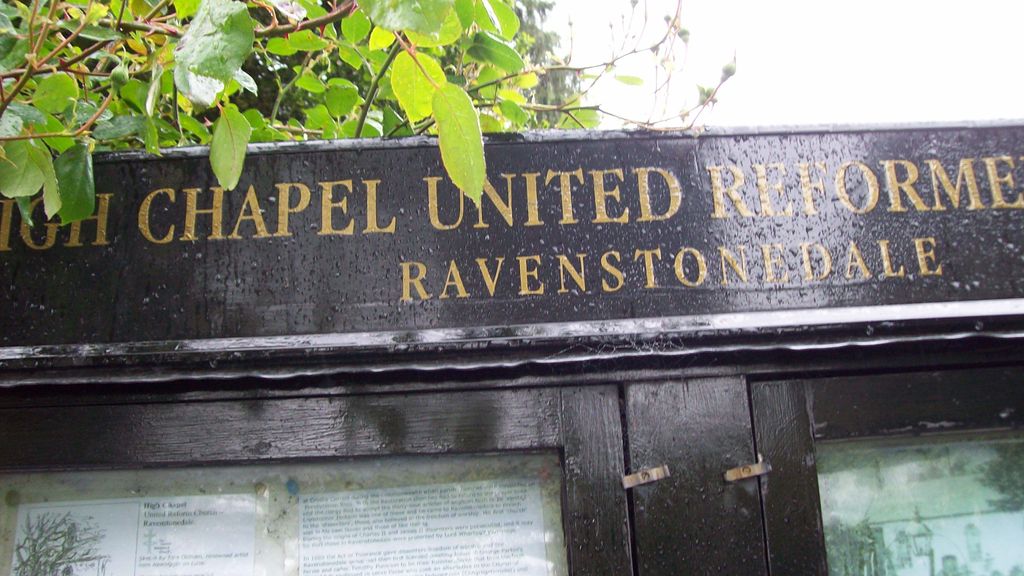
| Description | : | High Chapel United Reformed Church United Reformed Church. Founded 1662; present building 1726 with new windows inserted c.1868. Later additions and alterations, including wing to rear at south end. Slobbered rubble. Graduated slate roofs. Single tall storey, 5 bays. C20 plank ground-floor door in segement-headed doorcase. 3 tall semicircular-headed windows to right and similar shortened window above, all with projecting keystones and imposts to stone surrounds. Glazing bars to all windows. Steps up to C20 plank gallery door with remains of inscription on lintel, to left. Blocked original windows on rear elevation. Stone copings and kneelers to roof with gabled bellcote to south end and finial to north. |
frequently asked questions (FAQ):
-
Where is High Chapel Burial Ground?
High Chapel Burial Ground is located at Main Street Ravenstonedale Kirkby Stephen Ravenstonedale, Eden District ,Cumbria , CA17 4NGEngland.
-
High Chapel Burial Ground cemetery's updated grave count on graveviews.com?
0 memorials
-
Where are the coordinates of the High Chapel Burial Ground?
Latitude: 54.4299450
Longitude: -2.4286560
Nearby Cemetories:
1. St. Oswald Churchyard
Ravenstonedale, Eden District, England
Coordinate: 54.4329680, -2.4296740
2. St. Andrew's Churchyard
Crosby Garrett, Eden District, England
Coordinate: 54.4822030, -2.4179930
3. St Mary's Churchyard
Mallerstang, Eden District, England
Coordinate: 54.4079040, -2.3374060
4. St Stephen Churchyard
Kirkby Stephen, Eden District, England
Coordinate: 54.4740890, -2.3485130
5. Kirkby Stephen Cemetery
Kirkby Stephen, Eden District, England
Coordinate: 54.4784680, -2.3507840
6. Saint Luke Churchyard
Soulby, Eden District, England
Coordinate: 54.4945750, -2.3897580
7. Soulby Cemetery
Soulby, Eden District, England
Coordinate: 54.4943900, -2.3834200
8. St. Mark's Churchyard
Cautley, South Lakeland District, England
Coordinate: 54.3456280, -2.4767630
9. St Peter's Churchyard
Great Asby, Eden District, England
Coordinate: 54.5134470, -2.4946230
10. St Theobald Churchyard
Musgrave, Eden District, England
Coordinate: 54.5138380, -2.3605080
11. Cautley Methodist Churchyard
Sedbergh, South Lakeland District, England
Coordinate: 54.3419640, -2.4791850
12. St Theobald's Church
Great Musgrave, Eden District, England
Coordinate: 54.5139410, -2.3605410
13. St. James Churchyard
Tebay, Eden District, England
Coordinate: 54.4338540, -2.5931330
14. All Saints Churchyard
Orton, Eden District, England
Coordinate: 54.4694510, -2.5845290
15. Birks Chapel Burial Ground Ingham & Congregat
Warcop, Eden District, England
Coordinate: 54.5301820, -2.4356050
16. St. Columba Churchyard
Warcop, Eden District, England
Coordinate: 54.5359610, -2.3988140
17. St Michael Churchyard
Brough, Eden District, England
Coordinate: 54.5201950, -2.3210920
18. Holy Trinity Churchyard
Sedbergh, South Lakeland District, England
Coordinate: 54.3494590, -2.5651420
19. Frostrow Methodist Chapel Churchyard
Sedbergh, South Lakeland District, England
Coordinate: 54.3175080, -2.4871590
20. Saint Andrews Churchyard
Sedbergh, South Lakeland District, England
Coordinate: 54.3230690, -2.5285180
21. St. James Churchyard
Great Ormside, Eden District, England
Coordinate: 54.5531010, -2.4632470
22. St John the Evangelist Churchyard
Firbank, South Lakeland District, England
Coordinate: 54.3365050, -2.5737670
23. Sedbergh Cemetery
Sedbergh, South Lakeland District, England
Coordinate: 54.3206230, -2.5361770
24. Low Smithy Methodist Church Graveyard
Garsdale, South Lakeland District, England
Coordinate: 54.3003930, -2.3992090