
| Memorials | : | 0 |
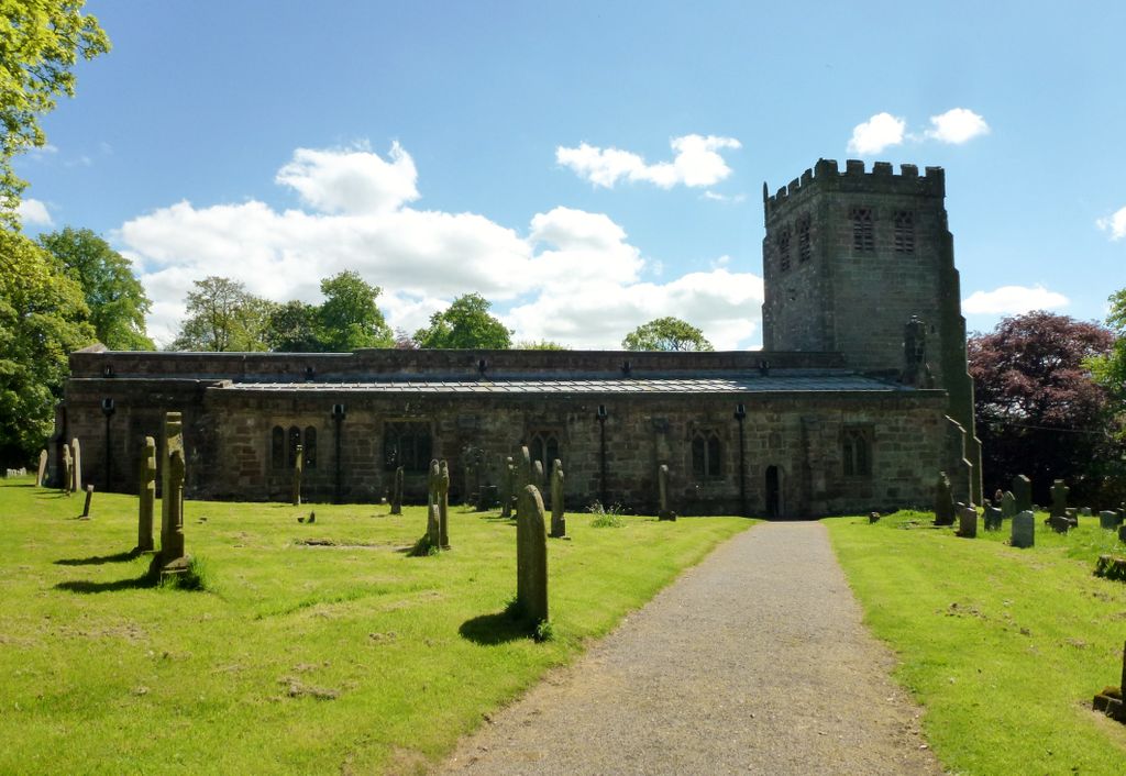
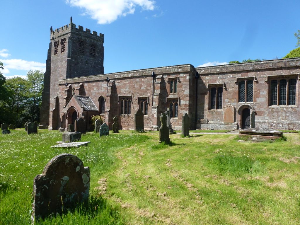
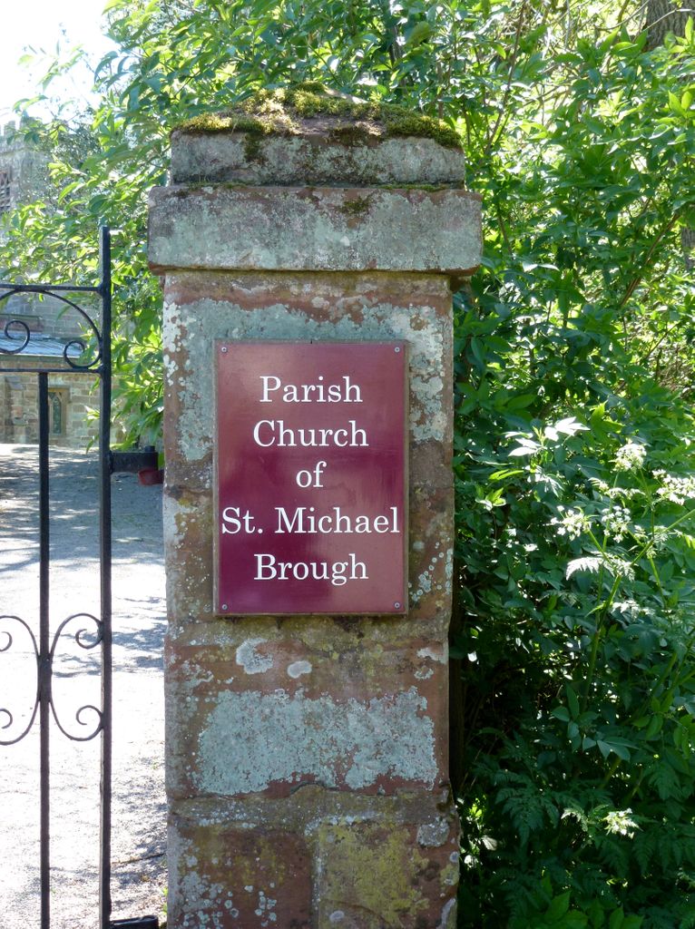
| Location | : | Brough, Eden District, England |
| Coordinate | : | 54.5201950, -2.3210920 |
frequently asked questions (FAQ):
-
Where is St Michael Churchyard?
St Michael Churchyard is located at Brough, Eden District ,Cumbria ,England.
-
St Michael Churchyard cemetery's updated grave count on graveviews.com?
0 memorials
-
Where are the coordinates of the St Michael Churchyard?
Latitude: 54.5201950
Longitude: -2.3210920
Nearby Cemetories:
1. St Theobald's Church
Great Musgrave, Eden District, England
Coordinate: 54.5139410, -2.3605410
2. St Theobald Churchyard
Musgrave, Eden District, England
Coordinate: 54.5138380, -2.3605080
3. Soulby Cemetery
Soulby, Eden District, England
Coordinate: 54.4943900, -2.3834200
4. Kirkby Stephen Cemetery
Kirkby Stephen, Eden District, England
Coordinate: 54.4784680, -2.3507840
5. Saint Luke Churchyard
Soulby, Eden District, England
Coordinate: 54.4945750, -2.3897580
6. St. Columba Churchyard
Warcop, Eden District, England
Coordinate: 54.5359610, -2.3988140
7. St Stephen Churchyard
Kirkby Stephen, Eden District, England
Coordinate: 54.4740890, -2.3485130
8. Birks Chapel Burial Ground Ingham & Congregat
Warcop, Eden District, England
Coordinate: 54.5301820, -2.4356050
9. St. Andrew's Churchyard
Crosby Garrett, Eden District, England
Coordinate: 54.4822030, -2.4179930
10. St. James Churchyard
Great Ormside, Eden District, England
Coordinate: 54.5531010, -2.4632470
11. St Peter's Churchyard
Great Asby, Eden District, England
Coordinate: 54.5134470, -2.4946230
12. Rey Cross
Eden District, England
Coordinate: 54.5057950, -2.1486260
13. Appleby Cemetery
Appleby-in-Westmorland, Eden District, England
Coordinate: 54.5749310, -2.4795190
14. St. Oswald Churchyard
Ravenstonedale, Eden District, England
Coordinate: 54.4329680, -2.4296740
15. St Michael Churchyard
Appleby-in-Westmorland, Eden District, England
Coordinate: 54.5731360, -2.4829400
16. High Chapel Burial Ground
Ravenstonedale, Eden District, England
Coordinate: 54.4299450, -2.4286560
17. St Mary's Churchyard
Mallerstang, Eden District, England
Coordinate: 54.4079040, -2.3374060
18. St. Lawrence Churchyard
Appleby-in-Westmorland, Eden District, England
Coordinate: 54.5781650, -2.4915290
19. St. Margaret & St. James Churchyard
Long Marton, Eden District, England
Coordinate: 54.6099400, -2.5175850
20. Keld United Reform Chapelyard
Keld, Richmondshire District, England
Coordinate: 54.4055920, -2.1660210
21. St. Cuthbert's Churchyard
Dufton, Eden District, England
Coordinate: 54.6299140, -2.4897870
22. St Lawrence Crosby Ravensworth
Crosby Ravensworth, Eden District, England
Coordinate: 54.5276540, -2.5859000
23. All Saints Churchyard
Orton, Eden District, England
Coordinate: 54.4694510, -2.5845290
24. St James the Less Churchyard
Forest in Teesdale, Durham Unitary Authority, England
Coordinate: 54.6719700, -2.2264200