
| Memorials | : | 0 |
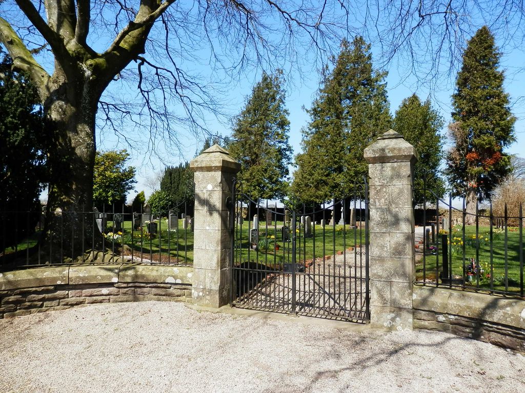
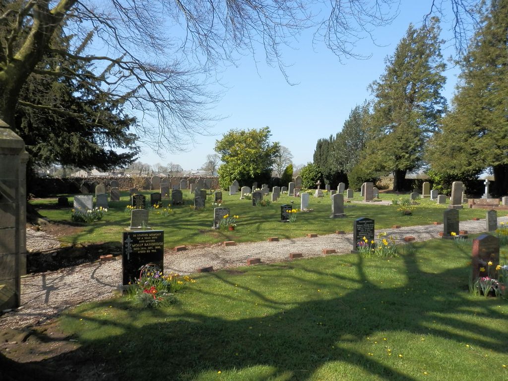
| Location | : | Soulby, Eden District, England |
| Coordinate | : | 54.4943900, -2.3834200 |
| Description | : | The majority of the burials are to the left (west) of the entrance. A number of old headstones against the west wall appear to have been moved from another location, probably nearby St Luke's Churchyard, where the few remaining headstones are propped against the redundant church's wall. |
frequently asked questions (FAQ):
-
Where is Soulby Cemetery?
Soulby Cemetery is located at Beckfoot Lane Soulby, Eden District ,Cumbria ,England.
-
Soulby Cemetery cemetery's updated grave count on graveviews.com?
0 memorials
-
Where are the coordinates of the Soulby Cemetery?
Latitude: 54.4943900
Longitude: -2.3834200
Nearby Cemetories:
1. Saint Luke Churchyard
Soulby, Eden District, England
Coordinate: 54.4945750, -2.3897580
2. St. Andrew's Churchyard
Crosby Garrett, Eden District, England
Coordinate: 54.4822030, -2.4179930
3. St Theobald Churchyard
Musgrave, Eden District, England
Coordinate: 54.5138380, -2.3605080
4. St Theobald's Church
Great Musgrave, Eden District, England
Coordinate: 54.5139410, -2.3605410
5. Kirkby Stephen Cemetery
Kirkby Stephen, Eden District, England
Coordinate: 54.4784680, -2.3507840
6. St Stephen Churchyard
Kirkby Stephen, Eden District, England
Coordinate: 54.4740890, -2.3485130
7. St. Columba Churchyard
Warcop, Eden District, England
Coordinate: 54.5359610, -2.3988140
8. St Michael Churchyard
Brough, Eden District, England
Coordinate: 54.5201950, -2.3210920
9. Birks Chapel Burial Ground Ingham & Congregat
Warcop, Eden District, England
Coordinate: 54.5301820, -2.4356050
10. St. Oswald Churchyard
Ravenstonedale, Eden District, England
Coordinate: 54.4329680, -2.4296740
11. St Peter's Churchyard
Great Asby, Eden District, England
Coordinate: 54.5134470, -2.4946230
12. High Chapel Burial Ground
Ravenstonedale, Eden District, England
Coordinate: 54.4299450, -2.4286560
13. St. James Churchyard
Great Ormside, Eden District, England
Coordinate: 54.5531010, -2.4632470
14. St Mary's Churchyard
Mallerstang, Eden District, England
Coordinate: 54.4079040, -2.3374060
15. St Michael Churchyard
Appleby-in-Westmorland, Eden District, England
Coordinate: 54.5731360, -2.4829400
16. Appleby Cemetery
Appleby-in-Westmorland, Eden District, England
Coordinate: 54.5749310, -2.4795190
17. St. Lawrence Churchyard
Appleby-in-Westmorland, Eden District, England
Coordinate: 54.5781650, -2.4915290
18. All Saints Churchyard
Orton, Eden District, England
Coordinate: 54.4694510, -2.5845290
19. St Lawrence Crosby Ravensworth
Crosby Ravensworth, Eden District, England
Coordinate: 54.5276540, -2.5859000
20. St. James Churchyard
Tebay, Eden District, England
Coordinate: 54.4338540, -2.5931330
21. Rey Cross
Eden District, England
Coordinate: 54.5057950, -2.1486260
22. St. Margaret & St. James Churchyard
Long Marton, Eden District, England
Coordinate: 54.6099400, -2.5175850
23. St. Cuthbert's Churchyard
Dufton, Eden District, England
Coordinate: 54.6299140, -2.4897870
24. All Saints Churchyard
Bolton, Eden District, England
Coordinate: 54.6043250, -2.5599880