
| Memorials | : | 0 |
| Location | : | Kirkby Stephen, Eden District, England |
| Coordinate | : | 54.4740890, -2.3485130 |
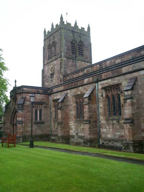
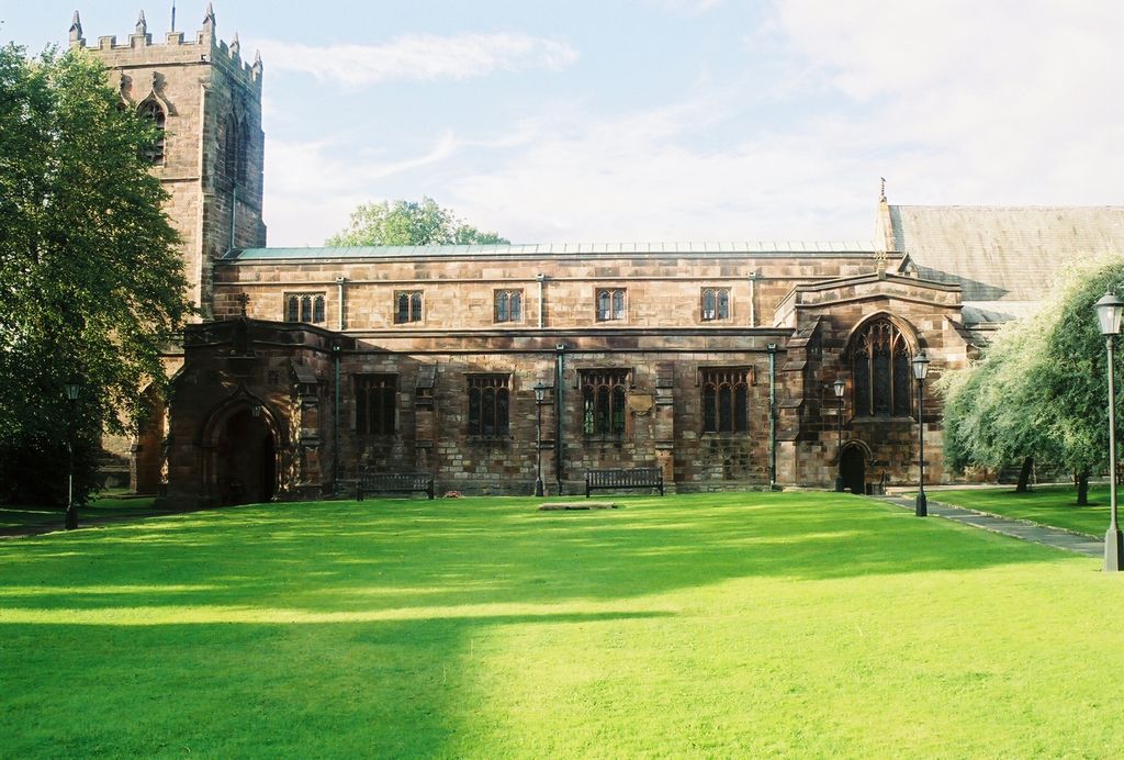
| Description | : | The Parish Church of Kirkby Stephen; aka the Cathedral of the Dales, was dedicated to Saint Stephen, hence the name of the town and parish. Here there was a Saxon place of worship followed by a Norman in the 1100's, but the present nave was built in 1220 and the tower in 1550. The church was renovated in the 1300's and also in the 19th century. The stones from the cemetery have been removed and placed along the outer wall of the church property. |
frequently asked questions (FAQ):
-
Where is St Stephen Churchyard?
St Stephen Churchyard is located at Kirkby Stephen, Eden District ,Cumbria ,England.
-
St Stephen Churchyard cemetery's updated grave count on graveviews.com?
0 memorials
-
Where are the coordinates of the St Stephen Churchyard?
Latitude: 54.4740890
Longitude: -2.3485130
Nearby Cemetories:
1. Kirkby Stephen Cemetery
Kirkby Stephen, Eden District, England
Coordinate: 54.4784680, -2.3507840
2. Soulby Cemetery
Soulby, Eden District, England
Coordinate: 54.4943900, -2.3834200
3. Saint Luke Churchyard
Soulby, Eden District, England
Coordinate: 54.4945750, -2.3897580
4. St Theobald Churchyard
Musgrave, Eden District, England
Coordinate: 54.5138380, -2.3605080
5. St Theobald's Church
Great Musgrave, Eden District, England
Coordinate: 54.5139410, -2.3605410
6. St. Andrew's Churchyard
Crosby Garrett, Eden District, England
Coordinate: 54.4822030, -2.4179930
7. St Michael Churchyard
Brough, Eden District, England
Coordinate: 54.5201950, -2.3210920
8. St. Oswald Churchyard
Ravenstonedale, Eden District, England
Coordinate: 54.4329680, -2.4296740
9. High Chapel Burial Ground
Ravenstonedale, Eden District, England
Coordinate: 54.4299450, -2.4286560
10. St Mary's Churchyard
Mallerstang, Eden District, England
Coordinate: 54.4079040, -2.3374060
11. St. Columba Churchyard
Warcop, Eden District, England
Coordinate: 54.5359610, -2.3988140
12. Birks Chapel Burial Ground Ingham & Congregat
Warcop, Eden District, England
Coordinate: 54.5301820, -2.4356050
13. St Peter's Churchyard
Great Asby, Eden District, England
Coordinate: 54.5134470, -2.4946230
14. St. James Churchyard
Great Ormside, Eden District, England
Coordinate: 54.5531010, -2.4632470
15. Rey Cross
Eden District, England
Coordinate: 54.5057950, -2.1486260
16. St Michael Churchyard
Appleby-in-Westmorland, Eden District, England
Coordinate: 54.5731360, -2.4829400
17. Appleby Cemetery
Appleby-in-Westmorland, Eden District, England
Coordinate: 54.5749310, -2.4795190
18. Keld United Reform Chapelyard
Keld, Richmondshire District, England
Coordinate: 54.4055920, -2.1660210
19. St. Lawrence Churchyard
Appleby-in-Westmorland, Eden District, England
Coordinate: 54.5781650, -2.4915290
20. All Saints Churchyard
Orton, Eden District, England
Coordinate: 54.4694510, -2.5845290
21. St. James Churchyard
Tebay, Eden District, England
Coordinate: 54.4338540, -2.5931330
22. St Lawrence Crosby Ravensworth
Crosby Ravensworth, Eden District, England
Coordinate: 54.5276540, -2.5859000
23. St. Mark's Churchyard
Cautley, South Lakeland District, England
Coordinate: 54.3456280, -2.4767630
24. Cautley Methodist Churchyard
Sedbergh, South Lakeland District, England
Coordinate: 54.3419640, -2.4791850