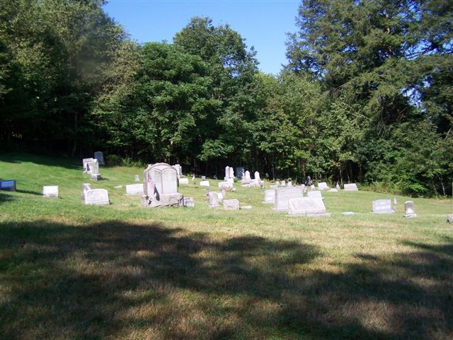
| Memorials | : | 0 |
| Location | : | North Vandergrift, Armstrong County, USA |
| Coordinate | : | 40.6392441, -79.5245590 |
| Description | : | Driving directions: In North Vandergrift, Armstrong County, Pennsylvania, at the intersection stoplight of Route 66 and Alternate Route 66, drive north on Alternate Route 66 for 3.10 miles to the intersection of Alternate 66 and Upper Mateer Road. At this intersection, turn right on Upper Mateer Road and drive 0.58 miles to the intersection of Piper Hill Road, which is directly across from Ash Road. Turn right on Piper Hill Road and drive 1/4 mile up the hill. The Highfield Cemetery is, directly on the road and is on the right side and it is not marked with a... Read More |
frequently asked questions (FAQ):
-
Where is Highfield Lutheran Church Cemetery?
Highfield Lutheran Church Cemetery is located at Piper Hill Rd North Vandergrift, Armstrong County ,Pennsylvania ,USA.
-
Highfield Lutheran Church Cemetery cemetery's updated grave count on graveviews.com?
0 memorials
-
Where are the coordinates of the Highfield Lutheran Church Cemetery?
Latitude: 40.6392441
Longitude: -79.5245590
Nearby Cemetories:
1. Shellhammer Cemetery
Mateer, Armstrong County, USA
Coordinate: 40.6404860, -79.4944850
2. Porter Cemetery
Armstrong County, USA
Coordinate: 40.6618996, -79.5147018
3. Shellhammer Cemetery
Mateer, Armstrong County, USA
Coordinate: 40.6420000, -79.4887000
4. Laurel Point Cemetery
Armstrong County, USA
Coordinate: 40.6203003, -79.5543976
5. Shellhammer-Beck Cemetery
Mateer, Armstrong County, USA
Coordinate: 40.6394230, -79.4799040
6. Spring Church Lutheran Church Cemetery
Spring Church, Armstrong County, USA
Coordinate: 40.6067009, -79.4916992
7. Fairview Cemetery
Spring Church, Armstrong County, USA
Coordinate: 40.6075000, -79.4899000
8. Spring Church Joint Cemetery
Spring Church, Armstrong County, USA
Coordinate: 40.6069000, -79.4902000
9. Parks Family Cemetery
Kiskimere, Armstrong County, USA
Coordinate: 40.6267950, -79.5775470
10. Smail Family Cemetery
North Vandergrift, Armstrong County, USA
Coordinate: 40.6781730, -79.5466050
11. Grinder Cemetery
Hyde Park, Westmoreland County, USA
Coordinate: 40.6308000, -79.5865000
12. Dunkard Baptist Christian Bretheren Cemetery
Cochrans Mills, Armstrong County, USA
Coordinate: 40.6697655, -79.4726105
13. Shoemaker Family Cemetery
Cochrans Mills, Armstrong County, USA
Coordinate: 40.6639400, -79.4665790
14. Cochrans Mill United Methodist Church Cemetery
Cochrans Mills, Armstrong County, USA
Coordinate: 40.6706000, -79.4700000
15. Keppel Burial Ground
Armstrong County, USA
Coordinate: 40.6101000, -79.5822000
16. Ramaley Family Cemetery
Cochrans Mills, Armstrong County, USA
Coordinate: 40.6574780, -79.4585220
17. Bethel Lutheran Church Cemetery
Ford City, Armstrong County, USA
Coordinate: 40.6969290, -79.5336720
18. Kidd Farm Cemetery
Leechburg, Armstrong County, USA
Coordinate: 40.6547220, -79.5988890
19. Saint Catherine's Cemetery
Leechburg, Armstrong County, USA
Coordinate: 40.6469994, -79.6019974
20. Evergreen Cemetery
Leechburg, Armstrong County, USA
Coordinate: 40.6478004, -79.6035995
21. Leechburg Cemetery
Leechburg, Armstrong County, USA
Coordinate: 40.6320220, -79.6064030
22. Prospect Cemetery
Apollo, Armstrong County, USA
Coordinate: 40.5796480, -79.5497920
23. McDonald Cemetery
Burrell Township, Armstrong County, USA
Coordinate: 40.6603012, -79.4464035
24. Apollo Presbyterian Church Cemetery
Armstrong County, USA
Coordinate: 40.5815000, -79.5637000

