
| Memorials | : | 3 |
| Location | : | Horsham, Horsham District, England |
| Coordinate | : | 51.0645800, -0.3463350 |
frequently asked questions (FAQ):
-
Where is Hills Cemetery?
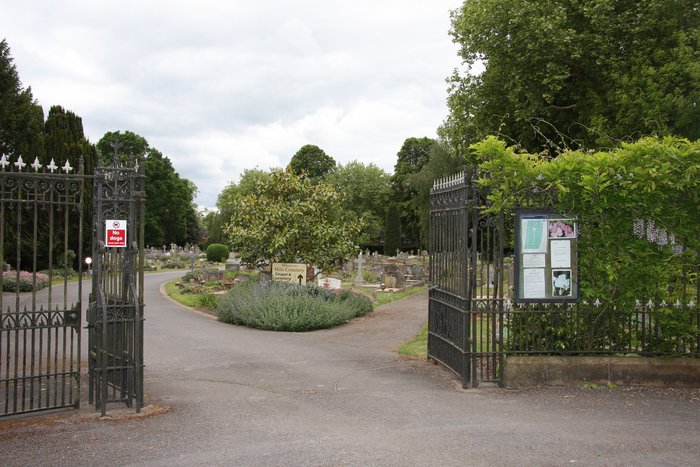
Hills Cemetery is located at Guildford Road Horsham, Horsham District ,West Sussex , RH12 1TTEngland.
-
Hills Cemetery cemetery's updated grave count on graveviews.com?
2 memorials
-
Where are the coordinates of the Hills Cemetery?
Latitude: 51.0645800
Longitude: -0.3463350


Nearby Cemetories:
1. St Mary the Virgin Churchyard
Horsham, Horsham District, England
Coordinate: 51.0597360, -0.3309600
2. Denne Road Cemetery
Horsham, Horsham District, England
Coordinate: 51.0596630, -0.3286750
3. St. Margaret Churchyard
Warnham, Horsham District, England
Coordinate: 51.0903160, -0.3462410
4. St Nicolas Churchyard
Itchingfield, Horsham District, England
Coordinate: 51.0485300, -0.3867900
5. Roffey Cemetery
Horsham, Horsham District, England
Coordinate: 51.0769320, -0.2930890
6. St John The Evangelist Churchyard
Lower Beeding, Horsham District, England
Coordinate: 51.0552500, -0.2889280
7. St Peter Churchyard
Slinfold, Horsham District, England
Coordinate: 51.0725490, -0.4057220
8. Holy Innocents Churchyard
Southwater, Horsham District, England
Coordinate: 51.0252410, -0.3584748
9. Southwater Parish Cemetery
Southwater, Horsham District, England
Coordinate: 51.0245167, -0.3574486
10. The Church of the Holy Innocents Cemetery
Southwater, Horsham District, England
Coordinate: 51.0244290, -0.3576390
11. St Andrew Churchyard
Nuthurst, Horsham District, England
Coordinate: 51.0222790, -0.3010080
12. Holy Trinity Churchyard
Lower Beeding, Horsham District, England
Coordinate: 51.0331850, -0.2610280
13. St Saviour Churchyard
Colgate, Horsham District, England
Coordinate: 51.0817080, -0.2444000
14. Holy Trinity Churchyard
Rudgwick, Horsham District, England
Coordinate: 51.0973900, -0.4442800
15. Okewood St John the Baptist Churchyard
Ewhurst, Waverley Borough, England
Coordinate: 51.1303800, -0.3895000
16. St John the Baptist Churchyard
Oakwoodhill, Mole Valley District, England
Coordinate: 51.1304600, -0.3895700
17. Saint Mary Magdalene Churchyard
Rusper, Horsham District, England
Coordinate: 51.1227750, -0.2789080
18. St Mary Churchyard
Billingshurst, Horsham District, England
Coordinate: 51.0223920, -0.4507020
19. Pleystowe in Capel Friends Grounds
Capel, Mole Valley District, England
Coordinate: 51.1411900, -0.3161300
20. Billingshurst Trinity United Reformed Churchyard
Billingshurst, Horsham District, England
Coordinate: 51.0208352, -0.4530985
21. St Mary the Virgin Churchyard
Shipley, Horsham District, England
Coordinate: 50.9842530, -0.3701900
22. Blue Idol Quaker Burying Ground
Thakeham, Horsham District, England
Coordinate: 50.9986257, -0.4249232
23. Ockley Cemetery
Ockley, Mole Valley District, England
Coordinate: 51.1473610, -0.3654400
24. St Peter Churchyard
Cowfold, Horsham District, England
Coordinate: 50.9898500, -0.2740200