
| Memorials | : | 0 |
| Location | : | Colgate, Horsham District, England |
| Coordinate | : | 51.0817080, -0.2444000 |
| Description | : | Colgate is a small village which is easy to miss as you pass through it. Sadly this was not the case on the 10th September in 1940 when the German Air force dropped several bombs on the village, destroying the village hall, post office and the home of the District Nurse. In all four people including three firemen and Nurse Hocken were killed. Heather Barnes, was killed in this incident as she was in the village hall when the bombs fell and died the next day in hospital. She was just 15 years old. |
frequently asked questions (FAQ):
-
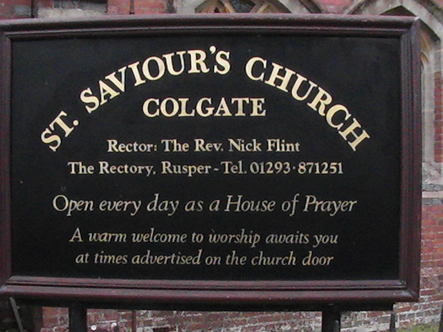
Where is St Saviour Churchyard?
St Saviour Churchyard is located at Forest Road Colgate, Horsham District ,West Sussex ,England.
-
St Saviour Churchyard cemetery's updated grave count on graveviews.com?
0 memorials
-
Where are the coordinates of the St Saviour Churchyard?
Latitude: 51.0817080
Longitude: -0.2444000

Nearby Cemetories:
1. Roffey Cemetery
Horsham, Horsham District, England
Coordinate: 51.0769320, -0.2930890
2. St John The Evangelist Churchyard
Lower Beeding, Horsham District, England
Coordinate: 51.0552500, -0.2889280
3. Snell Hatch Cemetery
Crawley, Crawley Borough, England
Coordinate: 51.1164130, -0.2053970
4. St Margaret of Antioch Churchyard
Ifield, Crawley Borough, England
Coordinate: 51.1238700, -0.2194760
5. Saint Mary Magdalene Churchyard
Rusper, Horsham District, England
Coordinate: 51.1227750, -0.2789080
6. St John the Baptist Church
Crawley, Crawley Borough, England
Coordinate: 51.1140840, -0.1892240
7. Friary Churchyard of St. Francis and St. Anthony
Crawley, Crawley Borough, England
Coordinate: 51.1133670, -0.1875970
8. St Mary Churchyard
Slaugham, Mid Sussex District, England
Coordinate: 51.0385470, -0.2081720
9. Friends Meeting House
Ifield, Crawley Borough, England
Coordinate: 51.1263400, -0.2120200
10. Holy Trinity Churchyard
Lower Beeding, Horsham District, England
Coordinate: 51.0331850, -0.2610280
11. Denne Road Cemetery
Horsham, Horsham District, England
Coordinate: 51.0596630, -0.3286750
12. St Mary the Virgin Churchyard
Horsham, Horsham District, England
Coordinate: 51.0597360, -0.3309600
13. St Mark's Churchyard
Staplefield, Mid Sussex District, England
Coordinate: 51.0387526, -0.1788845
14. St. Margaret Churchyard
Warnham, Horsham District, England
Coordinate: 51.0903160, -0.3462410
15. Saatchi Tomb
Mid Sussex District, England
Coordinate: 51.0398900, -0.1647300
16. Hills Cemetery
Horsham, Horsham District, England
Coordinate: 51.0645800, -0.3463350
17. St Andrew Churchyard
Nuthurst, Horsham District, England
Coordinate: 51.0222790, -0.3010080
18. St Mary's Churchyard
Balcombe, Mid Sussex District, England
Coordinate: 51.0626380, -0.1362240
19. St Nicholas Churchyard
Worth, Mid Sussex District, England
Coordinate: 51.1102870, -0.1415280
20. Charlwood Friends Burial Ground
Charlwood, Mole Valley District, England
Coordinate: 51.1553700, -0.2305800
21. Pleystowe in Capel Friends Grounds
Capel, Mole Valley District, England
Coordinate: 51.1411900, -0.3161300
22. Surrey and Sussex Crematorium
Crawley, Crawley Borough, England
Coordinate: 51.1357000, -0.1469230
23. Capel Friends Burial Ground #2
Capel, Mole Valley District, England
Coordinate: 51.1513970, -0.3219210
24. St. John the Baptist Churchyard
Capel, Mole Valley District, England
Coordinate: 51.1539730, -0.3201980