
| Memorials | : | 1 |
| Location | : | Warnham, Horsham District, England |
| Coordinate | : | 51.0903160, -0.3462410 |
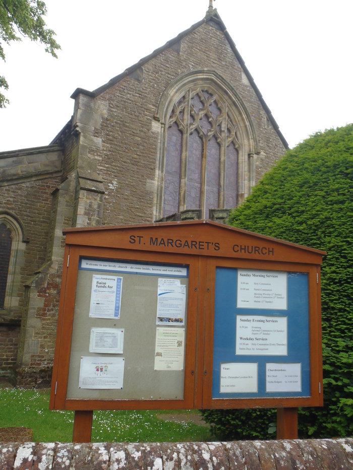
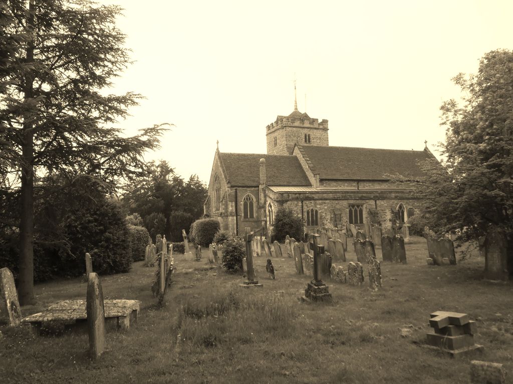
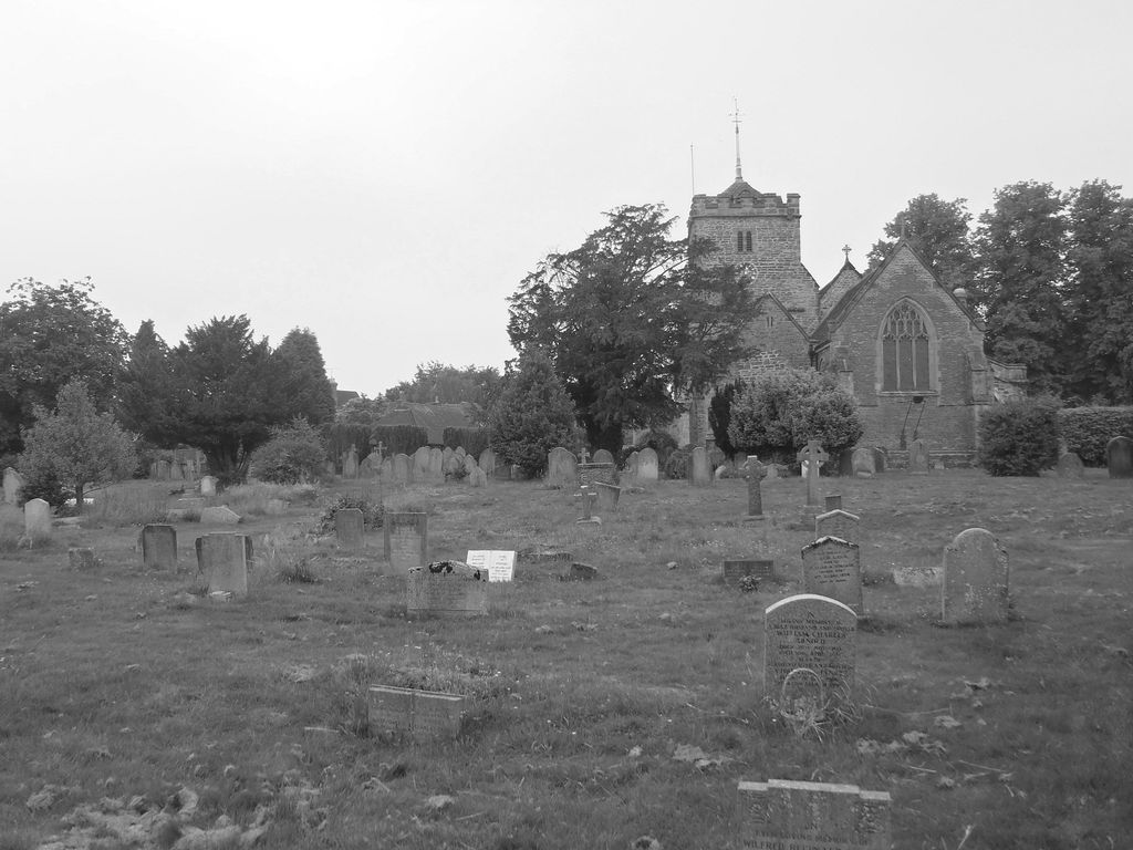
| Description | : | Warnham is a village and civil parish in the Horsham district of West Sussex, England. The village is centred 2 miles (3.2 km) NNW of Horsham, 31 miles (50 km) from London, to the west of the A24 road. The Anglican Parish Church, dedicated to St. Margaret was built in the 14th Century, but contains substantial later additions.St Margaret's is host to monuments belonging to at least three influential families nationally, the Durford, the Lucas and the Shelley family - in the case of the Shelley family internationally |
frequently asked questions (FAQ):
-
Where is St. Margaret Churchyard?
St. Margaret Churchyard is located at Church Street Warnham, Horsham District ,West Sussex , RH12 3QWEngland.
-
St. Margaret Churchyard cemetery's updated grave count on graveviews.com?
1 memorials
-
Where are the coordinates of the St. Margaret Churchyard?
Latitude: 51.0903160
Longitude: -0.3462410


Nearby Cemetories:
1. Hills Cemetery
Horsham, Horsham District, England
Coordinate: 51.0645800, -0.3463350
2. St Mary the Virgin Churchyard
Horsham, Horsham District, England
Coordinate: 51.0597360, -0.3309600
3. Denne Road Cemetery
Horsham, Horsham District, England
Coordinate: 51.0596630, -0.3286750
4. Roffey Cemetery
Horsham, Horsham District, England
Coordinate: 51.0769320, -0.2930890
5. St Peter Churchyard
Slinfold, Horsham District, England
Coordinate: 51.0725490, -0.4057220
6. Okewood St John the Baptist Churchyard
Ewhurst, Waverley Borough, England
Coordinate: 51.1303800, -0.3895000
7. St John the Baptist Churchyard
Oakwoodhill, Mole Valley District, England
Coordinate: 51.1304600, -0.3895700
8. St Nicolas Churchyard
Itchingfield, Horsham District, England
Coordinate: 51.0485300, -0.3867900
9. St John The Evangelist Churchyard
Lower Beeding, Horsham District, England
Coordinate: 51.0552500, -0.2889280
10. Saint Mary Magdalene Churchyard
Rusper, Horsham District, England
Coordinate: 51.1227750, -0.2789080
11. Pleystowe in Capel Friends Grounds
Capel, Mole Valley District, England
Coordinate: 51.1411900, -0.3161300
12. Ockley Cemetery
Ockley, Mole Valley District, England
Coordinate: 51.1473610, -0.3654400
13. Holy Trinity Churchyard
Rudgwick, Horsham District, England
Coordinate: 51.0973900, -0.4442800
14. Capel Friends Burial Ground #2
Capel, Mole Valley District, England
Coordinate: 51.1513970, -0.3219210
15. St Margaret Churchyard
Ockley, Mole Valley District, England
Coordinate: 51.1534880, -0.3473790
16. St Saviour Churchyard
Colgate, Horsham District, England
Coordinate: 51.0817080, -0.2444000
17. Holy Innocents Churchyard
Southwater, Horsham District, England
Coordinate: 51.0252410, -0.3584748
18. St. John the Baptist Churchyard
Capel, Mole Valley District, England
Coordinate: 51.1539730, -0.3201980
19. Southwater Parish Cemetery
Southwater, Horsham District, England
Coordinate: 51.0245167, -0.3574486
20. The Church of the Holy Innocents Cemetery
Southwater, Horsham District, England
Coordinate: 51.0244290, -0.3576390
21. St Andrew Churchyard
Nuthurst, Horsham District, England
Coordinate: 51.0222790, -0.3010080
22. Holy Trinity Churchyard
Lower Beeding, Horsham District, England
Coordinate: 51.0331850, -0.2610280
23. St Peter Churchyard
Newdigate, Mole Valley District, England
Coordinate: 51.1652200, -0.2884860
24. St Margaret of Antioch Churchyard
Ifield, Crawley Borough, England
Coordinate: 51.1238700, -0.2194760