
| Memorials | : | 12 |
| Location | : | Southampton, Southampton Unitary Authority, England |
| Coordinate | : | 50.8996600, -1.4035300 |
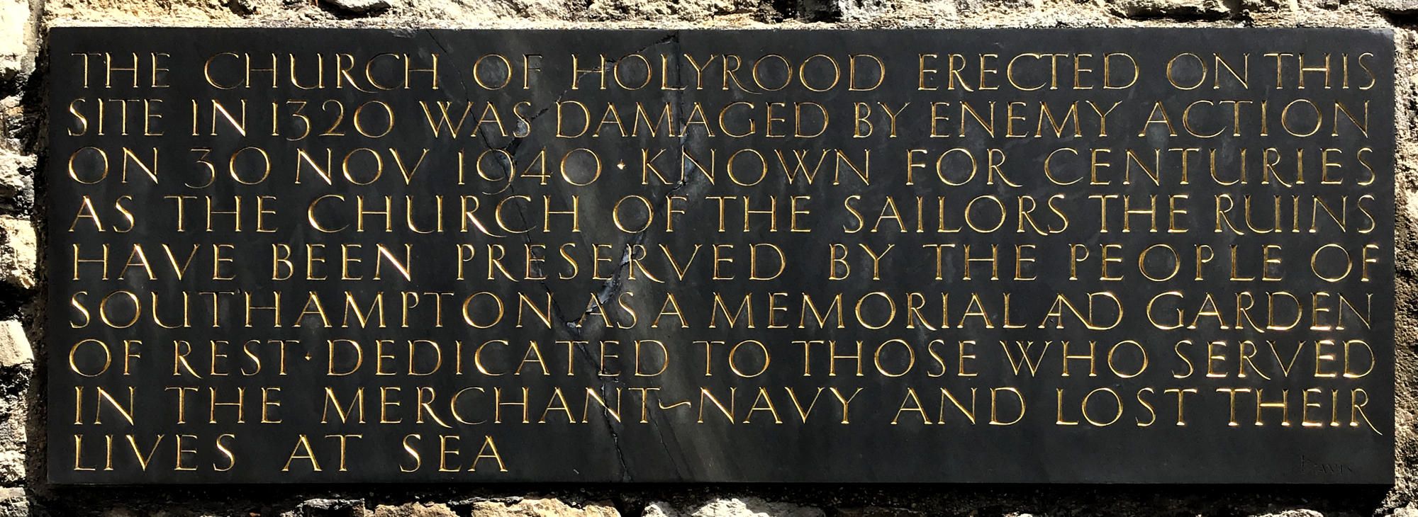
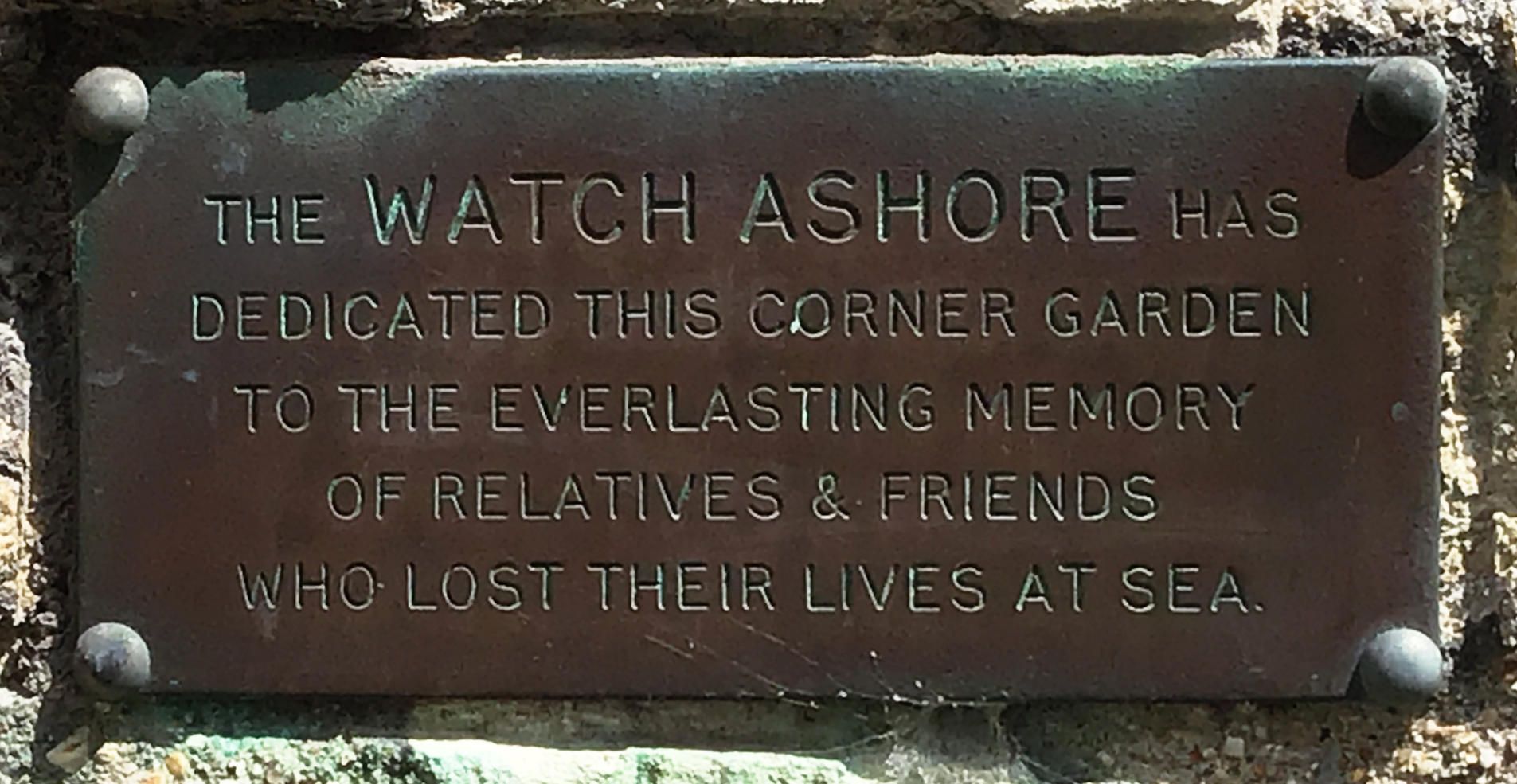
| Description | : | Holyrood Church was built in 1320 but was severely damaged by bombing in the Second World War. Its ruins have been preserved as a memorial and garden of rest. Known for centuries as the church of the sailors, Holyrood has been dedicated to those who served in the Merchant Navy and lost their lives at sea. The Holyrood burial register (1653-1812) is available through the Hampshire Archives. |
frequently asked questions (FAQ):
-
Where is Holyrood Churchyard?
Holyrood Churchyard is located at Bernard Street Southampton, Southampton Unitary Authority ,Hampshire , SO14 3AUEngland.
-
Holyrood Churchyard cemetery's updated grave count on graveviews.com?
11 memorials
-
Where are the coordinates of the Holyrood Churchyard?
Latitude: 50.8996600
Longitude: -1.4035300
Nearby Cemetories:
1. Holyrood Church
Southampton Unitary Authority, England
Coordinate: 50.8997498, -1.4034560
2. St Michael the Archangel Churchyard
Southampton, Southampton Unitary Authority, England
Coordinate: 50.8996200, -1.4056900
3. All Saints Catacombs and Burial Ground (Defunct)
Southampton, Southampton Unitary Authority, England
Coordinate: 50.9013350, -1.4021500
4. St Lawrence with St John Churchyard
Southampton, Southampton Unitary Authority, England
Coordinate: 50.8977570, -1.4052470
5. St. Julien's Church
Southampton, Southampton Unitary Authority, England
Coordinate: 50.8965000, -1.4036000
6. St Mary Churchyard
Southampton, Southampton Unitary Authority, England
Coordinate: 50.9027100, -1.3960800
7. St. Mary Extra Churchyard
Southampton, Southampton Unitary Authority, England
Coordinate: 50.9040000, -1.3743000
8. Southampton Old Cemetery
Southampton, Southampton Unitary Authority, England
Coordinate: 50.9202900, -1.4130650
9. Holy Trinity Churchyard
Southampton, Southampton Unitary Authority, England
Coordinate: 50.8896750, -1.3659150
10. St. Nicholas Churchyard
Millbrook, Southampton Unitary Authority, England
Coordinate: 50.9139100, -1.4439800
11. St Mary Churchyard
Sholing, Southampton Unitary Authority, England
Coordinate: 50.8991260, -1.3571350
12. Highfield Churchyard
Portswood, Southampton Unitary Authority, England
Coordinate: 50.9295400, -1.3949800
13. St John the Baptist Churchyard
Hythe, New Forest District, England
Coordinate: 50.8688500, -1.3985000
14. St James by the Park Churchyard
Shirley, Southampton Unitary Authority, England
Coordinate: 50.9266800, -1.4285800
15. St. James by the Park Cemetery
Southampton Unitary Authority, England
Coordinate: 50.9267988, -1.4283898
16. Holy Saviour Churchyard
Bitterne, Southampton Unitary Authority, England
Coordinate: 50.9138840, -1.3583560
17. All Saints Churchyard
Dibden, New Forest District, England
Coordinate: 50.8753020, -1.4362590
18. St Mary Extra Cemetery
Southampton, Southampton Unitary Authority, England
Coordinate: 50.8948700, -1.3522600
19. St John the Apostle Churchyard
Marchwood, New Forest District, England
Coordinate: 50.8900300, -1.4530700
20. Falklands War Memorial
Marchwood, New Forest District, England
Coordinate: 50.8898280, -1.4533250
21. Millbrook Cemetery
Millbrook, Southampton Unitary Authority, England
Coordinate: 50.9164900, -1.4526100
22. Holy Trinity Churchyard
Millbrook, Southampton Unitary Authority, England
Coordinate: 50.9158400, -1.4535100
23. Redcote Convent Cemetery
Bitterne, Southampton Unitary Authority, England
Coordinate: 50.9168600, -1.3510700
24. Hollybrook War Memorial
Southampton, Southampton Unitary Authority, England
Coordinate: 50.9337420, -1.4311350