
| Memorials | : | 0 |
| Location | : | Wyton, Huntingdonshire District, England |
| Coordinate | : | 52.3352100, -0.1135900 |
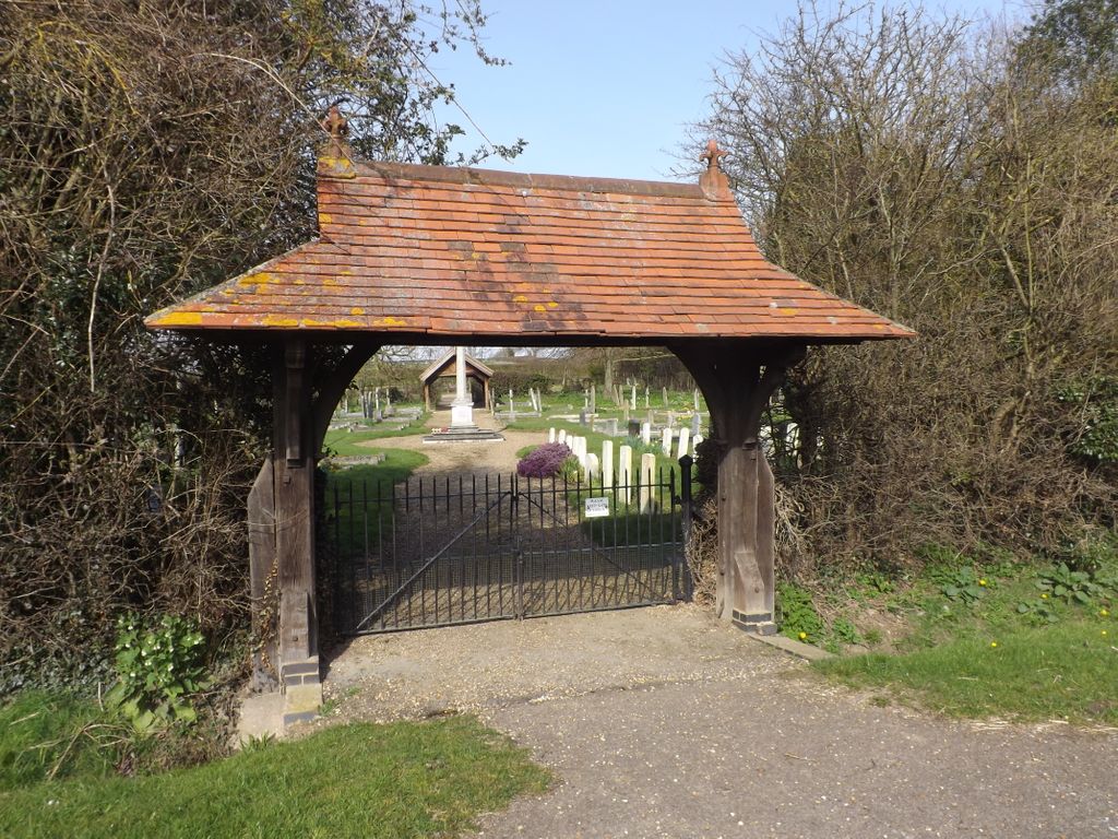
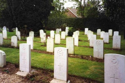
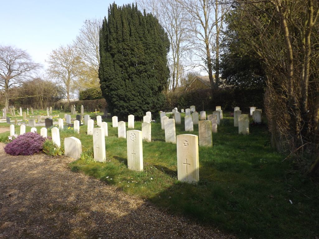
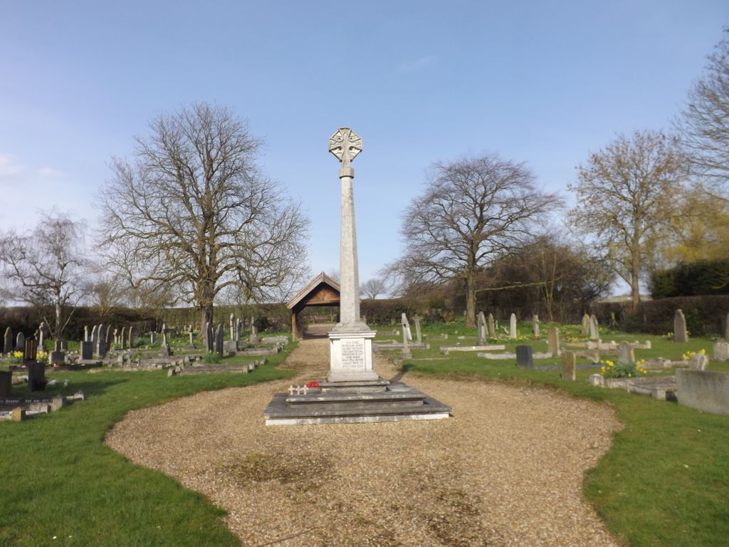
| Description | : | This site is situated in the county of Cambridgeshire, just off the A1123 Huntington to St Ives road - approximately 2.5 miles east of Huntingdon and 1.5 miles west of St Ives. There are 10 Commonwealth war graves marked by Commission headstones which stand together, with 30 non world war graves, situated near the Lychgate entrance. |
frequently asked questions (FAQ):
-
Where is Houghton and Wyton Burial Ground?
Houghton and Wyton Burial Ground is located at Wyton, Huntingdonshire District ,Cambridgeshire ,England.
-
Houghton and Wyton Burial Ground cemetery's updated grave count on graveviews.com?
0 memorials
-
Where are the coordinates of the Houghton and Wyton Burial Ground?
Latitude: 52.3352100
Longitude: -0.1135900
Nearby Cemetories:
1. St Mary The Virgin
Houghton, Huntingdonshire District, England
Coordinate: 52.3320200, -0.1213200
2. Houghton Chapel
Houghton, Huntingdonshire District, England
Coordinate: 52.3322400, -0.1219200
3. St Margaret and All Saints Churchyard
Wyton, Huntingdonshire District, England
Coordinate: 52.3335810, -0.1257620
4. St Margaret of Antioch Churchyard
Hemingford Abbots, Huntingdonshire District, England
Coordinate: 52.3237400, -0.1192820
5. Saint James Churchyard
Hemingford Grey, Huntingdonshire District, England
Coordinate: 52.3206701, -0.1051653
6. Ramsey Road Cemetery
St Ives, Huntingdonshire District, England
Coordinate: 52.3442700, -0.0854900
7. St Ives Church Cemetery
St Ives, Huntingdonshire District, England
Coordinate: 52.3287800, -0.0821800
8. Hemingford Grey Cemetery
Hemingford Grey, Huntingdonshire District, England
Coordinate: 52.3162700, -0.1008800
9. All Saints Churchyard
St Ives, Huntingdonshire District, England
Coordinate: 52.3265800, -0.0794490
10. St. Ives All Saints Churchyard
St Ives, Huntingdonshire District, England
Coordinate: 52.3265900, -0.0794200
11. St Ives Public Cemetery
St Ives, Huntingdonshire District, England
Coordinate: 52.3264600, -0.0744300
12. All Saints Churchyard
Huntingdon, Huntingdonshire District, England
Coordinate: 52.3366363, -0.1607257
13. Primrose Lane Lawn Cemetery
Huntingdonshire District, England
Coordinate: 52.3334666, -0.1760611
14. St. Mary the Virgin Churchyard
Godmanchester, Huntingdonshire District, England
Coordinate: 52.3202190, -0.1744400
15. Godmanchester War Memorial
Godmanchester, Huntingdonshire District, England
Coordinate: 52.3225780, -0.1759580
16. Priory Road Cemetery
Huntingdon, Huntingdonshire District, England
Coordinate: 52.3334320, -0.1796500
17. GODMANCHESTER LAWN CEMETERY
Godmanchester, Huntingdonshire District, England
Coordinate: 52.3091902, -0.1655030
18. St Marys Churchyard
Huntingdon, Huntingdonshire District, England
Coordinate: 52.3289548, -0.1799861
19. St Peter Churchyard
Kings Ripton, Huntingdonshire District, England
Coordinate: 52.3725600, -0.1487900
20. All Saints Parish Churchyard
Huntingdon, Huntingdonshire District, England
Coordinate: 52.3307170, -0.1849760
21. Fenstanton Cemetery
Fenstanton, Huntingdonshire District, England
Coordinate: 52.3013000, -0.0650700
22. St Peter's Churchyard
Huntingdonshire District, England
Coordinate: 52.3782650, -0.0914604
23. St. Peter and St. Paul Churchyard
Fenstanton, Huntingdonshire District, England
Coordinate: 52.3009610, -0.0653900
24. St. John the Baptist Churchyard
Holywell, Huntingdonshire District, England
Coordinate: 52.3189200, -0.0402900