
| Memorials | : | 0 |
| Location | : | Fenstanton, Huntingdonshire District, England |
| Coordinate | : | 52.3013000, -0.0650700 |
| Description | : | Fenstanton is a village and civil parish on the south side of the River Ouse in Cambridgeshire, England approximately 2 miles south of St Ives. It is situated within Huntingdonshire which is a non-metropolitan district of Cambridgeshire as well as being a historic county of England. Fenstanton lies Known as Stantun in the 11th century, Staunton and Stanton Gisbrit de Gant in the 13th century, the name Fenstanton (and Fennystanton) appeared from the 14th century. The name "Fenstanton" means "fenland stone enclosure". Lying on the Via Devana, the Roman road that linked the army camps at Godmanchester and Cambridge, Fenstanton was... Read More |
frequently asked questions (FAQ):
-
Where is Fenstanton Cemetery?
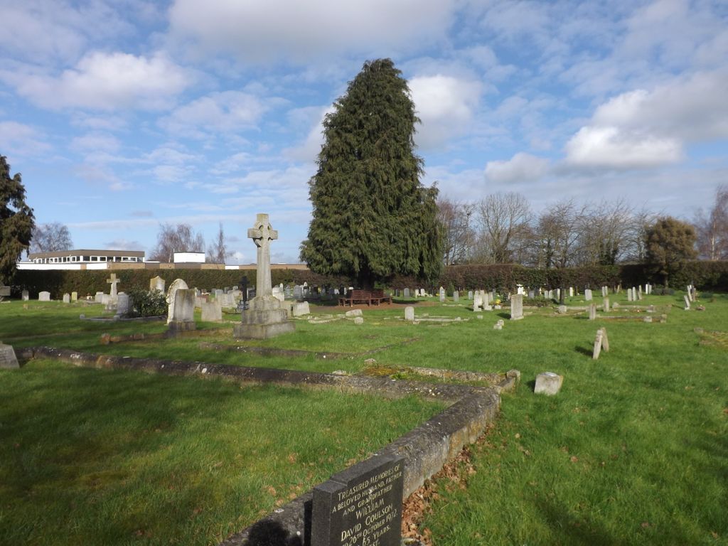
Fenstanton Cemetery is located at School Lane Fenstanton, Huntingdonshire District ,Cambridgeshire ,England.
-
Fenstanton Cemetery cemetery's updated grave count on graveviews.com?
0 memorials
-
Where are the coordinates of the Fenstanton Cemetery?
Latitude: 52.3013000
Longitude: -0.0650700
Nearby Cemetories:
1. St. Peter and St. Paul Churchyard
Fenstanton, Huntingdonshire District, England
Coordinate: 52.3009610, -0.0653900
2. St Mary Churchyard
Fen Drayton, South Cambridgeshire District, England
Coordinate: 52.2948320, -0.0369930
3. St. John the Baptist Churchyard
Holywell, Huntingdonshire District, England
Coordinate: 52.3189200, -0.0402900
4. St Mary Churchyard
Conington, South Cambridgeshire District, England
Coordinate: 52.2768320, -0.0665850
5. St Ives Public Cemetery
St Ives, Huntingdonshire District, England
Coordinate: 52.3264600, -0.0744300
6. Hemingford Grey Cemetery
Hemingford Grey, Huntingdonshire District, England
Coordinate: 52.3162700, -0.1008800
7. All Saints Churchyard
St Ives, Huntingdonshire District, England
Coordinate: 52.3265800, -0.0794490
8. St. Ives All Saints Churchyard
St Ives, Huntingdonshire District, England
Coordinate: 52.3265900, -0.0794200
9. St Ives Church Cemetery
St Ives, Huntingdonshire District, England
Coordinate: 52.3287800, -0.0821800
10. Saint James Churchyard
Hemingford Grey, Huntingdonshire District, England
Coordinate: 52.3206701, -0.1051653
11. St. Andrew's Churchyard
Swavesey, South Cambridgeshire District, England
Coordinate: 52.3050100, -0.0025700
12. St Margaret of Antioch Churchyard
Hemingford Abbots, Huntingdonshire District, England
Coordinate: 52.3237400, -0.1192820
13. Ramsey Road Cemetery
St Ives, Huntingdonshire District, England
Coordinate: 52.3442700, -0.0854900
14. Houghton and Wyton Burial Ground
Wyton, Huntingdonshire District, England
Coordinate: 52.3352100, -0.1135900
15. Elsworth Particular Baptist Chapelyard
Elsworth, South Cambridgeshire District, England
Coordinate: 52.2559800, -0.0686500
16. St. Peter's Churchyard
Boxworth, South Cambridgeshire District, England
Coordinate: 52.2620660, -0.0257910
17. St Mary The Virgin
Houghton, Huntingdonshire District, England
Coordinate: 52.3320200, -0.1213200
18. Over Baptist Cemetery
Over, South Cambridgeshire District, England
Coordinate: 52.3127700, 0.0081700
19. Houghton Chapel
Houghton, Huntingdonshire District, England
Coordinate: 52.3322400, -0.1219200
20. St Margaret and All Saints Churchyard
Wyton, Huntingdonshire District, England
Coordinate: 52.3335810, -0.1257620
21. St. Mary's Churchyard
Over, South Cambridgeshire District, England
Coordinate: 52.3177400, 0.0119500
22. Church of All Saints
Knapwell, South Cambridgeshire District, England
Coordinate: 52.2491000, -0.0447000
23. All Saints Churchyard
Lolworth, South Cambridgeshire District, England
Coordinate: 52.2583600, 0.0020200
24. St John the Baptist Churchyard
Papworth St Agnes, South Cambridgeshire District, England
Coordinate: 52.2641300, -0.1414700