
| Memorials | : | 0 |
| Location | : | Houghton, Huntingdonshire District, England |
| Coordinate | : | 52.3322400, -0.1219200 |
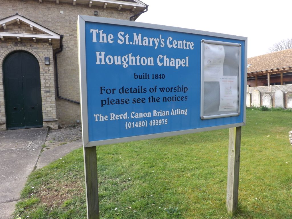
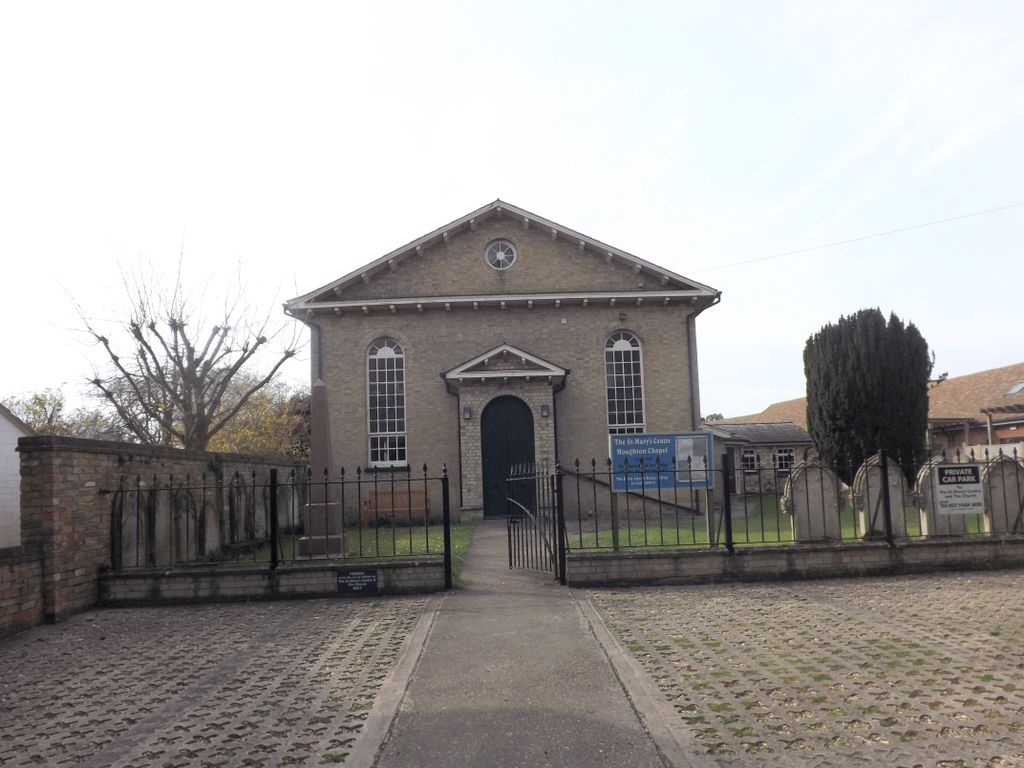
| Description | : | Houghton Chapel, also known as St Mary's Centre and formerly Houghton Chapel Retreat, which stands opposite the Parish church of St Mary the Virgin, Houghton and Wyton, was built in 1840 by villagers Potto Brown and Joseph Goodman. The location should not to be confused with Houghton Regis, near Dunstable in Bedfordshire. The Chapel became part of the United Reformed Church (URC) and continued as the village non-conformist place of worship until the 1980s. By then membership had fallen to just six and the URC decided that it was no longer viable as an independent chapel. The URC, under the leadership of the Minister... Read More |
frequently asked questions (FAQ):
-
Where is Houghton Chapel?
Houghton Chapel is located at Chapel Lane Houghton, Huntingdonshire District ,Cambridgeshire , PE28 2AYEngland.
-
Houghton Chapel cemetery's updated grave count on graveviews.com?
0 memorials
-
Where are the coordinates of the Houghton Chapel?
Latitude: 52.3322400
Longitude: -0.1219200
Nearby Cemetories:
1. St Mary The Virgin
Houghton, Huntingdonshire District, England
Coordinate: 52.3320200, -0.1213200
2. St Margaret and All Saints Churchyard
Wyton, Huntingdonshire District, England
Coordinate: 52.3335810, -0.1257620
3. Houghton and Wyton Burial Ground
Wyton, Huntingdonshire District, England
Coordinate: 52.3352100, -0.1135900
4. St Margaret of Antioch Churchyard
Hemingford Abbots, Huntingdonshire District, England
Coordinate: 52.3237400, -0.1192820
5. Saint James Churchyard
Hemingford Grey, Huntingdonshire District, England
Coordinate: 52.3206701, -0.1051653
6. Hemingford Grey Cemetery
Hemingford Grey, Huntingdonshire District, England
Coordinate: 52.3162700, -0.1008800
7. All Saints Churchyard
Huntingdon, Huntingdonshire District, England
Coordinate: 52.3366363, -0.1607257
8. St Ives Church Cemetery
St Ives, Huntingdonshire District, England
Coordinate: 52.3287800, -0.0821800
9. Ramsey Road Cemetery
St Ives, Huntingdonshire District, England
Coordinate: 52.3442700, -0.0854900
10. All Saints Churchyard
St Ives, Huntingdonshire District, England
Coordinate: 52.3265800, -0.0794490
11. St. Ives All Saints Churchyard
St Ives, Huntingdonshire District, England
Coordinate: 52.3265900, -0.0794200
12. St Ives Public Cemetery
St Ives, Huntingdonshire District, England
Coordinate: 52.3264600, -0.0744300
13. Primrose Lane Lawn Cemetery
Huntingdonshire District, England
Coordinate: 52.3334666, -0.1760611
14. St. Mary the Virgin Churchyard
Godmanchester, Huntingdonshire District, England
Coordinate: 52.3202190, -0.1744400
15. Godmanchester War Memorial
Godmanchester, Huntingdonshire District, England
Coordinate: 52.3225780, -0.1759580
16. GODMANCHESTER LAWN CEMETERY
Godmanchester, Huntingdonshire District, England
Coordinate: 52.3091902, -0.1655030
17. Priory Road Cemetery
Huntingdon, Huntingdonshire District, England
Coordinate: 52.3334320, -0.1796500
18. St Marys Churchyard
Huntingdon, Huntingdonshire District, England
Coordinate: 52.3289548, -0.1799861
19. All Saints Parish Churchyard
Huntingdon, Huntingdonshire District, England
Coordinate: 52.3307170, -0.1849760
20. St Peter Churchyard
Kings Ripton, Huntingdonshire District, England
Coordinate: 52.3725600, -0.1487900
21. Fenstanton Cemetery
Fenstanton, Huntingdonshire District, England
Coordinate: 52.3013000, -0.0650700
22. St. Peter and St. Paul Churchyard
Fenstanton, Huntingdonshire District, England
Coordinate: 52.3009610, -0.0653900
23. St Peter's Churchyard
Huntingdonshire District, England
Coordinate: 52.3782650, -0.0914604
24. St. John the Baptist Churchyard
Holywell, Huntingdonshire District, England
Coordinate: 52.3189200, -0.0402900