
| Memorials | : | 0 |
| Location | : | Hemingford Grey, Huntingdonshire District, England |
| Coordinate | : | 52.3162700, -0.1008800 |
| Description | : | Hemingford Grey is a village and civil parish in Cambridgeshire, England situated approximately 4 miles east of Huntingdon. It is within Huntingdonshire, a non-metropolitan district of Cambridgeshire as well as being a historic county of England. It lies on the southern bank of the River Great Ouse with the northern bank occupied by the flood meadow. In 1276 the village was given its present name by the de Grey family. The manor remained in the possession of the Greys until seized by Henry VII in the fifteenth century. The manor was subsequently leased to a number of people, including the great-grandfather... Read More |
frequently asked questions (FAQ):
-
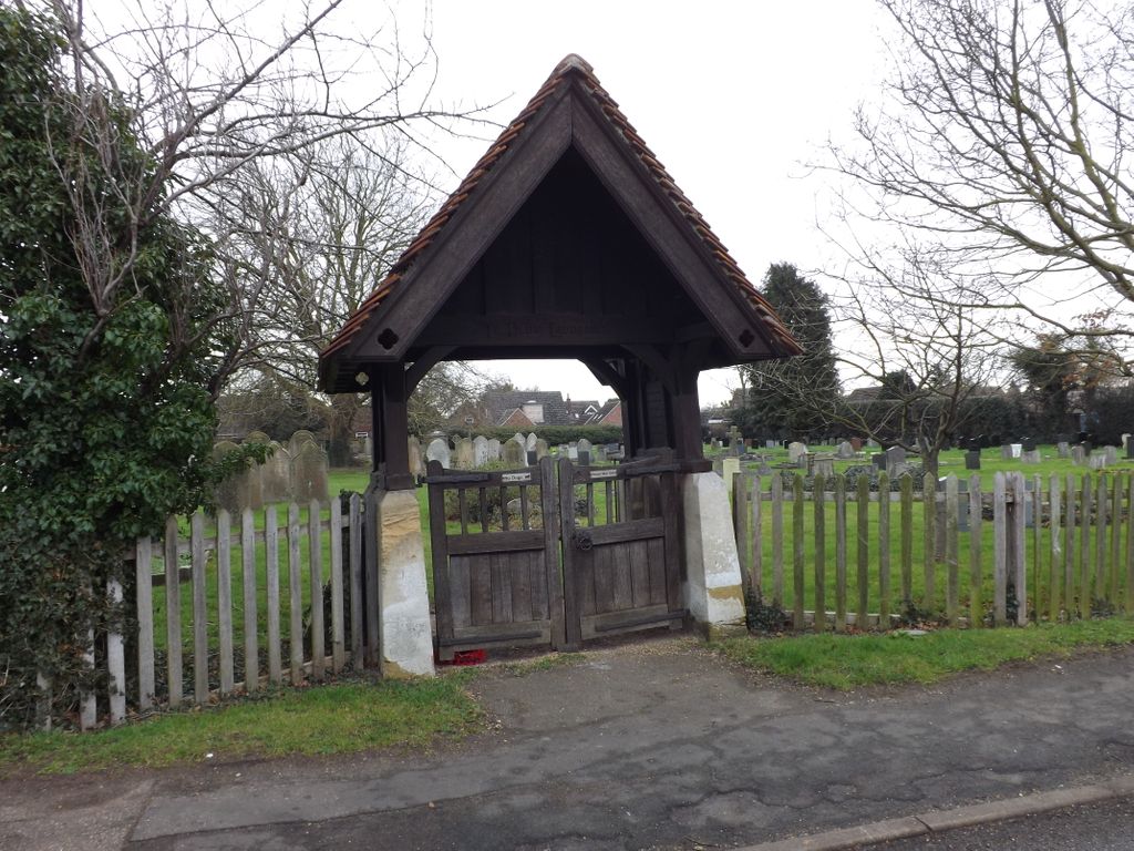
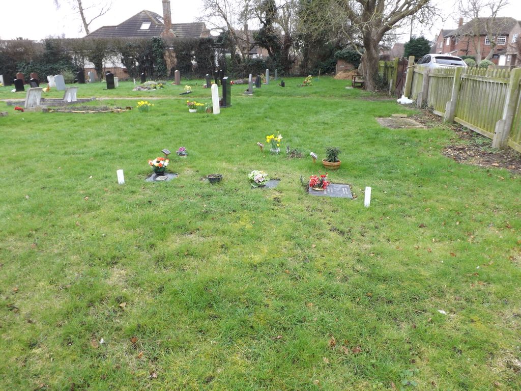
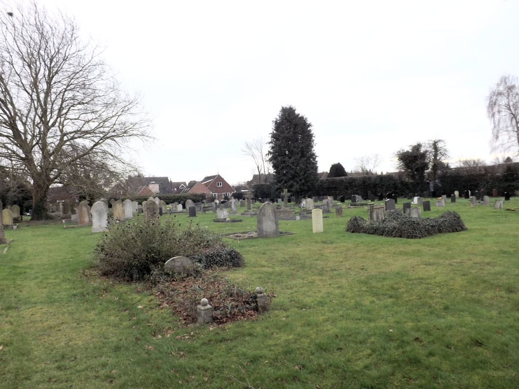
Where is Hemingford Grey Cemetery?
Hemingford Grey Cemetery is located at Pound Road Hemingford Grey, Huntingdonshire District ,Cambridgeshire ,England.
-
Hemingford Grey Cemetery cemetery's updated grave count on graveviews.com?
0 memorials
-
Where are the coordinates of the Hemingford Grey Cemetery?
Latitude: 52.3162700
Longitude: -0.1008800
Nearby Cemetories:
1. Saint James Churchyard
Hemingford Grey, Huntingdonshire District, England
Coordinate: 52.3206701, -0.1051653
2. St Margaret of Antioch Churchyard
Hemingford Abbots, Huntingdonshire District, England
Coordinate: 52.3237400, -0.1192820
3. All Saints Churchyard
St Ives, Huntingdonshire District, England
Coordinate: 52.3265800, -0.0794490
4. St. Ives All Saints Churchyard
St Ives, Huntingdonshire District, England
Coordinate: 52.3265900, -0.0794200
5. St Ives Church Cemetery
St Ives, Huntingdonshire District, England
Coordinate: 52.3287800, -0.0821800
6. St Ives Public Cemetery
St Ives, Huntingdonshire District, England
Coordinate: 52.3264600, -0.0744300
7. St Mary The Virgin
Houghton, Huntingdonshire District, England
Coordinate: 52.3320200, -0.1213200
8. Houghton and Wyton Burial Ground
Wyton, Huntingdonshire District, England
Coordinate: 52.3352100, -0.1135900
9. Houghton Chapel
Houghton, Huntingdonshire District, England
Coordinate: 52.3322400, -0.1219200
10. St Margaret and All Saints Churchyard
Wyton, Huntingdonshire District, England
Coordinate: 52.3335810, -0.1257620
11. Fenstanton Cemetery
Fenstanton, Huntingdonshire District, England
Coordinate: 52.3013000, -0.0650700
12. St. Peter and St. Paul Churchyard
Fenstanton, Huntingdonshire District, England
Coordinate: 52.3009610, -0.0653900
13. Ramsey Road Cemetery
St Ives, Huntingdonshire District, England
Coordinate: 52.3442700, -0.0854900
14. St. John the Baptist Churchyard
Holywell, Huntingdonshire District, England
Coordinate: 52.3189200, -0.0402900
15. GODMANCHESTER LAWN CEMETERY
Godmanchester, Huntingdonshire District, England
Coordinate: 52.3091902, -0.1655030
16. All Saints Churchyard
Huntingdon, Huntingdonshire District, England
Coordinate: 52.3366363, -0.1607257
17. St Mary Churchyard
Fen Drayton, South Cambridgeshire District, England
Coordinate: 52.2948320, -0.0369930
18. St Mary Churchyard
Conington, South Cambridgeshire District, England
Coordinate: 52.2768320, -0.0665850
19. St. Mary the Virgin Churchyard
Godmanchester, Huntingdonshire District, England
Coordinate: 52.3202190, -0.1744400
20. Godmanchester War Memorial
Godmanchester, Huntingdonshire District, England
Coordinate: 52.3225780, -0.1759580
21. Primrose Lane Lawn Cemetery
Huntingdonshire District, England
Coordinate: 52.3334666, -0.1760611
22. St Marys Churchyard
Huntingdon, Huntingdonshire District, England
Coordinate: 52.3289548, -0.1799861
23. Priory Road Cemetery
Huntingdon, Huntingdonshire District, England
Coordinate: 52.3334320, -0.1796500
24. All Saints Parish Churchyard
Huntingdon, Huntingdonshire District, England
Coordinate: 52.3307170, -0.1849760