
| Memorials | : | 2 |
| Location | : | Union Township, Putnam County, USA |
| Coordinate | : | 40.9458008, -84.1616974 |
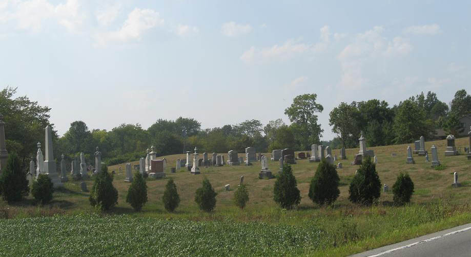
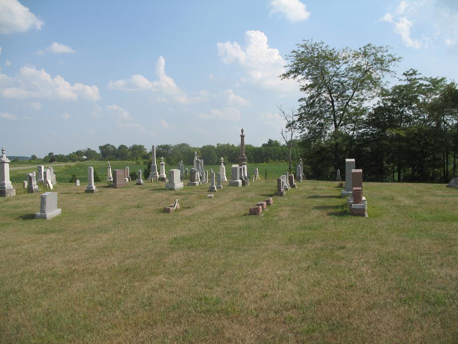
| Description | : | The cemetery is located on the west side of Ohio State Route 115 about 0.1 miles south of its intersection with County Road P. The cemetery is located in Union Township, Putnam County, Ohio, and is # 10163 (Hughes Cemetery) in “Ohio Cemeteries 1803-2003”, compiled by the Ohio Genealogical Society. The cemetery is registered with the Ohio Division of Real Estate and Professional Licensing (ODRE) as Hughes Cemetery with registration license number CGR.0000981741. The U.S. Geological Survey (USGS) Geographic Names Information System (GNIS) feature ID for the cemetery is 1041859 (Hughes Cemetery). |
frequently asked questions (FAQ):
-
Where is Hughes Cemetery?
Hughes Cemetery is located at Ohio State Route 115 Union Township, Putnam County ,Ohio , 45830USA.
-
Hughes Cemetery cemetery's updated grave count on graveviews.com?
2 memorials
-
Where are the coordinates of the Hughes Cemetery?
Latitude: 40.9458008
Longitude: -84.1616974

Nearby Cemetories:
1. Clevenger Cemetery
Kalida, Putnam County, USA
Coordinate: 40.9679460, -84.1857790
2. Reynolds Cemetery
Sugar Creek Township, Putnam County, USA
Coordinate: 40.9232940, -84.1986030
3. Ottawa River Cemetery
Rimer, Putnam County, USA
Coordinate: 40.9061012, -84.2080994
4. Saint Michaels Cemetery
Kalida, Putnam County, USA
Coordinate: 40.9846992, -84.2102966
5. Union Township Cemetery
Kalida, Putnam County, USA
Coordinate: 40.9843500, -84.2110400
6. Saint Anthony Cemetery
Columbus Grove, Putnam County, USA
Coordinate: 40.9197006, -84.0753021
7. Truro Cemetery
Columbus Grove, Putnam County, USA
Coordinate: 40.9056015, -84.0847015
8. Vaughnsville Cemetery
Vaughnsville, Putnam County, USA
Coordinate: 40.8754275, -84.1505957
9. Keirns Cemetery
Sugar Creek Township, Putnam County, USA
Coordinate: 40.8875008, -84.2181015
10. Wetherell Cemetery
Cloverdale, Putnam County, USA
Coordinate: 40.9963540, -84.2665100
11. Bogart Cemetery
Columbus Grove, Putnam County, USA
Coordinate: 40.9227982, -84.0385971
12. Comer Cemetery
Jackson Township, Putnam County, USA
Coordinate: 41.0031013, -84.2649994
13. Raabe Cemetery
Fort Jennings, Putnam County, USA
Coordinate: 40.8993988, -84.2789001
14. Carmen Cemetery
Gomer, Allen County, USA
Coordinate: 40.8531380, -84.2118660
15. Martz Cemetery
Cairo, Allen County, USA
Coordinate: 40.8485170, -84.1280870
16. Holden Cemetery
Jackson Township, Putnam County, USA
Coordinate: 41.0006060, -84.2740720
17. Altstaetter Cemetery
Cairo, Allen County, USA
Coordinate: 40.8607860, -84.0859520
18. Pike Run Cemetery
Gomer, Allen County, USA
Coordinate: 40.8432999, -84.1669006
19. Kirkendall Cemetery
Greensburg Township, Putnam County, USA
Coordinate: 41.0489920, -84.1660670
20. Saint Johns Pioneer Cemetery
Glandorf, Putnam County, USA
Coordinate: 41.0295400, -84.0799400
21. Landis Cemetery
Kalida, Putnam County, USA
Coordinate: 41.0404960, -84.2190350
22. Myers Cemetery
Greensburg Township, Putnam County, USA
Coordinate: 41.0517006, -84.1541977
23. Saints Peter And Paul Cemetery
Ottawa, Putnam County, USA
Coordinate: 41.0172005, -84.0575027
24. Saint Joseph Cemetery
Fort Jennings, Putnam County, USA
Coordinate: 40.9056015, -84.2928009