
| Memorials | : | 3 |
| Location | : | Kalida, Putnam County, USA |
| Coordinate | : | 40.9846992, -84.2102966 |
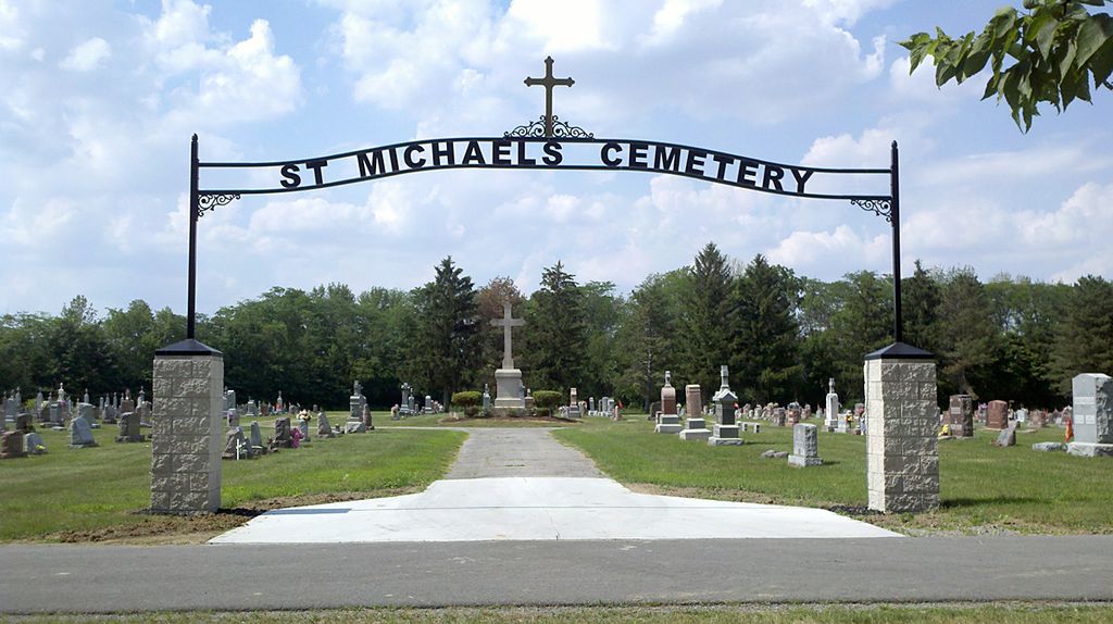
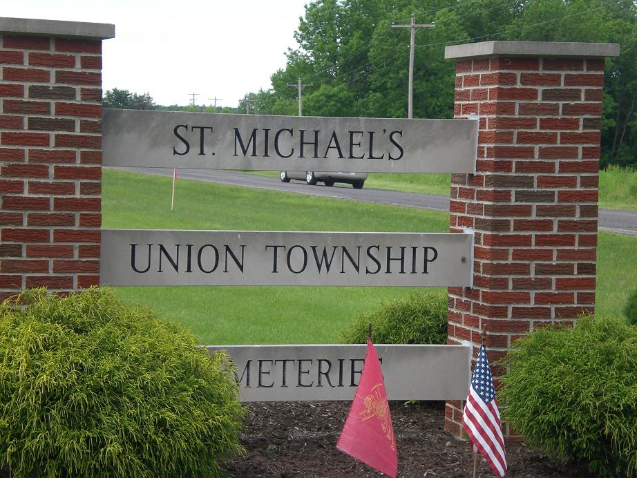
| Description | : | The cemetery is located on the southwest side of W Main Street (Ohio State Route 114) about 0.2 miles northwest of its intersection with E Front Street. The cemetery is located in Union Township, Putnam County, Ohio, and is # 10165 (Saint Michaels Catholic Cemetery / Saint Michaels Cemetery) in “Ohio Cemeteries 1803-2003”, compiled by the Ohio Genealogical Society. The cemetery is registered with the Ohio Division of Real Estate and Professional Licensing (ODRE) as Saint Michael Cemetery with registration license number CBR.0000981972. The U.S. Geological Survey (USGS) Geographic Names Information System (GNIS) feature ID for the cemetery... Read More |
frequently asked questions (FAQ):
-
Where is Saint Michaels Cemetery?
Saint Michaels Cemetery is located at W Main Street (Ohio State Route 114) Kalida, Putnam County ,Ohio , 45827USA.
-
Saint Michaels Cemetery cemetery's updated grave count on graveviews.com?
2 memorials
-
Where are the coordinates of the Saint Michaels Cemetery?
Latitude: 40.9846992
Longitude: -84.2102966
Nearby Cemetories:
1. Union Township Cemetery
Kalida, Putnam County, USA
Coordinate: 40.9843500, -84.2110400
2. Clevenger Cemetery
Kalida, Putnam County, USA
Coordinate: 40.9679460, -84.1857790
3. Wetherell Cemetery
Cloverdale, Putnam County, USA
Coordinate: 40.9963540, -84.2665100
4. Comer Cemetery
Jackson Township, Putnam County, USA
Coordinate: 41.0031013, -84.2649994
5. Holden Cemetery
Jackson Township, Putnam County, USA
Coordinate: 41.0006060, -84.2740720
6. Hughes Cemetery
Union Township, Putnam County, USA
Coordinate: 40.9458008, -84.1616974
7. Landis Cemetery
Kalida, Putnam County, USA
Coordinate: 41.0404960, -84.2190350
8. Reynolds Cemetery
Sugar Creek Township, Putnam County, USA
Coordinate: 40.9232940, -84.1986030
9. Asa Varner Cemetery
Cuba, Putnam County, USA
Coordinate: 41.0478000, -84.2081000
10. Brower Cemetery
Cuba, Putnam County, USA
Coordinate: 41.0510444, -84.1992837
11. Myers Cemetery
Perry Township, Putnam County, USA
Coordinate: 41.0175589, -84.2890091
12. Cascade Cemetery
Cloverdale, Putnam County, USA
Coordinate: 41.0182470, -84.2901990
13. Saint Isidore Catholic Cemetery
Greensburg Township, Putnam County, USA
Coordinate: 41.0536003, -84.2003021
14. Brower Cemetery
Cuba, Putnam County, USA
Coordinate: 41.0531500, -84.1849100
15. Kirkendall Cemetery
Greensburg Township, Putnam County, USA
Coordinate: 41.0489920, -84.1660670
16. Sigler Cemetery
Dupont, Putnam County, USA
Coordinate: 41.0477340, -84.2605610
17. Saint Barbaras Catholic Church Cemetery
Cloverdale, Putnam County, USA
Coordinate: 41.0184410, -84.2974091
18. Ottawa River Cemetery
Rimer, Putnam County, USA
Coordinate: 40.9061012, -84.2080994
19. Myers Cemetery
Greensburg Township, Putnam County, USA
Coordinate: 41.0517006, -84.1541977
20. Varner Cemetery
Greensburg Township, Putnam County, USA
Coordinate: 41.0572600, -84.1577100
21. Franconia Cemetery
Dupont, Putnam County, USA
Coordinate: 41.0393982, -84.2936020
22. Keirns Cemetery
Sugar Creek Township, Putnam County, USA
Coordinate: 40.8875008, -84.2181015
23. Crow Cemetery
Glandorf, Putnam County, USA
Coordinate: 41.0574989, -84.1239014
24. Raabe Cemetery
Fort Jennings, Putnam County, USA
Coordinate: 40.8993988, -84.2789001