
| Memorials | : | 21 |
| Location | : | Kalida, Putnam County, USA |
| Coordinate | : | 40.9843500, -84.2110400 |
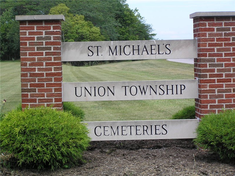
| Description | : | The cemetery is located on the west side of W Main Street (Ohio State Route 114) adjacent to and west of Saint Michaels Cemetery about 0.2 miles northwest of its intersection with E Front Street. The cemetery is located in Union Township, Putnam County, Ohio, and is # 10164 (Old Kalida Cemetery / Township Cemetery / New Union Cemetery) in “Ohio Cemeteries 1803-2003”, compiled by the Ohio Genealogical Society. The cemetery is registered with the Ohio Division of Real Estate and Professional Licensing (ODRE) as Kalida Cemetery with registration license number CGR.0000981739. |
frequently asked questions (FAQ):
-
Where is Union Township Cemetery?
Union Township Cemetery is located at W Main Street (Ohio State Route 114) Kalida, Putnam County ,Ohio , 45844USA.
-
Union Township Cemetery cemetery's updated grave count on graveviews.com?
19 memorials
-
Where are the coordinates of the Union Township Cemetery?
Latitude: 40.9843500
Longitude: -84.2110400
Nearby Cemetories:
1. Saint Michaels Cemetery
Kalida, Putnam County, USA
Coordinate: 40.9846992, -84.2102966
2. Clevenger Cemetery
Kalida, Putnam County, USA
Coordinate: 40.9679460, -84.1857790
3. Wetherell Cemetery
Cloverdale, Putnam County, USA
Coordinate: 40.9963540, -84.2665100
4. Comer Cemetery
Jackson Township, Putnam County, USA
Coordinate: 41.0031013, -84.2649994
5. Holden Cemetery
Jackson Township, Putnam County, USA
Coordinate: 41.0006060, -84.2740720
6. Hughes Cemetery
Union Township, Putnam County, USA
Coordinate: 40.9458008, -84.1616974
7. Landis Cemetery
Kalida, Putnam County, USA
Coordinate: 41.0404960, -84.2190350
8. Reynolds Cemetery
Sugar Creek Township, Putnam County, USA
Coordinate: 40.9232940, -84.1986030
9. Asa Varner Cemetery
Cuba, Putnam County, USA
Coordinate: 41.0478000, -84.2081000
10. Brower Cemetery
Cuba, Putnam County, USA
Coordinate: 41.0510444, -84.1992837
11. Myers Cemetery
Perry Township, Putnam County, USA
Coordinate: 41.0175589, -84.2890091
12. Cascade Cemetery
Cloverdale, Putnam County, USA
Coordinate: 41.0182470, -84.2901990
13. Saint Isidore Catholic Cemetery
Greensburg Township, Putnam County, USA
Coordinate: 41.0536003, -84.2003021
14. Brower Cemetery
Cuba, Putnam County, USA
Coordinate: 41.0531500, -84.1849100
15. Kirkendall Cemetery
Greensburg Township, Putnam County, USA
Coordinate: 41.0489920, -84.1660670
16. Saint Barbaras Catholic Church Cemetery
Cloverdale, Putnam County, USA
Coordinate: 41.0184410, -84.2974091
17. Sigler Cemetery
Dupont, Putnam County, USA
Coordinate: 41.0477340, -84.2605610
18. Ottawa River Cemetery
Rimer, Putnam County, USA
Coordinate: 40.9061012, -84.2080994
19. Myers Cemetery
Greensburg Township, Putnam County, USA
Coordinate: 41.0517006, -84.1541977
20. Franconia Cemetery
Dupont, Putnam County, USA
Coordinate: 41.0393982, -84.2936020
21. Varner Cemetery
Greensburg Township, Putnam County, USA
Coordinate: 41.0572600, -84.1577100
22. Keirns Cemetery
Sugar Creek Township, Putnam County, USA
Coordinate: 40.8875008, -84.2181015
23. Crow Cemetery
Glandorf, Putnam County, USA
Coordinate: 41.0574989, -84.1239014
24. Raabe Cemetery
Fort Jennings, Putnam County, USA
Coordinate: 40.8993988, -84.2789001