
| Memorials | : | 9 |
| Location | : | Sugar Creek Township, Putnam County, USA |
| Coordinate | : | 40.9232940, -84.1986030 |
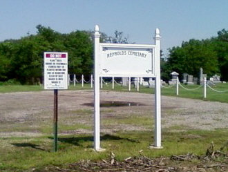
| Description | : | The cemetery is located at the east end of Township Road Q-17 about 0.2 miles east of its intersection with Township Road 17N. The cemetery is located in Sugar Creek Township, Putnam County, Ohio, and is # 10161 (Reynolds Cemetery) in “Ohio Cemeteries 1803-2003”, compiled by the Ohio Genealogical Society. The U.S. Geological Survey (USGS) Geographic Names Information System (GNIS) feature ID for the cemetery is 1044958 (Reynolds Cemetery). |
frequently asked questions (FAQ):
-
Where is Reynolds Cemetery?
Reynolds Cemetery is located at Township Road Q-17 Sugar Creek Township, Putnam County ,Ohio , 45830USA.
-
Reynolds Cemetery cemetery's updated grave count on graveviews.com?
9 memorials
-
Where are the coordinates of the Reynolds Cemetery?
Latitude: 40.9232940
Longitude: -84.1986030
Nearby Cemetories:
1. Ottawa River Cemetery
Rimer, Putnam County, USA
Coordinate: 40.9061012, -84.2080994
2. Hughes Cemetery
Union Township, Putnam County, USA
Coordinate: 40.9458008, -84.1616974
3. Keirns Cemetery
Sugar Creek Township, Putnam County, USA
Coordinate: 40.8875008, -84.2181015
4. Clevenger Cemetery
Kalida, Putnam County, USA
Coordinate: 40.9679460, -84.1857790
5. Vaughnsville Cemetery
Vaughnsville, Putnam County, USA
Coordinate: 40.8754275, -84.1505957
6. Union Township Cemetery
Kalida, Putnam County, USA
Coordinate: 40.9843500, -84.2110400
7. Saint Michaels Cemetery
Kalida, Putnam County, USA
Coordinate: 40.9846992, -84.2102966
8. Raabe Cemetery
Fort Jennings, Putnam County, USA
Coordinate: 40.8993988, -84.2789001
9. Carmen Cemetery
Gomer, Allen County, USA
Coordinate: 40.8531380, -84.2118660
10. Saint Joseph Cemetery
Fort Jennings, Putnam County, USA
Coordinate: 40.9056015, -84.2928009
11. Mount Calvary Cemetery
Fort Jennings, Putnam County, USA
Coordinate: 40.8986015, -84.3035965
12. Pike Run Cemetery
Gomer, Allen County, USA
Coordinate: 40.8432999, -84.1669006
13. Truro Cemetery
Columbus Grove, Putnam County, USA
Coordinate: 40.9056015, -84.0847015
14. Wetherell Cemetery
Cloverdale, Putnam County, USA
Coordinate: 40.9963540, -84.2665100
15. Hadding Cemetery
Gomer, Allen County, USA
Coordinate: 40.8319016, -84.2035980
16. Martz Cemetery
Cairo, Allen County, USA
Coordinate: 40.8485170, -84.1280870
17. Saint Anthony Cemetery
Columbus Grove, Putnam County, USA
Coordinate: 40.9197006, -84.0753021
18. Comer Cemetery
Jackson Township, Putnam County, USA
Coordinate: 41.0031013, -84.2649994
19. Holden Cemetery
Jackson Township, Putnam County, USA
Coordinate: 41.0006060, -84.2740720
20. New Saint John's Catholic Cemetery
Delphos, Allen County, USA
Coordinate: 40.8451390, -84.2889380
21. Oard Cemetery
West Cairo, Allen County, USA
Coordinate: 40.8326550, -84.1305760
22. Altstaetter Cemetery
Cairo, Allen County, USA
Coordinate: 40.8607860, -84.0859520
23. Salem Mennonite Cemetery
Elida, Allen County, USA
Coordinate: 40.8171220, -84.1851000
24. Hartshorn Cemetery
Allen County, USA
Coordinate: 40.8424988, -84.2908020