
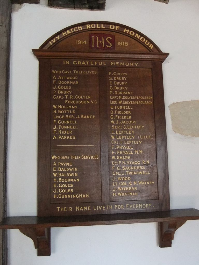
| Memorials | : | 14 |
| Location | : | Ightham, Tonbridge and Malling Borough, England |
| Coordinate | : | 51.2584610, 0.2695830 |
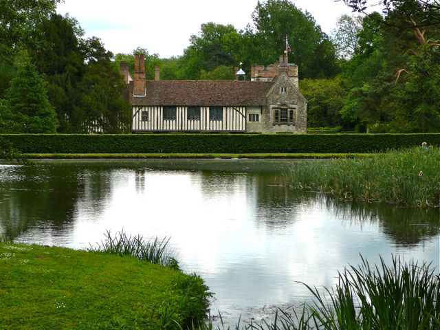
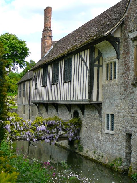
| Description | : | Ightham Mote is a fourteenth century manor house with a fascinating history, tucked into a wooded valley not far from Sevenoaks, Kent. The last private owner was an American, C. Henry Robinson, who gave the house to the National Trust on his death. His ashes were returned to the house, and are enclosed in a buttress in the crypt. |
frequently asked questions (FAQ):
-
Where is Ightham Mote?
Ightham Mote is located at Ightham, Tonbridge and Malling Borough ,Kent ,England.
-
Ightham Mote cemetery's updated grave count on graveviews.com?
14 memorials
-
Where are the coordinates of the Ightham Mote?
Latitude: 51.2584610
Longitude: 0.2695830
Nearby Cemetories:
1. St Giles Churchyard
Shipbourne, Tonbridge and Malling Borough, England
Coordinate: 51.2471700, 0.2786090
2. Plaxtol Parish Churchyard
Plaxtol, Tonbridge and Malling Borough, England
Coordinate: 51.2593498, 0.2945710
3. Plaxtol War Memorial
Plaxtol, Tonbridge and Malling Borough, England
Coordinate: 51.2592888, 0.2948450
4. St. Lawrence Churchyard
Seal Chart, Sevenoaks District, England
Coordinate: 51.2742910, 0.2537250
5. St. Margaret's Churchyard
Underriver, Sevenoaks District, England
Coordinate: 51.2458191, 0.2291520
6. St Peter Churchyard
Ightham, Tonbridge and Malling Borough, England
Coordinate: 51.2891680, 0.2858450
7. Church of the Good Shepherd
Borough Green, Tonbridge and Malling Borough, England
Coordinate: 51.2910300, 0.3037660
8. Borough Green Baptist Churchyard
Borough Green, Tonbridge and Malling Borough, England
Coordinate: 51.2916540, 0.3053750
9. OMF International UK
Borough Green, Tonbridge and Malling Borough, England
Coordinate: 51.2937286, 0.3066902
10. St Peter and St Paul Churchyard
Seal, Sevenoaks District, England
Coordinate: 51.2907080, 0.2223010
11. St John the Evangelist Churchyard
Hildenborough, Tonbridge and Malling Borough, England
Coordinate: 51.2174100, 0.2391660
12. Hildenborough War Memorial
Hildenborough, Tonbridge and Malling Borough, England
Coordinate: 51.2175827, 0.2372410
13. St Mary the Virgin Churchyard
Platt, Tonbridge and Malling Borough, England
Coordinate: 51.2892070, 0.3252260
14. St Nicholas Churchyard
Sevenoaks, Sevenoaks District, England
Coordinate: 51.2673310, 0.1933100
15. Sevenoaks War Memorial
Sevenoaks, Sevenoaks District, England
Coordinate: 51.2761078, 0.1927860
16. Greatness Park Cemetery
Sevenoaks, Sevenoaks District, England
Coordinate: 51.2906800, 0.2043260
17. Tonbridge Cemetery
Tonbridge, Tonbridge and Malling Borough, England
Coordinate: 51.2057762, 0.2772440
18. St Dunstan Churchyard
West Peckham, Tonbridge and Malling Borough, England
Coordinate: 51.2486191, 0.3544910
19. St Mary the Virgin Churchyard
Kemsing, Sevenoaks District, England
Coordinate: 51.3068670, 0.2310220
20. Hadlow Cemetery
Hadlow, Tonbridge and Malling Borough, England
Coordinate: 51.2292860, 0.3468200
21. St George Churchyard
Wrotham, Tonbridge and Malling Borough, England
Coordinate: 51.3088360, 0.3110130
22. Wrotham Cemetery
Wrotham, Tonbridge and Malling Borough, England
Coordinate: 51.3099430, 0.3108890
23. Tonbridge Castle
Tonbridge, Tonbridge and Malling Borough, England
Coordinate: 51.1987000, 0.2764000
24. St Peter and St Paul Church
Tonbridge, Tonbridge and Malling Borough, England
Coordinate: 51.1977660, 0.2764630