
| Memorials | : | 0 |
| Location | : | Seal, Sevenoaks District, England |
| Coordinate | : | 51.2907080, 0.2223010 |
| Description | : | The village is located in the valley between the North Downs and the Greensand ridge to the north east of Sevenoaks town in Kent. It lies on the A25 road, and although ancient, is fast becoming part of the built-up area of Sevenoaks. In early documents the name of the village is often given as 'Sele', 'Sale','Zela' or 'La Sela'. Until recently it was supposed to come from the French word 'salle' meaning a hall but there is no evidence to support this. The etymology of place names suggests that the name of the village could have come from the... Read More |
frequently asked questions (FAQ):
-
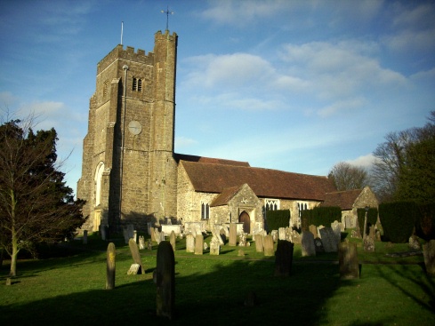
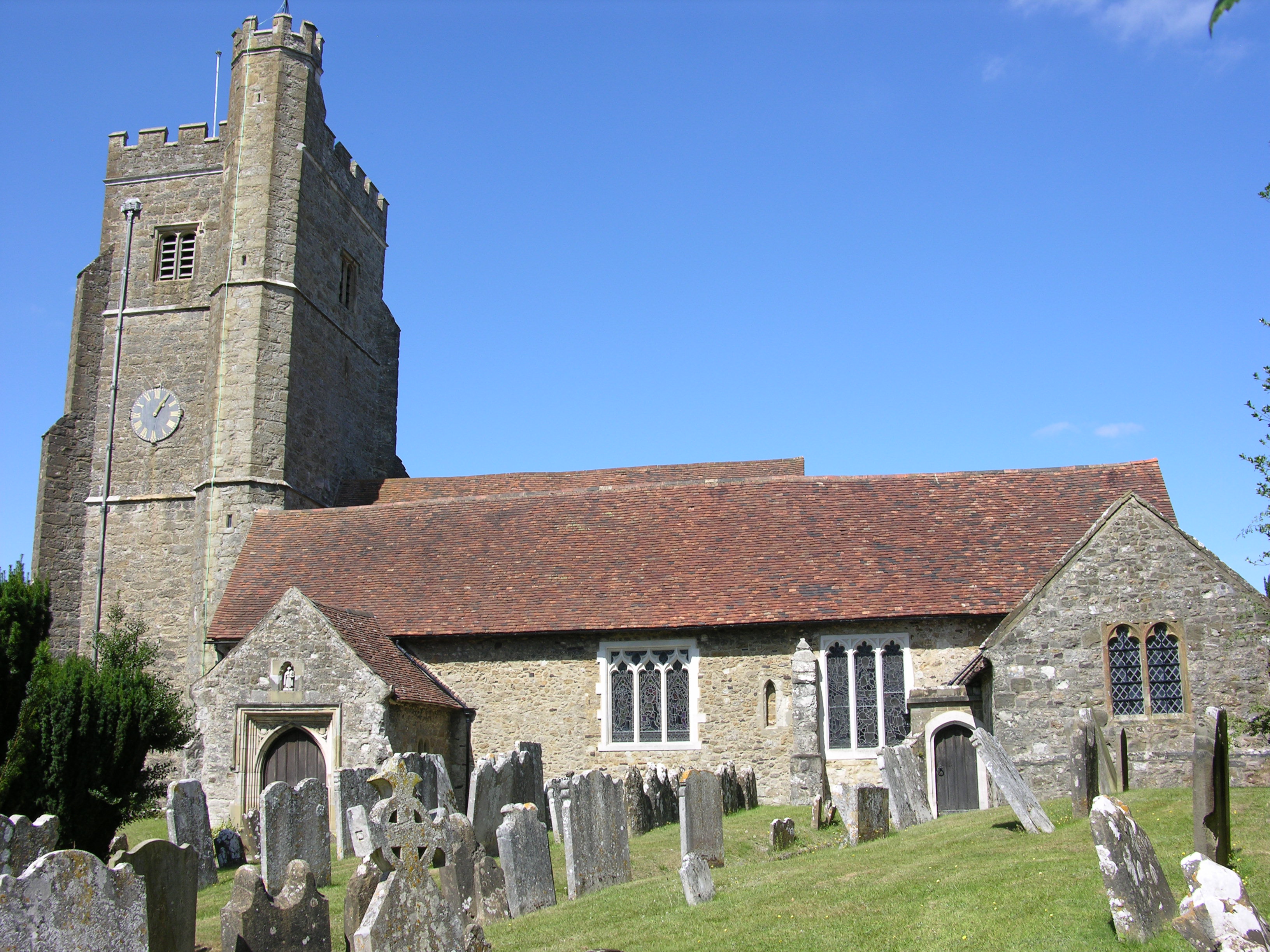
Where is St Peter and St Paul Churchyard?
St Peter and St Paul Churchyard is located at Church Street Seal, Sevenoaks District ,Kent , TN15 0ATEngland.
-
St Peter and St Paul Churchyard cemetery's updated grave count on graveviews.com?
0 memorials
-
Where are the coordinates of the St Peter and St Paul Churchyard?
Latitude: 51.2907080
Longitude: 0.2223010
Nearby Cemetories:
1. Greatness Park Cemetery
Sevenoaks, Sevenoaks District, England
Coordinate: 51.2906800, 0.2043260
2. St Mary the Virgin Churchyard
Kemsing, Sevenoaks District, England
Coordinate: 51.3068670, 0.2310220
3. Sevenoaks War Memorial
Sevenoaks, Sevenoaks District, England
Coordinate: 51.2761078, 0.1927860
4. St. Lawrence Churchyard
Seal Chart, Sevenoaks District, England
Coordinate: 51.2742910, 0.2537250
5. St. Bartholomew's Churchyard
Otford, Sevenoaks District, England
Coordinate: 51.3123700, 0.1916890
6. St Nicholas Churchyard
Sevenoaks, Sevenoaks District, England
Coordinate: 51.2673310, 0.1933100
7. St Mary the Virgin Churchyard
Riverhead, Sevenoaks District, England
Coordinate: 51.2840040, 0.1707580
8. St Mary's Churchyard Woodlands
West Kingsdown, Sevenoaks District, England
Coordinate: 51.3233700, 0.2428600
9. St Mary's
Dunton Green, Sevenoaks District, England
Coordinate: 51.2986100, 0.1632100
10. St Peter Churchyard
Ightham, Tonbridge and Malling Borough, England
Coordinate: 51.2891680, 0.2858450
11. Ightham Mote
Ightham, Tonbridge and Malling Borough, England
Coordinate: 51.2584610, 0.2695830
12. St. Margaret's Churchyard
Underriver, Sevenoaks District, England
Coordinate: 51.2458191, 0.2291520
13. St. Peter and St. Paul's Churchyard
Shoreham, Sevenoaks District, England
Coordinate: 51.3330170, 0.1844590
14. Church of the Good Shepherd
Borough Green, Tonbridge and Malling Borough, England
Coordinate: 51.2910300, 0.3037660
15. Borough Green Baptist Churchyard
Borough Green, Tonbridge and Malling Borough, England
Coordinate: 51.2916540, 0.3053750
16. OMF International UK
Borough Green, Tonbridge and Malling Borough, England
Coordinate: 51.2937286, 0.3066902
17. Chevening Parish Burial Ground
Chevening, Sevenoaks District, England
Coordinate: 51.2987450, 0.1356290
18. Plaxtol Parish Churchyard
Plaxtol, Tonbridge and Malling Borough, England
Coordinate: 51.2593498, 0.2945710
19. Plaxtol War Memorial
Plaxtol, Tonbridge and Malling Borough, England
Coordinate: 51.2592888, 0.2948450
20. St Botolph Churchyard
Chevening, Sevenoaks District, England
Coordinate: 51.2987650, 0.1345180
21. St Giles Churchyard
Shipbourne, Tonbridge and Malling Borough, England
Coordinate: 51.2471700, 0.2786090
22. St George Churchyard
Wrotham, Tonbridge and Malling Borough, England
Coordinate: 51.3088360, 0.3110130
23. Wrotham Cemetery
Wrotham, Tonbridge and Malling Borough, England
Coordinate: 51.3099430, 0.3108890
24. St Mary Churchyard
Sundridge, Sevenoaks District, England
Coordinate: 51.2743360, 0.1292510