
| Memorials | : | 383 |
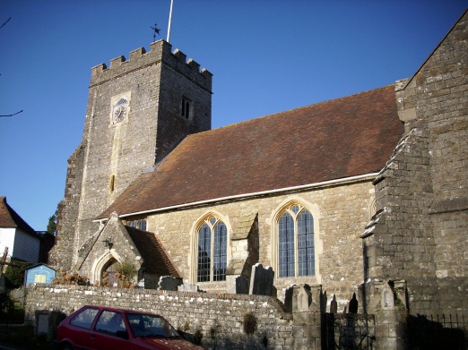
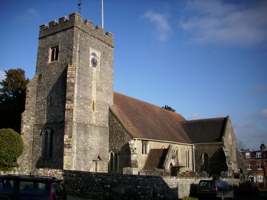
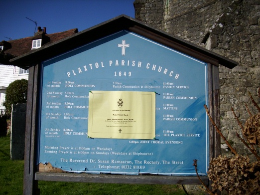
| Location | : | Plaxtol, Tonbridge and Malling Borough, England |
| Coordinate | : | 51.2593498, 0.2945710 |
frequently asked questions (FAQ):
-
Where is Plaxtol Parish Churchyard?
Plaxtol Parish Churchyard is located at Plaxtol, Tonbridge and Malling Borough ,Kent ,England.
-
Plaxtol Parish Churchyard cemetery's updated grave count on graveviews.com?
383 memorials
-
Where are the coordinates of the Plaxtol Parish Churchyard?
Latitude: 51.2593498
Longitude: 0.2945710
Nearby Cemetories:
1. Plaxtol War Memorial
Plaxtol, Tonbridge and Malling Borough, England
Coordinate: 51.2592888, 0.2948450
2. Ightham Mote
Ightham, Tonbridge and Malling Borough, England
Coordinate: 51.2584610, 0.2695830
3. St Giles Churchyard
Shipbourne, Tonbridge and Malling Borough, England
Coordinate: 51.2471700, 0.2786090
4. St. Lawrence Churchyard
Seal Chart, Sevenoaks District, England
Coordinate: 51.2742910, 0.2537250
5. St Peter Churchyard
Ightham, Tonbridge and Malling Borough, England
Coordinate: 51.2891680, 0.2858450
6. Church of the Good Shepherd
Borough Green, Tonbridge and Malling Borough, England
Coordinate: 51.2910300, 0.3037660
7. Borough Green Baptist Churchyard
Borough Green, Tonbridge and Malling Borough, England
Coordinate: 51.2916540, 0.3053750
8. OMF International UK
Borough Green, Tonbridge and Malling Borough, England
Coordinate: 51.2937286, 0.3066902
9. St Mary the Virgin Churchyard
Platt, Tonbridge and Malling Borough, England
Coordinate: 51.2892070, 0.3252260
10. St Dunstan Churchyard
West Peckham, Tonbridge and Malling Borough, England
Coordinate: 51.2486191, 0.3544910
11. St. Margaret's Churchyard
Underriver, Sevenoaks District, England
Coordinate: 51.2458191, 0.2291520
12. Hadlow Cemetery
Hadlow, Tonbridge and Malling Borough, England
Coordinate: 51.2292860, 0.3468200
13. St George Churchyard
Wrotham, Tonbridge and Malling Borough, England
Coordinate: 51.3088360, 0.3110130
14. Wrotham Cemetery
Wrotham, Tonbridge and Malling Borough, England
Coordinate: 51.3099430, 0.3108890
15. St Lawrence Churchyard
Mereworth, Tonbridge and Malling Borough, England
Coordinate: 51.2587620, 0.3778260
16. St John the Evangelist Churchyard
Hildenborough, Tonbridge and Malling Borough, England
Coordinate: 51.2174100, 0.2391660
17. Tonbridge Cemetery
Tonbridge, Tonbridge and Malling Borough, England
Coordinate: 51.2057762, 0.2772440
18. St Peter and St Paul Churchyard
Seal, Sevenoaks District, England
Coordinate: 51.2907080, 0.2223010
19. Hildenborough War Memorial
Hildenborough, Tonbridge and Malling Borough, England
Coordinate: 51.2175827, 0.2372410
20. St. Michael's Churchyard
East Peckham, Tonbridge and Malling Borough, England
Coordinate: 51.2442703, 0.3791970
21. Tonbridge Castle
Tonbridge, Tonbridge and Malling Borough, England
Coordinate: 51.1987000, 0.2764000
22. St Mary the Virgin Churchyard
Kemsing, Sevenoaks District, England
Coordinate: 51.3068670, 0.2310220
23. St Peter and St Paul Church
Tonbridge, Tonbridge and Malling Borough, England
Coordinate: 51.1977660, 0.2764630
24. St Nicholas Churchyard
Sevenoaks, Sevenoaks District, England
Coordinate: 51.2673310, 0.1933100