
| Memorials | : | 22 |
| Location | : | Put-in-Bay, Ottawa County, USA |
| Coordinate | : | 41.7174540, -82.8177740 |
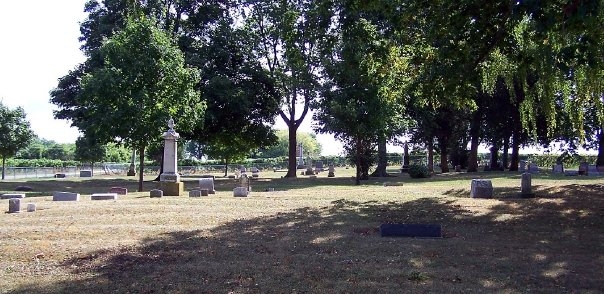
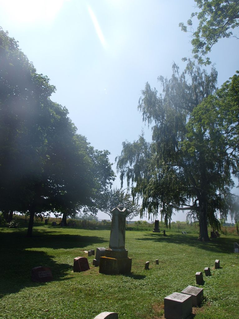
| Description | : | The cemetery is located on the south side of Tuhan Road (Township Road 156) about 0.1 miles east of its intersection with Peeple Road (Township Road 155). The cemetery is located in Puy-In-Bay Township, Ottawa County, Ohio, and is # 9207 (North Bass Island Cemetery / Isle of Saint George Cemetery) in “Ohio Cemeteries 1803-2003”, compiled by the Ohio Genealogical Society. The cemetery is registered with the Ohio Division of Real Estate and Professional Licensing (ODRE) as North Bass Cemetery with registration license number CGR.0000981035. The U.S. Geological Survey (USGS) Geographic Names Information System (GNIS) feature ID for... Read More |
frequently asked questions (FAQ):
-
Where is Isle of Saint George Cemetery?
Isle of Saint George Cemetery is located at Tuhan Road (Township Road 156) Put-in-Bay, Ottawa County ,Ohio , 43436USA.
-
Isle of Saint George Cemetery cemetery's updated grave count on graveviews.com?
21 memorials
-
Where are the coordinates of the Isle of Saint George Cemetery?
Latitude: 41.7174540
Longitude: -82.8177740
Nearby Cemetories:
1. Middle Bass Island Cemetery
Put-in-Bay Township, Ottawa County, USA
Coordinate: 41.6814380, -82.8110900
2. Perrys Victory and International Peace Memorial
Put-in-Bay, Ottawa County, USA
Coordinate: 41.6541240, -82.8113830
3. Crown Hill Cemetery
Put-in-Bay, Ottawa County, USA
Coordinate: 41.6436005, -82.8349991
4. Maple Leaf Cemetery
Put-in-Bay, Ottawa County, USA
Coordinate: 41.6324997, -82.8368988
5. Kelleys Island Cemetery
Kelleys Island, Erie County, USA
Coordinate: 41.6096410, -82.7075150
6. North Bay Cemetery
Pelee Island, Essex County, Canada
Coordinate: 41.8117900, -82.6817800
7. K'Burg Family Cemetery
Catawba Island Township, Ottawa County, USA
Coordinate: 41.5589400, -82.8463000
8. Catawba Island Cemetery
Catawba Island, Ottawa County, USA
Coordinate: 41.5569000, -82.8403015
9. Lockwood Cemetery
Lakeside, Ottawa County, USA
Coordinate: 41.5435140, -82.8161560
10. Chautauqua Park Memorial Garden
Lakeside, Ottawa County, USA
Coordinate: 41.5412410, -82.7418240
11. Sackett Cemetery
Danbury, Ottawa County, USA
Coordinate: 41.5303001, -82.7872009
12. Saint Mary's Byzantine Catholic Cemetery
Marblehead, Ottawa County, USA
Coordinate: 41.5409012, -82.7223969
13. Holy Assumption Orthodox Cemetery
Marblehead, Ottawa County, USA
Coordinate: 41.5361530, -82.7389380
14. Clemons Cemetery
Marblehead, Ottawa County, USA
Coordinate: 41.5409012, -82.7213974
15. Saint Joseph's Catholic Cemetery
Marblehead, Ottawa County, USA
Coordinate: 41.5344009, -82.7382965
16. Russian Cemetery
Marblehead, Ottawa County, USA
Coordinate: 41.5335999, -82.7371979
17. Saint Pauls Lutheran Church Cemetery
Lakeside, Ottawa County, USA
Coordinate: 41.5242200, -82.8049100
18. Kelly Cemetery
Danbury, Ottawa County, USA
Coordinate: 41.5245720, -82.7705950
19. Shook Cemetery
Portage Township, Ottawa County, USA
Coordinate: 41.5214005, -82.8758011
20. Wolcott Cemetery
Marblehead, Ottawa County, USA
Coordinate: 41.5177994, -82.7403030
21. Hartshorn Cemetery
Danbury, Ottawa County, USA
Coordinate: 41.5144440, -82.7499530
22. War of 1812 Battle Site
Mineyahta-on-the Bay, Ottawa County, USA
Coordinate: 41.5140350, -82.7438530
23. Jamison Cemetery
Danbury, Ottawa County, USA
Coordinate: 41.5050060, -82.8180740
24. Dwelle Cemetery
Port Clinton, Ottawa County, USA
Coordinate: 41.5069008, -82.8563995