
| Memorials | : | 121 |
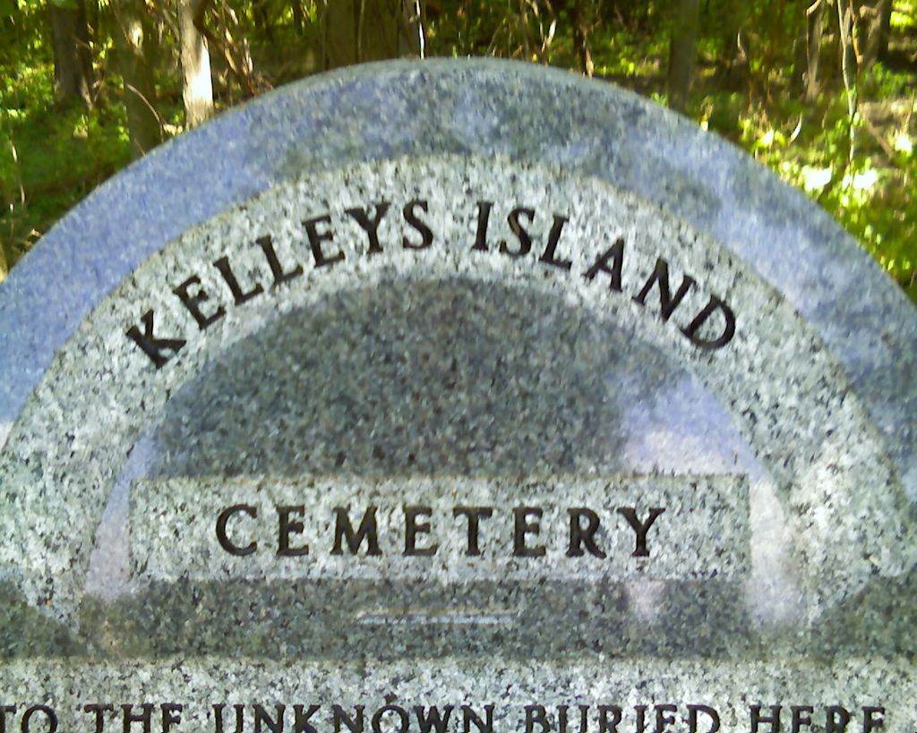
| Location | : | Kelleys Island, Erie County, USA |
| Coordinate | : | 41.6096410, -82.7075150 |
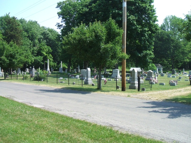
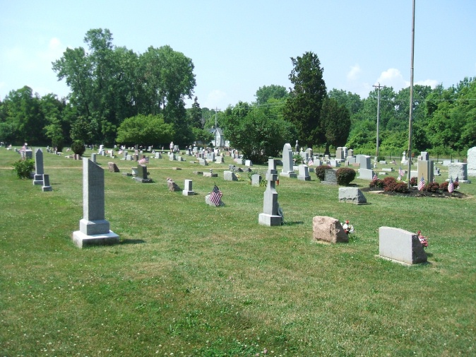
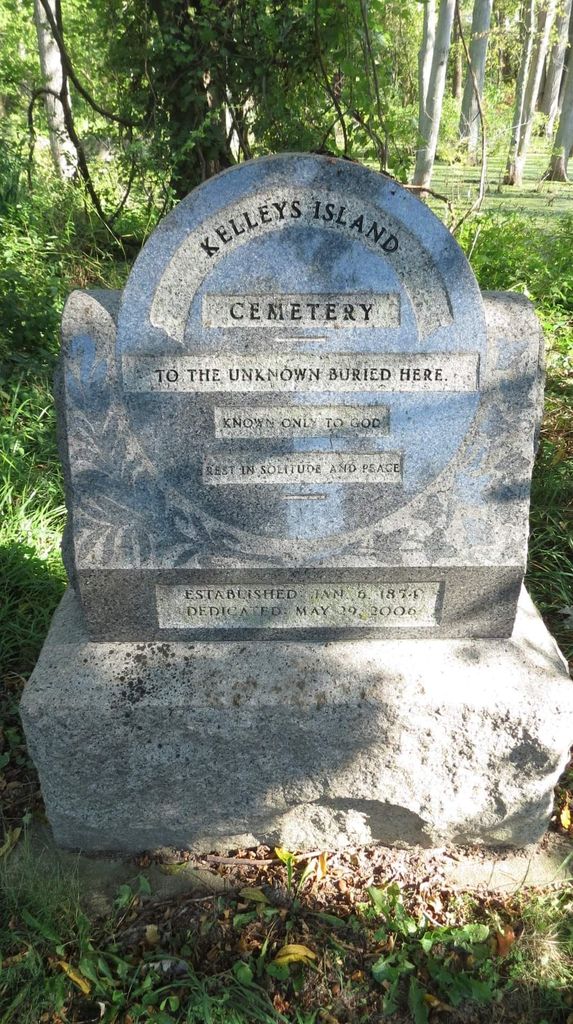
| Description | : | The cemetery is located on the east side of Division Street about 0.1 miles north of its intersection with Sweet Valley Lane. The cemetery is located in Kelley Island Township, Erie County, Ohio, and is 3004 (Kelley Island Township Cemetery / Village Cemetery) in “Ohio Cemeteries 1803-2003”, compiled by the Ohio Genealogical Society. The cemetery is registered with the Ohio Division of Real Estate and Professional Licensing (ODRE) as Kelley Island Cemetery with registration license number CGR.2015001387. The U.S. Geological Survey (USGS) Geographic Names Information System (GNIS) feature ID for the cemetery is 1047458 (Village Cemetery). |
frequently asked questions (FAQ):
-
Where is Kelleys Island Cemetery?
Kelleys Island Cemetery is located at Division Street Kelleys Island, Erie County ,Ohio , 43438USA.
-
Kelleys Island Cemetery cemetery's updated grave count on graveviews.com?
116 memorials
-
Where are the coordinates of the Kelleys Island Cemetery?
Latitude: 41.6096410
Longitude: -82.7075150
Nearby Cemetories:
1. Clemons Cemetery
Marblehead, Ottawa County, USA
Coordinate: 41.5409012, -82.7213974
2. Saint Mary's Byzantine Catholic Cemetery
Marblehead, Ottawa County, USA
Coordinate: 41.5409012, -82.7223969
3. Chautauqua Park Memorial Garden
Lakeside, Ottawa County, USA
Coordinate: 41.5412410, -82.7418240
4. Holy Assumption Orthodox Cemetery
Marblehead, Ottawa County, USA
Coordinate: 41.5361530, -82.7389380
5. Saint Joseph's Catholic Cemetery
Marblehead, Ottawa County, USA
Coordinate: 41.5344009, -82.7382965
6. Russian Cemetery
Marblehead, Ottawa County, USA
Coordinate: 41.5335999, -82.7371979
7. Perrys Victory and International Peace Memorial
Put-in-Bay, Ottawa County, USA
Coordinate: 41.6541240, -82.8113830
8. Wolcott Cemetery
Marblehead, Ottawa County, USA
Coordinate: 41.5177994, -82.7403030
9. Kelly Cemetery
Danbury, Ottawa County, USA
Coordinate: 41.5245720, -82.7705950
10. Sackett Cemetery
Danbury, Ottawa County, USA
Coordinate: 41.5303001, -82.7872009
11. Maple Leaf Cemetery
Put-in-Bay, Ottawa County, USA
Coordinate: 41.6324997, -82.8368988
12. War of 1812 Battle Site
Mineyahta-on-the Bay, Ottawa County, USA
Coordinate: 41.5140350, -82.7438530
13. Hartshorn Cemetery
Danbury, Ottawa County, USA
Coordinate: 41.5144440, -82.7499530
14. Crown Hill Cemetery
Put-in-Bay, Ottawa County, USA
Coordinate: 41.6436005, -82.8349991
15. Lockwood Cemetery
Lakeside, Ottawa County, USA
Coordinate: 41.5435140, -82.8161560
16. Middle Bass Island Cemetery
Put-in-Bay Township, Ottawa County, USA
Coordinate: 41.6814380, -82.8110900
17. Johnson's Island Confederate Cemetery
Marblehead, Ottawa County, USA
Coordinate: 41.5003014, -82.7300034
18. Saint Pauls Lutheran Church Cemetery
Lakeside, Ottawa County, USA
Coordinate: 41.5242200, -82.8049100
19. Catawba Island Cemetery
Catawba Island, Ottawa County, USA
Coordinate: 41.5569000, -82.8403015
20. K'Burg Family Cemetery
Catawba Island Township, Ottawa County, USA
Coordinate: 41.5589400, -82.8463000
21. Jamison Cemetery
Danbury, Ottawa County, USA
Coordinate: 41.5050060, -82.8180740
22. Isle of Saint George Cemetery
Put-in-Bay, Ottawa County, USA
Coordinate: 41.7174540, -82.8177740
23. Dwelle Cemetery
Port Clinton, Ottawa County, USA
Coordinate: 41.5069008, -82.8563995
24. Shook Cemetery
Portage Township, Ottawa County, USA
Coordinate: 41.5214005, -82.8758011