
| Memorials | : | 0 |
| Location | : | Cairo, Randolph County, USA |
| Coordinate | : | 39.5458370, -92.3983460 |
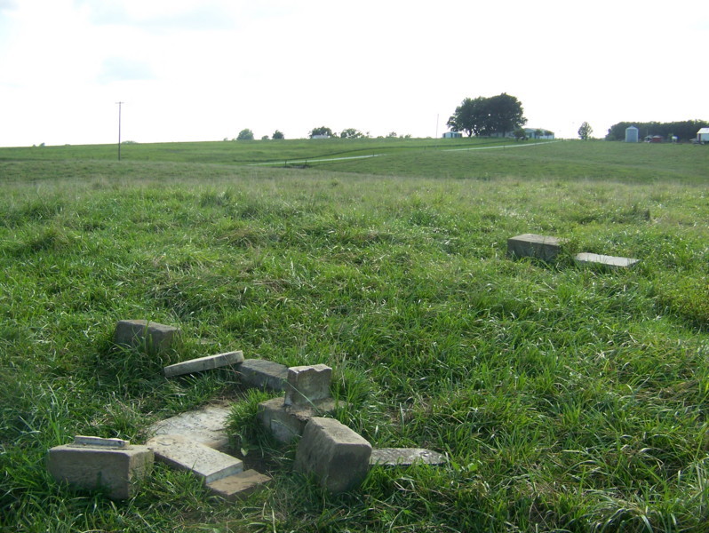
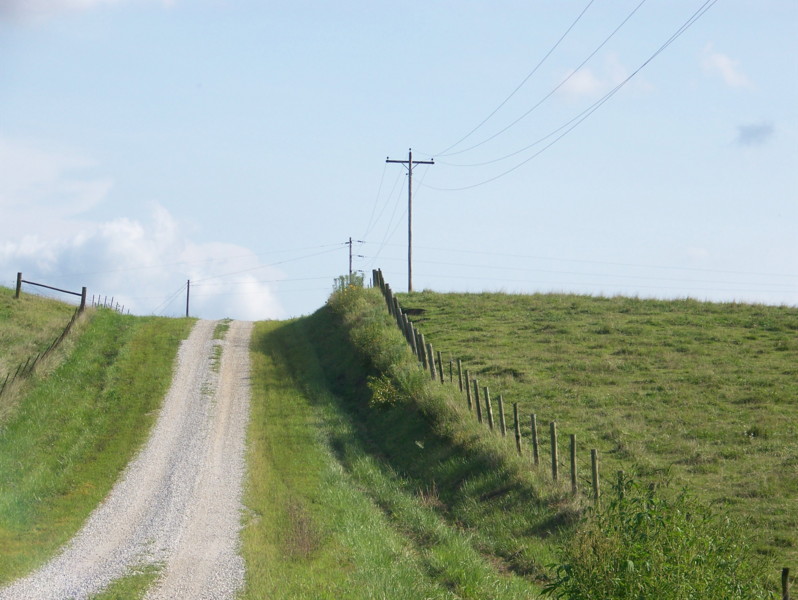
| Description | : | Information provided by Hazel Switzer, Summer 1870. Cemetery on farm located between Liberty Church and Cemetery and Union Cemetery (Church building torn down). These 2 cemeteries are on gravel road east off highway 63 (about half way between Cairo and Jacksonville). Cemetery is about 1/8 mile on 1st road north after leaving Liberty, and is on right next to road. This is about on the township lines of Salt River township and Cairo township. Complete canvas of all legible markers and gravestones summer 1970. Information filed on microfilm in Family History Library, Salt Lake City, Utah. Additional directions provided by JMK: More directions for... Read More |
frequently asked questions (FAQ):
-
Where is Jones-Brock Cemetery?
Jones-Brock Cemetery is located at Cairo, Randolph County ,Missouri ,USA.
-
Jones-Brock Cemetery cemetery's updated grave count on graveviews.com?
0 memorials
-
Where are the coordinates of the Jones-Brock Cemetery?
Latitude: 39.5458370
Longitude: -92.3983460
Nearby Cemetories:
1. Liberty Cemetery
Cairo, Randolph County, USA
Coordinate: 39.5411200, -92.4035600
2. Pleasant View Cemetery
Randolph County, USA
Coordinate: 39.5107994, -92.3668976
3. Grand Prairie Cemetery
Cairo, Randolph County, USA
Coordinate: 39.5363998, -92.4539032
4. Davis Cemetery
Randolph County, USA
Coordinate: 39.5630240, -92.4691570
5. Old Jacksonville Cemetery
Jacksonville, Randolph County, USA
Coordinate: 39.5769600, -92.4670500
6. Felps Cemetery
Jacksonville, Randolph County, USA
Coordinate: 39.5602400, -92.3158800
7. Dameron Family Cemetery
Cairo, Randolph County, USA
Coordinate: 39.5074898, -92.4732701
8. Coulter Cemetery
Jacksonville, Randolph County, USA
Coordinate: 39.6062000, -92.4435900
9. Missouri Veterans Cemetery at Jacksonville
Jacksonville, Randolph County, USA
Coordinate: 39.5817795, -92.4808426
10. Switzer Cemetery
Macon County, USA
Coordinate: 39.6116300, -92.3548440
11. McCanne Burying Ground
Excello, Macon County, USA
Coordinate: 39.6084518, -92.4564667
12. Landram Cemetery
Cox, Macon County, USA
Coordinate: 39.6249230, -92.3885430
13. McCampbell Cemetery
Randolph County, USA
Coordinate: 39.4645810, -92.3935890
14. Ancell Cemetery
Cairo, Randolph County, USA
Coordinate: 39.5324600, -92.5044200
15. Polson-Pipes Cemetery
Randolph County, USA
Coordinate: 39.5044590, -92.4919350
16. Reynolds Cemetery
Jacksonville, Randolph County, USA
Coordinate: 39.5855700, -92.4982300
17. Eads Chapel Cemetery
Randolph County, USA
Coordinate: 39.5742580, -92.5052750
18. Abbott Cemetery
Woodville, Macon County, USA
Coordinate: 39.6125360, -92.3248980
19. Ray Cemetery
Macon County, USA
Coordinate: 39.6332990, -92.3953370
20. Woodville Cemetery
Woodville, Macon County, USA
Coordinate: 39.6198000, -92.3367200
21. Hickory Grove Cemetery
Ash, Monroe County, USA
Coordinate: 39.5149000, -92.2912390
22. Antioch Christian Cemetery
Moberly, Randolph County, USA
Coordinate: 39.4635100, -92.3566700
23. Harman-Lampton-Newton Cemetery
Moberly, Randolph County, USA
Coordinate: 39.4620720, -92.3594210
24. Gregory Cemetery
Randolph County, USA
Coordinate: 39.5640660, -92.5119030