
| Memorials | : | 0 |
| Location | : | Arnhem, Arnhem Municipality, Netherlands |
| Coordinate | : | 52.0022860, 5.9203300 |
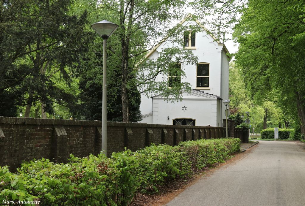
| Description | : | Constructed 1864, consisting of a walled triangular area that is bounded by the Apeldoornseweg (east side), the Road along the cemeteries (west side) and the Roman Catholic section of the "Moscowa" cemetery (north side). The main entrance is located in the southern corner of the site, near the intersection of the Apeldoornseweg and the Weg along the cemeteries. To the left are gravestones removed from the earlier obsolete Jewish cemeteries at the Utrechtseweg. |
frequently asked questions (FAQ):
-
Where is Joodse Begraafplaats Moscowa?
Joodse Begraafplaats Moscowa is located at Weg langs de Begraafplaatsen 2 Arnhem, Arnhem Municipality ,Gelderland , 6815AZNetherlands.
-
Joodse Begraafplaats Moscowa cemetery's updated grave count on graveviews.com?
0 memorials
-
Where are the coordinates of the Joodse Begraafplaats Moscowa?
Latitude: 52.0022860
Longitude: 5.9203300
Nearby Cemetories:
1. Arnhem Moscowa General Cemetery
Arnhem, Arnhem Municipality, Netherlands
Coordinate: 52.0050800, 5.9152800
2. Voormalige Begraafplaats Onder de Linden
Arnhem, Arnhem Municipality, Netherlands
Coordinate: 51.9889652, 5.9166571
3. Joodse Begraafplaats Utrechtseweg
Arnhem, Arnhem Municipality, Netherlands
Coordinate: 51.9853100, 5.8906500
4. Rozendaal Communal Cemetery
Rozendaal, Rozendaal Municipality, Netherlands
Coordinate: 52.0131400, 5.9683700
5. Schaarsbergen Vredenoord Cemetery
Schaarsbergen, Arnhem Municipality, Netherlands
Coordinate: 52.0290600, 5.8745300
6. Velp Old Protestant Cemetery
Velp, Rheden Municipality, Netherlands
Coordinate: 51.9927300, 5.9816100
7. Oosterbeek General Cemetery
Oosterbeek, Renkum Municipality, Netherlands
Coordinate: 51.9920100, 5.8490100
8. Arnhem War Cemetery
Oosterbeek, Renkum Municipality, Netherlands
Coordinate: 51.9931800, 5.8481900
9. Oude Algemene Begraafplaats
Oosterbeek, Renkum Municipality, Netherlands
Coordinate: 51.9832100, 5.8434700
10. Rheden Heiderust General Cemetery
Rheden, Rheden Municipality, Netherlands
Coordinate: 52.0083600, 6.0077900
11. Natuurbegraafplaats Heidepol
Arnhem, Arnhem Municipality, Netherlands
Coordinate: 52.0333784, 5.8232974
12. NH Begraafplaats De Pinkel
Rheden, Rheden Municipality, Netherlands
Coordinate: 52.0087450, 6.0354830
13. Doorwerth Roman Catholic Cemetery
Doorwerth, Renkum Municipality, Netherlands
Coordinate: 51.9783200, 5.8058900
14. Driel Protestant Churchyard
Driel, Overbetuwe Municipality, Netherlands
Coordinate: 51.9619700, 5.8113700
15. Roman Catholic Cemetery
Duiven, Duiven Municipality, Netherlands
Coordinate: 51.9495185, 6.0238638
16. Algemene Begraafplaats 't Heijlige Lant
Duiven, Duiven Municipality, Netherlands
Coordinate: 51.9452663, 6.0353131
17. Landgoed Groenouwe Mausoleum
Loenen, Apeldoorn Municipality, Netherlands
Coordinate: 52.0965000, 6.0120300
18. Heteren General Cemetery
Heteren, Overbetuwe Municipality, Netherlands
Coordinate: 51.9530900, 5.7574100
19. Renkum Roman Catholic Cemetery
Renkum, Renkum Municipality, Netherlands
Coordinate: 51.9752800, 5.7375200
20. Joodse Begraafplaats Arnhemseweg
Zevenaar Municipality, Netherlands
Coordinate: 51.9308280, 6.0700100
21. Oude Algemene Begraafplaats
Dieren, Rheden Municipality, Netherlands
Coordinate: 52.0485900, 6.0967600
22. Zevenaar Roman Catholic Cemetery
Zevenaar, Zevenaar Municipality, Netherlands
Coordinate: 51.9289700, 6.0732300
23. Nationale Veteranenbegraafplaats Loenen
Loenen, Apeldoorn Municipality, Netherlands
Coordinate: 52.1138024, 5.9935134
24. Hoenderloo Nederlands Hervormde Begraafplaats
Hoenderloo, Apeldoorn Municipality, Netherlands
Coordinate: 52.1200700, 5.8805700