
| Memorials | : | 0 |
| Location | : | Arnhem, Arnhem Municipality, Netherlands |
| Coordinate | : | 51.9889652, 5.9166571 |
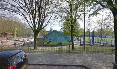
| Description | : | Former cemetery in Arnhem. The cemetery consisted of three parts, the Catholic part (constructed 1852), the Jewish part (constructed 1858) and the General part (constructed 1862). In 1873, the cemetery was nearly at full capacity and thus plans were made for a new cemetery, which became Begraafplaats Moscowa. Around 1876, burials at the cemetery stopped. Several graves were cleared. In 1930, more graves were cleared and a playground was built on a part of the cemetery. In 1959, the last graves were cleared and in 1960, the entrance gate to the cemetery was demolished, marking the end of the cemetery. |
frequently asked questions (FAQ):
-
Where is Voormalige Begraafplaats Onder de Linden?
Voormalige Begraafplaats Onder de Linden is located at Arnhem, Arnhem Municipality ,Gelderland ,Netherlands.
-
Voormalige Begraafplaats Onder de Linden cemetery's updated grave count on graveviews.com?
0 memorials
-
Where are the coordinates of the Voormalige Begraafplaats Onder de Linden?
Latitude: 51.9889652
Longitude: 5.9166571
Nearby Cemetories:
1. Joodse Begraafplaats Moscowa
Arnhem, Arnhem Municipality, Netherlands
Coordinate: 52.0022860, 5.9203300
2. Arnhem Moscowa General Cemetery
Arnhem, Arnhem Municipality, Netherlands
Coordinate: 52.0050800, 5.9152800
3. Joodse Begraafplaats Utrechtseweg
Arnhem, Arnhem Municipality, Netherlands
Coordinate: 51.9853100, 5.8906500
4. Rozendaal Communal Cemetery
Rozendaal, Rozendaal Municipality, Netherlands
Coordinate: 52.0131400, 5.9683700
5. Velp Old Protestant Cemetery
Velp, Rheden Municipality, Netherlands
Coordinate: 51.9927300, 5.9816100
6. Oosterbeek General Cemetery
Oosterbeek, Renkum Municipality, Netherlands
Coordinate: 51.9920100, 5.8490100
7. Arnhem War Cemetery
Oosterbeek, Renkum Municipality, Netherlands
Coordinate: 51.9931800, 5.8481900
8. Oude Algemene Begraafplaats
Oosterbeek, Renkum Municipality, Netherlands
Coordinate: 51.9832100, 5.8434700
9. Schaarsbergen Vredenoord Cemetery
Schaarsbergen, Arnhem Municipality, Netherlands
Coordinate: 52.0290600, 5.8745300
10. Rheden Heiderust General Cemetery
Rheden, Rheden Municipality, Netherlands
Coordinate: 52.0083600, 6.0077900
11. Doorwerth Roman Catholic Cemetery
Doorwerth, Renkum Municipality, Netherlands
Coordinate: 51.9783200, 5.8058900
12. Driel Protestant Churchyard
Driel, Overbetuwe Municipality, Netherlands
Coordinate: 51.9619700, 5.8113700
13. Natuurbegraafplaats Heidepol
Arnhem, Arnhem Municipality, Netherlands
Coordinate: 52.0333784, 5.8232974
14. NH Begraafplaats De Pinkel
Rheden, Rheden Municipality, Netherlands
Coordinate: 52.0087450, 6.0354830
15. Roman Catholic Cemetery
Duiven, Duiven Municipality, Netherlands
Coordinate: 51.9495185, 6.0238638
16. Algemene Begraafplaats 't Heijlige Lant
Duiven, Duiven Municipality, Netherlands
Coordinate: 51.9452663, 6.0353131
17. Heteren General Cemetery
Heteren, Overbetuwe Municipality, Netherlands
Coordinate: 51.9530900, 5.7574100
18. Joodse Begraafplaats Arnhemseweg
Zevenaar Municipality, Netherlands
Coordinate: 51.9308280, 6.0700100
19. Renkum Roman Catholic Cemetery
Renkum, Renkum Municipality, Netherlands
Coordinate: 51.9752800, 5.7375200
20. Zevenaar Roman Catholic Cemetery
Zevenaar, Zevenaar Municipality, Netherlands
Coordinate: 51.9289700, 6.0732300
21. Joodse Begraafplaats
Zevenaar Municipality, Netherlands
Coordinate: 51.9310110, 6.0825120
22. Onder de Bomen Cemetery
Renkum, Renkum Municipality, Netherlands
Coordinate: 51.9714500, 5.7205500
23. Landgoed Groenouwe Mausoleum
Loenen, Apeldoorn Municipality, Netherlands
Coordinate: 52.0965000, 6.0120300
24. Oude Algemene Begraafplaats
Dieren, Rheden Municipality, Netherlands
Coordinate: 52.0485900, 6.0967600