
| Memorials | : | 1 |
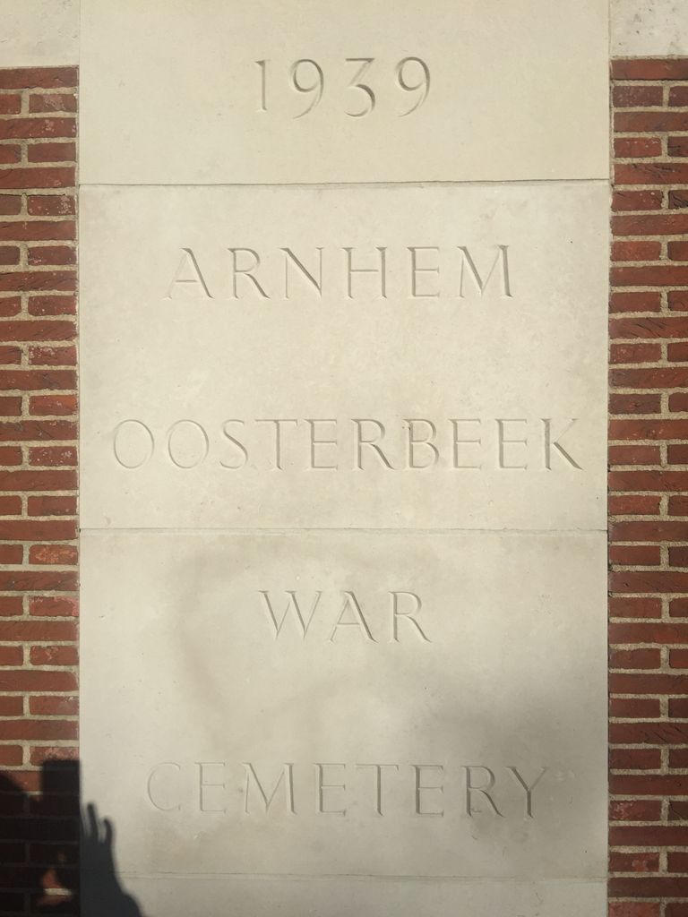
| Location | : | Oosterbeek, Renkum Municipality, Netherlands |
| Coordinate | : | 51.9931800, 5.8481900 |
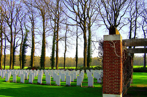
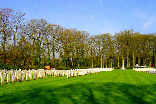
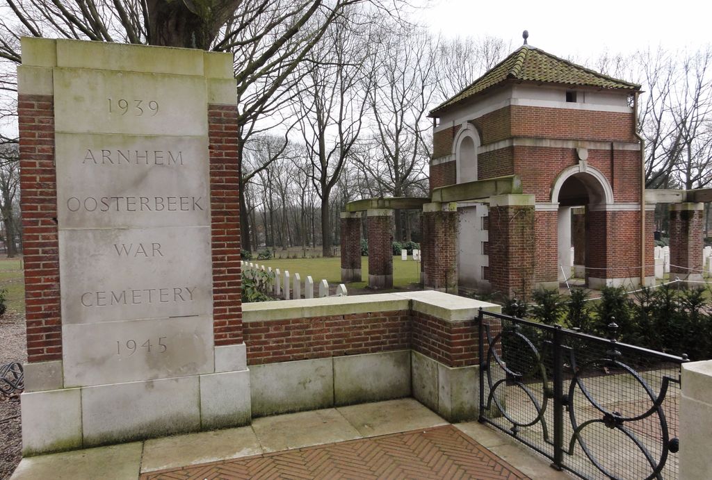
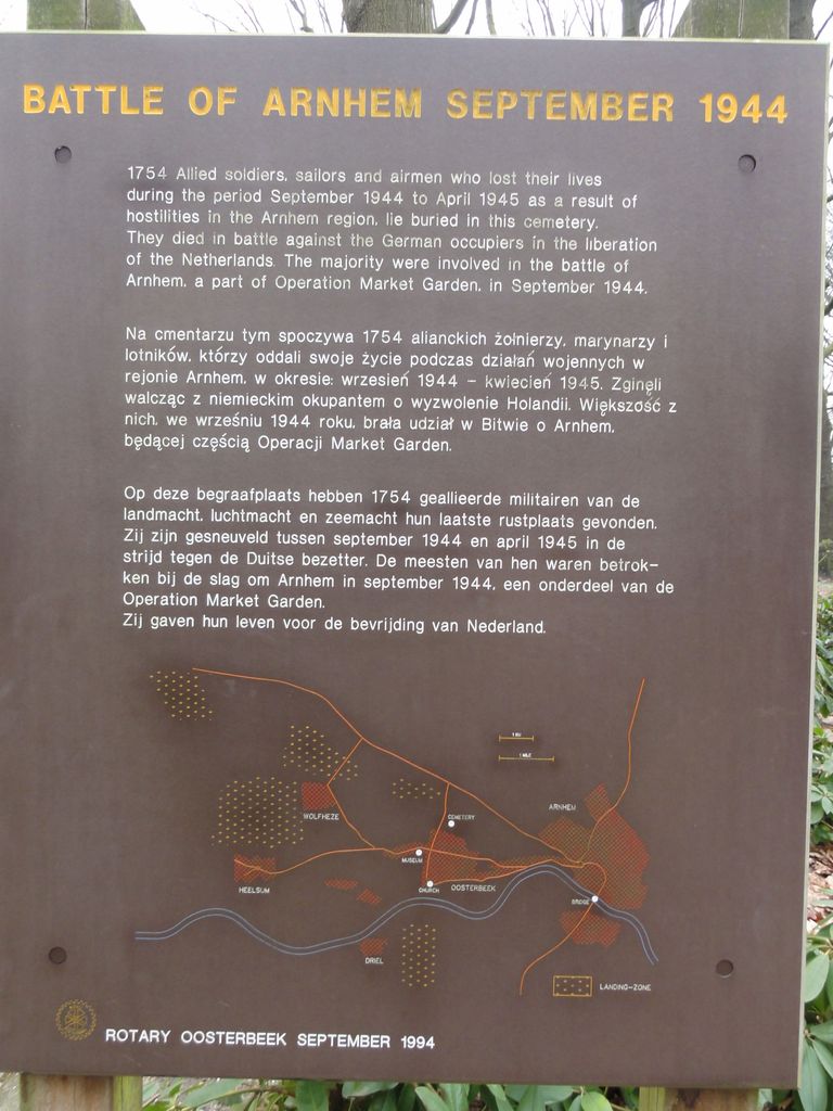
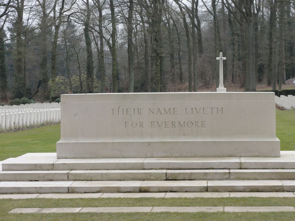
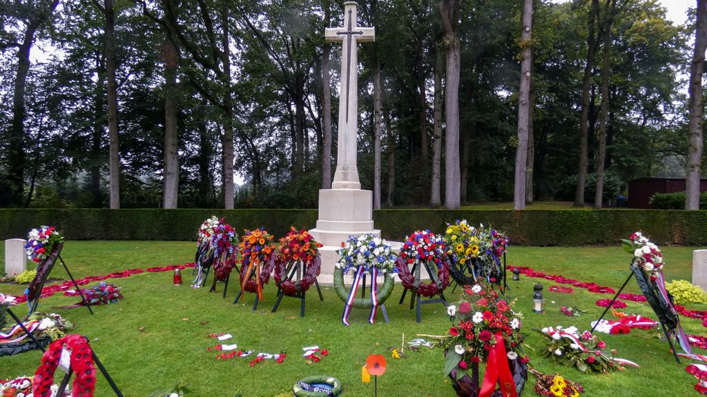
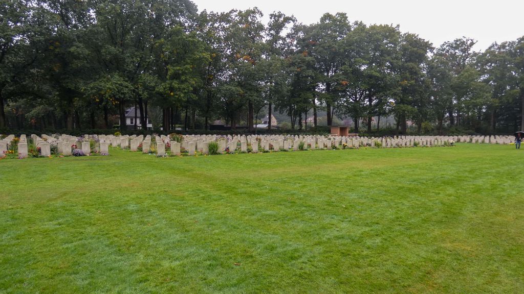
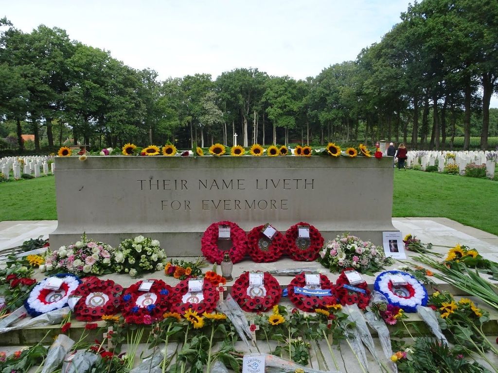
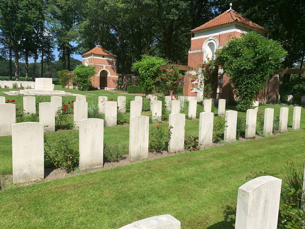
| Description | : | The city of Arnhem is in the east of the Netherlands, the village of Oosterbeek is 7kms west of Arnhem. From the A12 motorway DEN HAAG to ARNHEM take exit 25 (Afrit 25) N224 OOSTERBEEK / WOLFHEZE. Follow the signs for OOSTERBEEK. After approx 3.5kms turn right (CWGC Sign) onto the DREYENSEWEG. Continue for approx 2kms and turn left (CWGC sign) onto VAN LIMBURG STIRUMWEG. After approx 1km the cemetery can be found on the left side. There are more than 1,500 casualties of World War Two here. |
frequently asked questions (FAQ):
-
Where is Arnhem War Cemetery?
Arnhem War Cemetery is located at Van Limburg Stirumweg Oosterbeek, Renkum Municipality ,Gelderland , 6861 WLNetherlands.
-
Arnhem War Cemetery cemetery's updated grave count on graveviews.com?
1 memorials
-
Where are the coordinates of the Arnhem War Cemetery?
Latitude: 51.9931800
Longitude: 5.8481900


Nearby Cemetories:
1. Oosterbeek General Cemetery
Oosterbeek, Renkum Municipality, Netherlands
Coordinate: 51.9920100, 5.8490100
2. Oude Algemene Begraafplaats
Oosterbeek, Renkum Municipality, Netherlands
Coordinate: 51.9832100, 5.8434700
3. Joodse Begraafplaats Utrechtseweg
Arnhem, Arnhem Municipality, Netherlands
Coordinate: 51.9853100, 5.8906500
4. Doorwerth Roman Catholic Cemetery
Doorwerth, Renkum Municipality, Netherlands
Coordinate: 51.9783200, 5.8058900
5. Driel Protestant Churchyard
Driel, Overbetuwe Municipality, Netherlands
Coordinate: 51.9619700, 5.8113700
6. Schaarsbergen Vredenoord Cemetery
Schaarsbergen, Arnhem Municipality, Netherlands
Coordinate: 52.0290600, 5.8745300
7. Voormalige Begraafplaats Onder de Linden
Arnhem, Arnhem Municipality, Netherlands
Coordinate: 51.9889652, 5.9166571
8. Arnhem Moscowa General Cemetery
Arnhem, Arnhem Municipality, Netherlands
Coordinate: 52.0050800, 5.9152800
9. Natuurbegraafplaats Heidepol
Arnhem, Arnhem Municipality, Netherlands
Coordinate: 52.0333784, 5.8232974
10. Joodse Begraafplaats Moscowa
Arnhem, Arnhem Municipality, Netherlands
Coordinate: 52.0022860, 5.9203300
11. Heteren General Cemetery
Heteren, Overbetuwe Municipality, Netherlands
Coordinate: 51.9530900, 5.7574100
12. Renkum Roman Catholic Cemetery
Renkum, Renkum Municipality, Netherlands
Coordinate: 51.9752800, 5.7375200
13. Rozendaal Communal Cemetery
Rozendaal, Rozendaal Municipality, Netherlands
Coordinate: 52.0131400, 5.9683700
14. Onder de Bomen Cemetery
Renkum, Renkum Municipality, Netherlands
Coordinate: 51.9714500, 5.7205500
15. Velp Old Protestant Cemetery
Velp, Rheden Municipality, Netherlands
Coordinate: 51.9927300, 5.9816100
16. Rheden Heiderust General Cemetery
Rheden, Rheden Municipality, Netherlands
Coordinate: 52.0083600, 6.0077900
17. Begraafplaats Vluchtheuvelkerk Protestant
Zetten, Overbetuwe Municipality, Netherlands
Coordinate: 51.9315860, 5.7141320
18. Begraafplaats de Leeuwerenk
Wageningen, Wageningen Municipality, Netherlands
Coordinate: 51.9849600, 5.6806900
19. Bennekom Algemene Begraafplaats
Bennekom, Ede Municipality, Netherlands
Coordinate: 51.9983500, 5.6775500
20. Joodse Begraafplaats
Wageningen Municipality, Netherlands
Coordinate: 51.9668606, 5.6695901
21. Andelst Kerkhof
Andelst, Overbetuwe Municipality, Netherlands
Coordinate: 51.9057800, 5.7278200
22. Slijk-Ewijk General Cemetery
Slijk-Ewijk, Overbetuwe Municipality, Netherlands
Coordinate: 51.8839100, 5.7854400
23. Paasberg Mausoleum
Ede, Ede Municipality, Netherlands
Coordinate: 52.0437800, 5.6786500
24. NH Begraafplaats De Pinkel
Rheden, Rheden Municipality, Netherlands
Coordinate: 52.0087450, 6.0354830