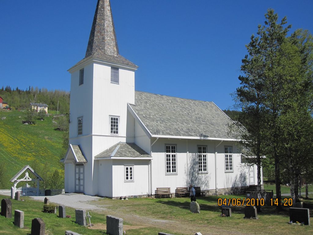
| Memorials | : | 0 |
| Location | : | Al, Ål kommune, Norway |
| Coordinate | : | 60.6972348, 8.5010804 |
| Description | : | Located in Leveld. Leveld, Buskerud Norway is located 8.5 km from Aal, Buskerud, Norway. The cemetery is with-in the church yard. |
frequently asked questions (FAQ):
-
Where is Leveld Church Cemetery?
Leveld Church Cemetery is located at Al, Ål kommune ,Buskerud fylke ,Norway.
-
Leveld Church Cemetery cemetery's updated grave count on graveviews.com?
0 memorials
-
Where are the coordinates of the Leveld Church Cemetery?
Latitude: 60.6972348
Longitude: 8.5010804
Nearby Cemetories:
1. Aal Cemetery
Al, Ål kommune, Norway
Coordinate: 60.6290400, 8.5567350
2. Hol Old Church & Cemetery
Hol, Hol kommune, Norway
Coordinate: 60.6150040, 8.3000550
3. Hovet Church and Cemetery
Hovet, Hol kommune, Norway
Coordinate: 60.6004500, 8.3001700
4. Hemsedal Church Cemetery
Hemsedal, Hemsedal kommune, Norway
Coordinate: 60.8618370, 8.5635500
5. Nes kirke
Nesbyen, Nes kommune, Norway
Coordinate: 60.5669920, 9.1034140
6. Ulnes Church Cemetery
Aurdal, Nord-Aurdal kommune, Norway
Coordinate: 60.9949520, 9.1140090
7. Øyjar Cemetery
Vestre Slidre kommune, Norway
Coordinate: 61.0435370, 9.0139510
8. Røn Cemetery
Vestre Slidre kommune, Norway
Coordinate: 61.0469680, 9.0497780
9. Vestre Slidre Cemetery
Vestre Slidre kommune, Norway
Coordinate: 61.0902130, 8.9797490
10. Slidredomen Church and Cemetery
Slidre, Vestre Slidre kommune, Norway
Coordinate: 61.0902780, 8.9800000
11. Uvdal Old Cemetery
Uvdal, Nore og Uvdal kommune, Norway
Coordinate: 60.2651450, 8.8348110
12. Tingnes Kirke
Fagernes, Nord-Aurdal kommune, Norway
Coordinate: 60.9835994, 9.2585656
13. Borgund Stave Church Cemetery
Laerdalsoyri, Lærdal kommune, Norway
Coordinate: 61.0473408, 7.8126800
14. Rogne Cemetery
Rogne, Øystre Slidre kommune, Norway
Coordinate: 61.0874550, 9.1243580
15. Aurdal
Aurdal, Nord-Aurdal kommune, Norway
Coordinate: 60.9248040, 9.4132630
16. Bagn Cemetery
Bagn, Sør-Aurdal kommune, Norway
Coordinate: 60.8201360, 9.5629660
17. Flaa Cemetery
Ler, Melhus kommune, Norway
Coordinate: 60.4284681, 9.4662050
18. Leirskogen Cemetery
Begndal, Sør-Aurdal kommune, Norway
Coordinate: 60.7977150, 9.6832080
19. Nord Etnedal Kirke
Etnedal kommune, Norway
Coordinate: 61.0253740, 9.5010940
20. Bruflat Cemetery
Bruflat, Etnedal kommune, Norway
Coordinate: 60.8884550, 9.6389820
21. Hedalen Cemetery
Hedalen, Sør-Aurdal kommune, Norway
Coordinate: 60.6226500, 9.6905850
22. Eggedal Kirke
Eggedal, Sigdal kommune, Norway
Coordinate: 60.2463170, 9.3573130
23. Hauge Church Cemetery
Lærdal kommune, Norway
Coordinate: 61.0991905, 7.4948466
24. Aardalstangen Cemetery
Ardal, Jølster kommune, Norway
Coordinate: 61.2384580, 7.7067610

