
| Memorials | : | 0 |
| Location | : | Hol, Hol kommune, Norway |
| Coordinate | : | 60.6150040, 8.3000550 |
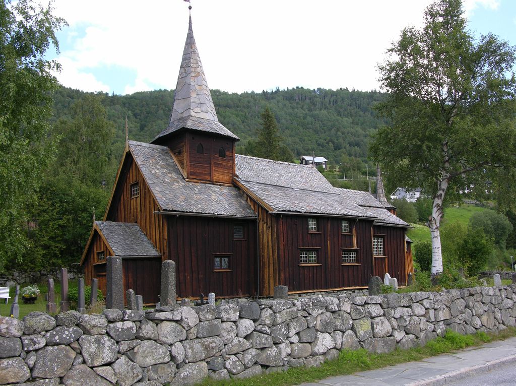
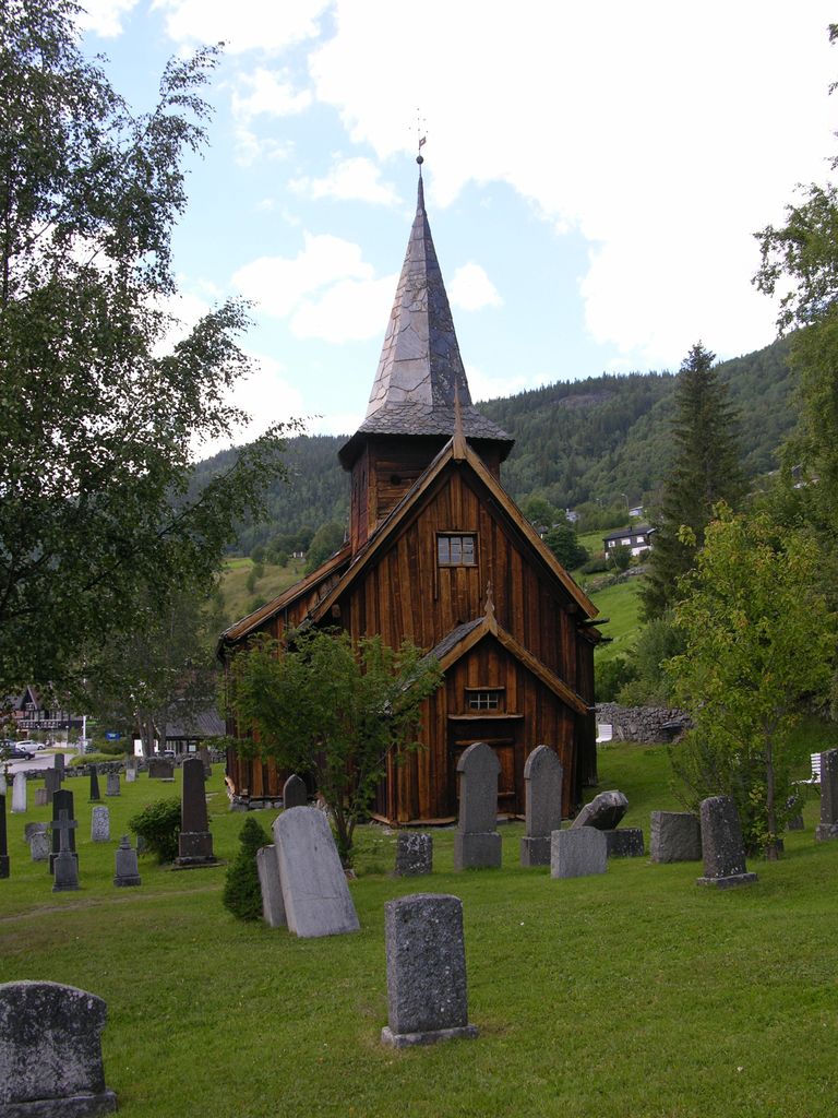
| Description | : | The Hol old church and cemetery are near Holsfjord in the village of Hol in Buskerud County, Norway. The church is a stave church built in the 13th century. Hol Old Church, also known as Hol gamle kirke, dates from the 13th century, but the exact date of completion is not known. The church is the oldest parish in Hol. and It was first mentioned in a letter from 1328 as a small stave church with covered side porches or svalganger. The church has been expanded several times and was rebuilt in 1888 and 1938. The floor of the... Read More |
frequently asked questions (FAQ):
-
Where is Hol Old Church & Cemetery?
Hol Old Church & Cemetery is located at Hol, Hol kommune ,Buskerud fylke , 3576Norway.
-
Hol Old Church & Cemetery cemetery's updated grave count on graveviews.com?
0 memorials
-
Where are the coordinates of the Hol Old Church & Cemetery?
Latitude: 60.6150040
Longitude: 8.3000550
Nearby Cemetories:
1. Hovet Church and Cemetery
Hovet, Hol kommune, Norway
Coordinate: 60.6004500, 8.3001700
2. Aal Cemetery
Al, Ål kommune, Norway
Coordinate: 60.6290400, 8.5567350
3. Leveld Church Cemetery
Al, Ål kommune, Norway
Coordinate: 60.6972348, 8.5010804
4. Hemsedal Church Cemetery
Hemsedal, Hemsedal kommune, Norway
Coordinate: 60.8618370, 8.5635500
5. Nes kirke
Nesbyen, Nes kommune, Norway
Coordinate: 60.5669920, 9.1034140
6. Uvdal Old Cemetery
Uvdal, Nore og Uvdal kommune, Norway
Coordinate: 60.2651450, 8.8348110
7. Borgund Stave Church Cemetery
Laerdalsoyri, Lærdal kommune, Norway
Coordinate: 61.0473408, 7.8126800
8. Ulnes Church Cemetery
Aurdal, Nord-Aurdal kommune, Norway
Coordinate: 60.9949520, 9.1140090
9. Øyjar Cemetery
Vestre Slidre kommune, Norway
Coordinate: 61.0435370, 9.0139510
10. Røn Cemetery
Vestre Slidre kommune, Norway
Coordinate: 61.0469680, 9.0497780
11. Vestre Slidre Cemetery
Vestre Slidre kommune, Norway
Coordinate: 61.0902130, 8.9797490
12. Slidredomen Church and Cemetery
Slidre, Vestre Slidre kommune, Norway
Coordinate: 61.0902780, 8.9800000
13. Tingnes Kirke
Fagernes, Nord-Aurdal kommune, Norway
Coordinate: 60.9835994, 9.2585656
14. Flaa Cemetery
Ler, Melhus kommune, Norway
Coordinate: 60.4284681, 9.4662050
15. Vangen Kyrkje
Aurlandsvangen, Aurland kommune, Norway
Coordinate: 60.9069870, 7.1888140
16. Flaam Church Cemetery
Flam, Aurland kommune, Norway
Coordinate: 60.8378100, 7.1208500
17. Rogne Cemetery
Rogne, Øystre Slidre kommune, Norway
Coordinate: 61.0874550, 9.1243580
18. Hauge Church Cemetery
Lærdal kommune, Norway
Coordinate: 61.0991905, 7.4948466
19. Kyrkjetræet kyrkjegard
Eidfjord, Eidfjord kommune, Norway
Coordinate: 60.4621100, 7.0715000
20. Eidfjord gamle Kyrkje
Eidfjord, Eidfjord kommune, Norway
Coordinate: 60.4617720, 7.0715580
21. Aurdal
Aurdal, Nord-Aurdal kommune, Norway
Coordinate: 60.9248040, 9.4132630
22. Eggedal Kirke
Eggedal, Sigdal kommune, Norway
Coordinate: 60.2463170, 9.3573130
23. Austbygde Kirke Cemetery
Tinne, Notodden kommune, Norway
Coordinate: 60.0295356, 8.8263993
24. Bagn Cemetery
Bagn, Sør-Aurdal kommune, Norway
Coordinate: 60.8201360, 9.5629660