| Memorials | : | 0 |
| Location | : | Hovet, Hol kommune, Norway |
| Coordinate | : | 60.6004500, 8.3001700 |
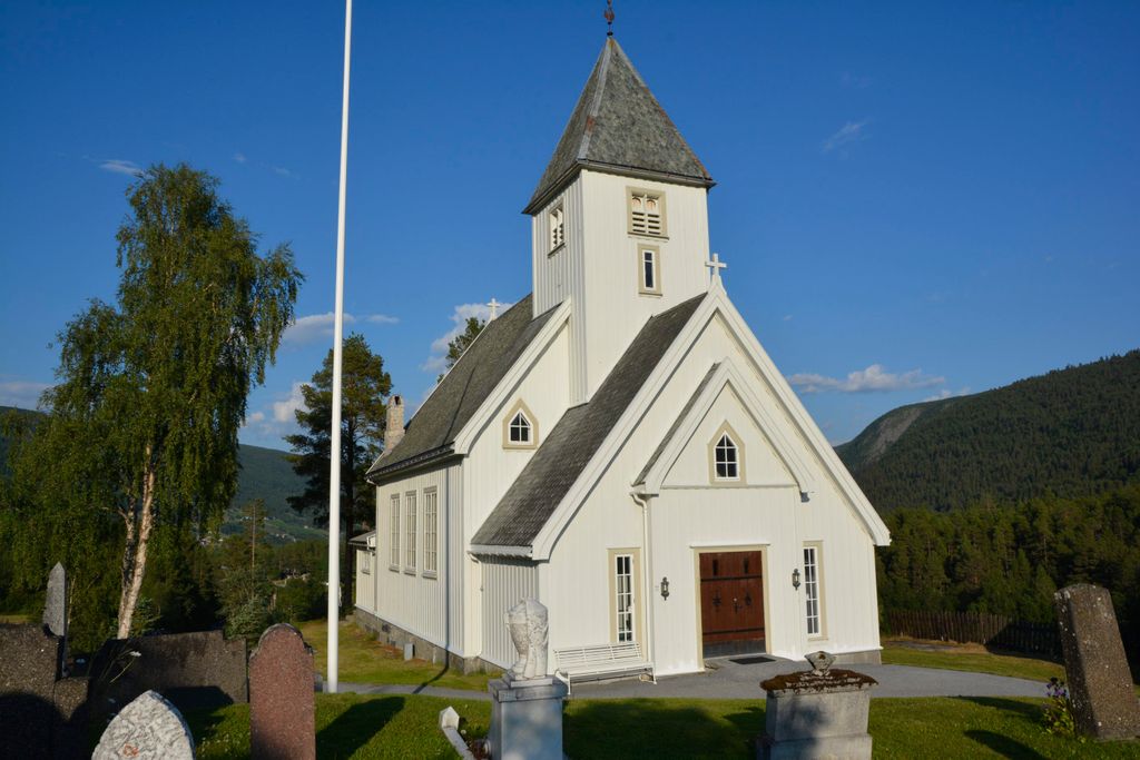
| Description | : | Hovet Church and cemetery is in Hol municipality, Buskerud County, Norway. Discussions regarding plans to develop a cemetery in Hovet were recorded in 1882 and 1890. The first time the cemetery was used for a burial was in 1891. The cemetery is very hilly and is extended to the north and west with two lower-lying terraces. In the northeastern part, the cemetery is surrounded by railings. Hovet Church is built on a hillside; it is described as a long church built of wood. It was designed by architect, Ole Stein, and was built by builder, Kristian Odegaard.... Read More |
frequently asked questions (FAQ):
-
Where is Hovet Church and Cemetery?
Hovet Church and Cemetery is located at Hovet, Hol kommune ,Buskerud fylke ,Norway.
-
Hovet Church and Cemetery cemetery's updated grave count on graveviews.com?
0 memorials
-
Where are the coordinates of the Hovet Church and Cemetery?
Latitude: 60.6004500
Longitude: 8.3001700
Nearby Cemetories:
1. Hol Old Church & Cemetery
Hol, Hol kommune, Norway
Coordinate: 60.6150040, 8.3000550
2. Aal Cemetery
Al, Ål kommune, Norway
Coordinate: 60.6290400, 8.5567350
3. Leveld Church Cemetery
Al, Ål kommune, Norway
Coordinate: 60.6972348, 8.5010804
4. Hemsedal Church Cemetery
Hemsedal, Hemsedal kommune, Norway
Coordinate: 60.8618370, 8.5635500
5. Nes kirke
Nesbyen, Nes kommune, Norway
Coordinate: 60.5669920, 9.1034140
6. Uvdal Old Cemetery
Uvdal, Nore og Uvdal kommune, Norway
Coordinate: 60.2651450, 8.8348110
7. Borgund Stave Church Cemetery
Laerdalsoyri, Lærdal kommune, Norway
Coordinate: 61.0473408, 7.8126800
8. Ulnes Church Cemetery
Aurdal, Nord-Aurdal kommune, Norway
Coordinate: 60.9949520, 9.1140090
9. Øyjar Cemetery
Vestre Slidre kommune, Norway
Coordinate: 61.0435370, 9.0139510
10. Røn Cemetery
Vestre Slidre kommune, Norway
Coordinate: 61.0469680, 9.0497780
11. Vestre Slidre Cemetery
Vestre Slidre kommune, Norway
Coordinate: 61.0902130, 8.9797490
12. Slidredomen Church and Cemetery
Slidre, Vestre Slidre kommune, Norway
Coordinate: 61.0902780, 8.9800000
13. Flaa Cemetery
Ler, Melhus kommune, Norway
Coordinate: 60.4284681, 9.4662050
14. Tingnes Kirke
Fagernes, Nord-Aurdal kommune, Norway
Coordinate: 60.9835994, 9.2585656
15. Kyrkjetræet kyrkjegard
Eidfjord, Eidfjord kommune, Norway
Coordinate: 60.4621100, 7.0715000
16. Eidfjord gamle Kyrkje
Eidfjord, Eidfjord kommune, Norway
Coordinate: 60.4617720, 7.0715580
17. Vangen Kyrkje
Aurlandsvangen, Aurland kommune, Norway
Coordinate: 60.9069870, 7.1888140
18. Flaam Church Cemetery
Flam, Aurland kommune, Norway
Coordinate: 60.8378100, 7.1208500
19. Austbygde Kirke Cemetery
Tinne, Notodden kommune, Norway
Coordinate: 60.0295356, 8.8263993
20. Eggedal Kirke
Eggedal, Sigdal kommune, Norway
Coordinate: 60.2463170, 9.3573130
21. Rogne Cemetery
Rogne, Øystre Slidre kommune, Norway
Coordinate: 61.0874550, 9.1243580
22. Aurdal
Aurdal, Nord-Aurdal kommune, Norway
Coordinate: 60.9248040, 9.4132630
23. Hauge Church Cemetery
Lærdal kommune, Norway
Coordinate: 61.0991905, 7.4948466
24. Atraa Kirke Cemetery
Tinne, Notodden kommune, Norway
Coordinate: 59.9883980, 8.7319790

