
| Memorials | : | 12 |
| Location | : | Eolia, Letcher County, USA |
| Coordinate | : | 37.0634600, -82.7956650 |
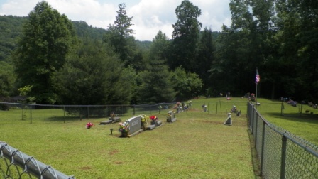
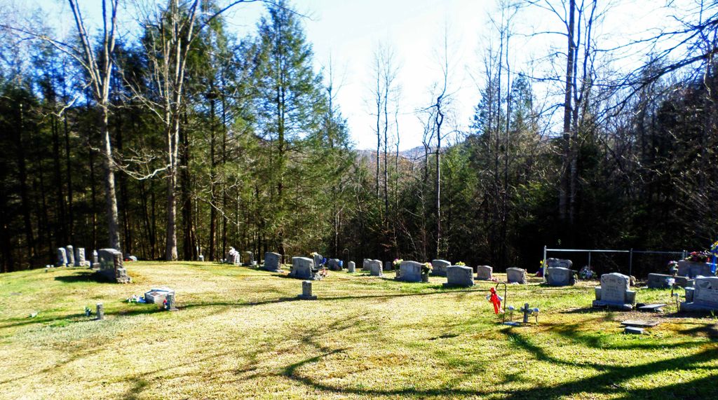
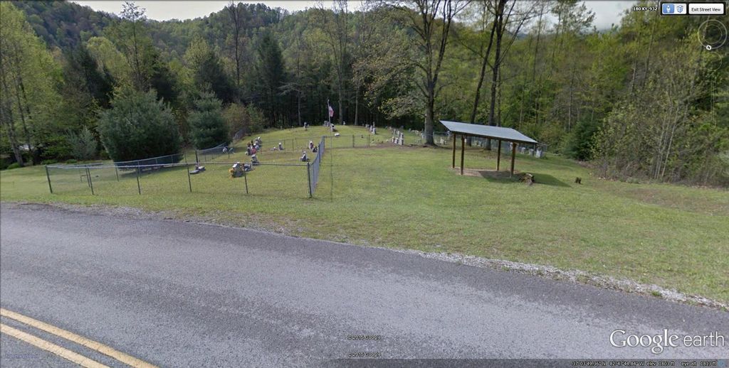
| Description | : | From Virginia in Pound on US 58 going North, take second exit to Pound, turning left off the 4-lane onto South Fork Road--go about 4 miles--road will fork, stay right--go about 6 miles to stop sign--turn right--go approximately 2 miles--just after entering Kentucky, cemetery will be on the left down over the hill--you will have to park on the side of the road which is very narrow. Cemetery is on the left just after you enter Letcher County, Kentucky. It is fenced in sections and well-maintained. There are no unmarked graves in this cemetery. |
frequently asked questions (FAQ):
-
Where is Maggard Cemetery?
Maggard Cemetery is located at Eolia, Letcher County ,Kentucky ,USA.
-
Maggard Cemetery cemetery's updated grave count on graveviews.com?
2 memorials
-
Where are the coordinates of the Maggard Cemetery?
Latitude: 37.0634600
Longitude: -82.7956650
Nearby Cemetories:
1. Mullins Family Cemetery
Eolia, Letcher County, USA
Coordinate: 37.0713400, -82.7839220
2. Beyrl Boggs Cemetery
Eolia, Letcher County, USA
Coordinate: 37.0595500, -82.7774500
3. Joel Sturgill Cemetery
Eolia, Letcher County, USA
Coordinate: 37.0589981, -82.7770004
4. Caudill Cemetery
Dongola, Letcher County, USA
Coordinate: 37.0919620, -82.8045430
5. Dinah Blair Branch Cemetery
Letcher County, USA
Coordinate: 37.0733140, -82.8314320
6. Hop Gibson Cemetery
Letcher County, USA
Coordinate: 37.0896190, -82.8163350
7. Fields Cemetery
Dongola, Letcher County, USA
Coordinate: 37.0932270, -82.8220650
8. Cowan Creek Cemetery
Letcher County, USA
Coordinate: 37.0916800, -82.8408700
9. Day Cemetery
Ermine, Letcher County, USA
Coordinate: 37.1123100, -82.7967900
10. Fields Meade Cemetery
Day, Letcher County, USA
Coordinate: 37.0663800, -82.8576200
11. Mullins Cemetery
Eolia, Letcher County, USA
Coordinate: 37.0705040, -82.7332570
12. Adams Cemetery
Eolia, Letcher County, USA
Coordinate: 37.0656013, -82.7288971
13. Green Acres Cemetery
Ermine, Letcher County, USA
Coordinate: 37.1176987, -82.7956009
14. Combs Cemetery
Ermine, Letcher County, USA
Coordinate: 37.1193620, -82.7948360
15. Fugate Cemetery
Mayking, Letcher County, USA
Coordinate: 37.1159000, -82.7703770
16. Cram Creek Cemetery
Mayking, Letcher County, USA
Coordinate: 37.1164790, -82.7706700
17. Hall Cemetery
Mayking, Letcher County, USA
Coordinate: 37.1225880, -82.7797270
18. Craft's Colly Cemetery
Ermine, Letcher County, USA
Coordinate: 37.1280240, -82.7950290
19. Colson Cemetery
Colson, Letcher County, USA
Coordinate: 37.1228790, -82.7483495
20. Webb Cemetery
Mayking, Letcher County, USA
Coordinate: 37.1314300, -82.7652510
21. Adams Cemetery
Isom, Letcher County, USA
Coordinate: 37.1369019, -82.7944031
22. Melvin Adams Cemetery
Ermine, Letcher County, USA
Coordinate: 37.1370000, -82.7944000
23. Collins Cemetery
Mayking, Letcher County, USA
Coordinate: 37.1348720, -82.7682810
24. Peaceful Hills Cemetery
Ice, Letcher County, USA
Coordinate: 37.1143890, -82.8666670