
| Memorials | : | 1 |
| Location | : | Eolia, Letcher County, USA |
| Coordinate | : | 37.0705040, -82.7332570 |
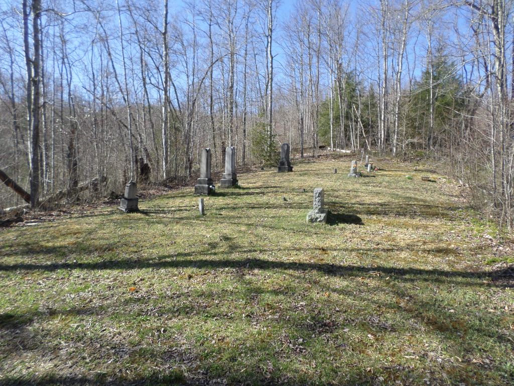
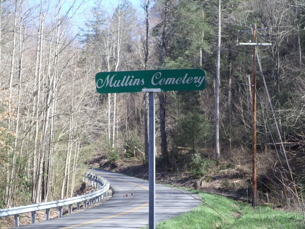
| Description | : | There are many small "Mullins" family cemeteries in the area. This particular Cemetery is very hard to find. After following directions with the latitude/longitude info provided, look for the street sign (in photo to right), that is on Hwy. 932 (Flat Gap). Then, turn up that road. The cemetery is actually located on an old mine road called Sun Trucking Rd. Lats and longs on that road are 37 degrees 4 minutes -82 degrees 44 minutes off of Highway 932(Flat Gap). The cemetery itself is located up sun trucking road. Go up the hill and over the hill. At the foot... Read More |
frequently asked questions (FAQ):
-
Where is Mullins Cemetery?
Mullins Cemetery is located at Roberts Branch Road, Flat Gap Eolia, Letcher County ,Kentucky ,USA.
-
Mullins Cemetery cemetery's updated grave count on graveviews.com?
1 memorials
-
Where are the coordinates of the Mullins Cemetery?
Latitude: 37.0705040
Longitude: -82.7332570
Nearby Cemetories:
1. Adams Cemetery
Eolia, Letcher County, USA
Coordinate: 37.0656013, -82.7288971
2. Joel Sturgill Cemetery
Eolia, Letcher County, USA
Coordinate: 37.0589981, -82.7770004
3. Beyrl Boggs Cemetery
Eolia, Letcher County, USA
Coordinate: 37.0595500, -82.7774500
4. Mullins Family Cemetery
Eolia, Letcher County, USA
Coordinate: 37.0713400, -82.7839220
5. Maggard Cemetery
Eolia, Letcher County, USA
Coordinate: 37.0634600, -82.7956650
6. Colson Cemetery
Colson, Letcher County, USA
Coordinate: 37.1228790, -82.7483495
7. Fugate Cemetery
Mayking, Letcher County, USA
Coordinate: 37.1159000, -82.7703770
8. Cram Creek Cemetery
Mayking, Letcher County, USA
Coordinate: 37.1164790, -82.7706700
9. Caudill Cemetery
Dongola, Letcher County, USA
Coordinate: 37.0919620, -82.8045430
10. Hall Cemetery
Mayking, Letcher County, USA
Coordinate: 37.1225880, -82.7797270
11. Day Cemetery
Ermine, Letcher County, USA
Coordinate: 37.1123100, -82.7967900
12. Webb Cemetery
Mayking, Letcher County, USA
Coordinate: 37.1314300, -82.7652510
13. Green Acres Cemetery
Ermine, Letcher County, USA
Coordinate: 37.1176987, -82.7956009
14. Hop Gibson Cemetery
Letcher County, USA
Coordinate: 37.0896190, -82.8163350
15. Combs Cemetery
Ermine, Letcher County, USA
Coordinate: 37.1193620, -82.7948360
16. Collins Cemetery
Mayking, Letcher County, USA
Coordinate: 37.1348720, -82.7682810
17. Haven of Rest Cemetery
Mayking, Letcher County, USA
Coordinate: 37.1372090, -82.7611020
18. Holbrook Cemetery
Mayking, Letcher County, USA
Coordinate: 37.1372250, -82.7611660
19. Fields Cemetery
Dongola, Letcher County, USA
Coordinate: 37.0932270, -82.8220650
20. Craft's Colly Cemetery
Ermine, Letcher County, USA
Coordinate: 37.1280240, -82.7950290
21. Dinah Blair Branch Cemetery
Letcher County, USA
Coordinate: 37.0733140, -82.8314320
22. Adams Cemetery
Isom, Letcher County, USA
Coordinate: 37.1369019, -82.7944031
23. Melvin Adams Cemetery
Ermine, Letcher County, USA
Coordinate: 37.1370000, -82.7944000
24. Wright Cemetery
Jenkins, Letcher County, USA
Coordinate: 37.1505620, -82.6942880