| Memorials | : | 1 |
| Location | : | Blue Goose, Henderson County, USA |
| Coordinate | : | 35.7069600, -88.5837520 |
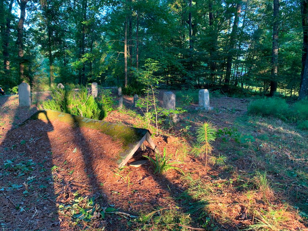
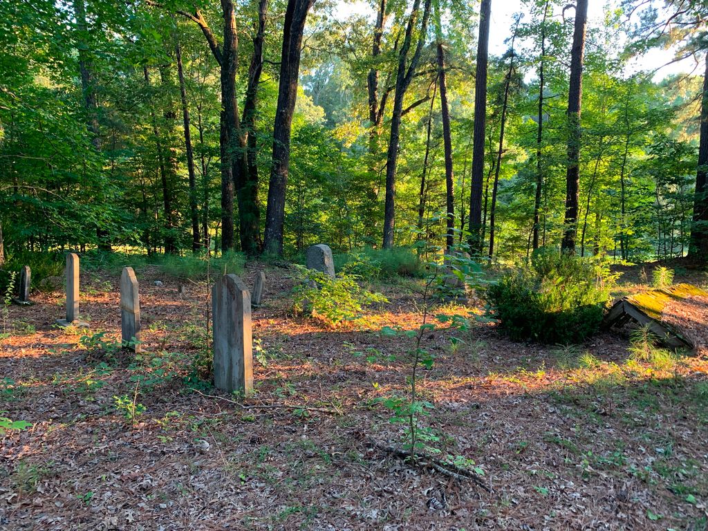
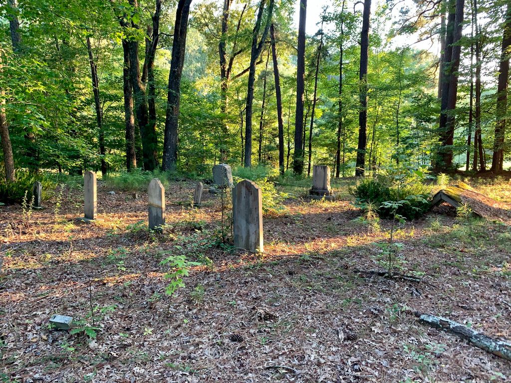
| Description | : | From the intersection of Manley Rd. & US-412, travel north on Manley Rd., going 0.3 mi., to the cemetery on the west (left) side, about 30' off the road. This late nineteen century family cemetery is located on Manley Road just west of its intersection with Feathers Lane. The most interesting feature is the surviving grave house over the grave of Alice Manley. Grave houses were once seen frequently in Henderson County but very few remain. The cemetery may have been vandalized at some point in the past and its markers knocked down. Whoever reset the markers did... Read More |
frequently asked questions (FAQ):
-
Where is Manley Cemetery?
Manley Cemetery is located at 351 Manley Rd Blue Goose, Henderson County ,Tennessee ,USA.
-
Manley Cemetery cemetery's updated grave count on graveviews.com?
1 memorials
-
Where are the coordinates of the Manley Cemetery?
Latitude: 35.7069600
Longitude: -88.5837520
Nearby Cemetories:
1. Cogdell Cemetery
Blue Goose, Henderson County, USA
Coordinate: 35.7015520, -88.5732290
2. Independence Cemetery
Poplar Springs, Henderson County, USA
Coordinate: 35.7280998, -88.5860977
3. Bells Chapel Cemetery
Blue Goose, Henderson County, USA
Coordinate: 35.6811000, -88.5905000
4. Claybrook-Berry Zion Cemetery
Beech Bluff, Madison County, USA
Coordinate: 35.7072720, -88.6249050
5. Union Grove Church Cemetery
Henderson County, USA
Coordinate: 35.6731520, -88.6040190
6. Anderson Cemetery
Henderson County, USA
Coordinate: 35.7016983, -88.5342026
7. George Anderson Cemetery
Lexington, Henderson County, USA
Coordinate: 35.7014470, -88.5324140
8. Old Shady Grove Methodist Church Cemetery
Lexington, Henderson County, USA
Coordinate: 35.7056400, -88.5319300
9. Cool Springs Cemetery
Independence, Henderson County, USA
Coordinate: 35.7494490, -88.5923100
10. Oakley Cemetery
Jackson, Madison County, USA
Coordinate: 35.7467730, -88.6094490
11. Juno Church of Christ Cemetery
Lexington, Henderson County, USA
Coordinate: 35.6917460, -88.5308050
12. Williams Family Cemetery
Jackson, Madison County, USA
Coordinate: 35.7306000, -88.6325000
13. Church of Christ Cemetery
Huron, Henderson County, USA
Coordinate: 35.6919921, -88.5300273
14. Hamlett Cemetery
Blue Goose, Henderson County, USA
Coordinate: 35.6838989, -88.5333023
15. Pearson Family Graveyard
Claybrook, Madison County, USA
Coordinate: 35.7083100, -88.6441600
16. Wards Grove Baptist Church Cemetery
Spring Creek, Madison County, USA
Coordinate: 35.7450900, -88.6235510
17. Maple Springs Cemetery
Henderson County, USA
Coordinate: 35.6559460, -88.6050000
18. Oak Grove Cemetery
Madison County, USA
Coordinate: 35.7581000, -88.6139000
19. Key Cemetery
Spring Creek, Madison County, USA
Coordinate: 35.7036680, -88.6538450
20. Grant-Gaston Cemeteryʌ
Spring Creek, Madison County, USA
Coordinate: 35.7412000, -88.6406000
21. Waller-Douglas Cemetery
Henderson County, USA
Coordinate: 35.7301970, -88.5179270
22. Pleasant Hill Cemetery
Mount Gilead, Henderson County, USA
Coordinate: 35.7599983, -88.5408020
23. Stewart Cemetery
Henderson County, USA
Coordinate: 35.7694170, -88.5537500
24. Nebo Church Cemetery
Henderson County, USA
Coordinate: 35.6400540, -88.5689960


