
| Memorials | : | 31 |
| Location | : | Tunnel Hill, Coshocton County, USA |
| Coordinate | : | 40.2508370, -82.0165580 |
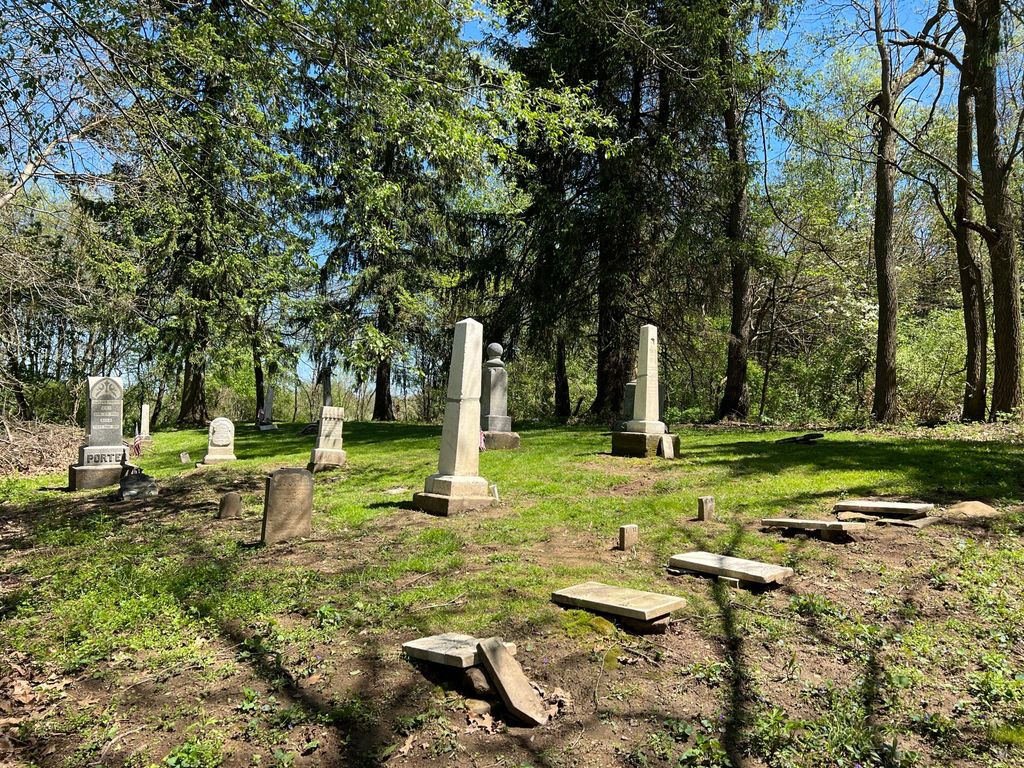
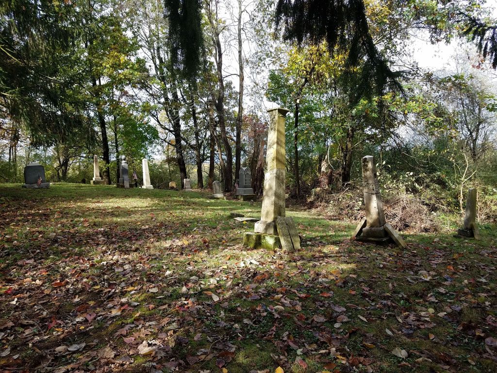
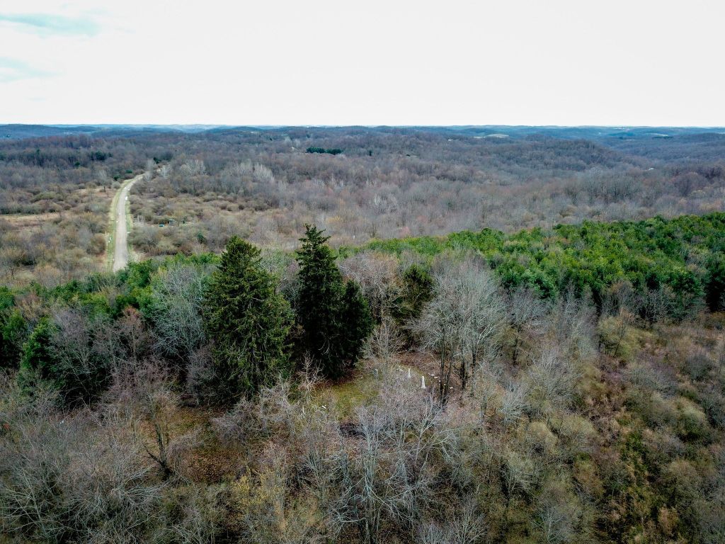
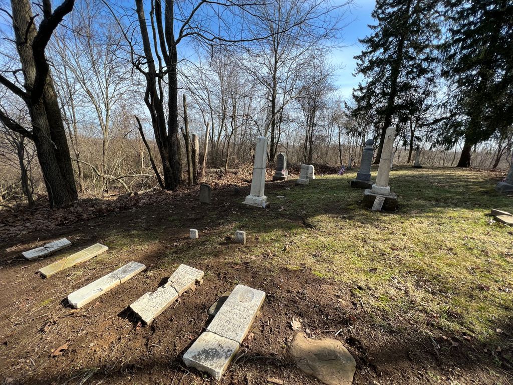
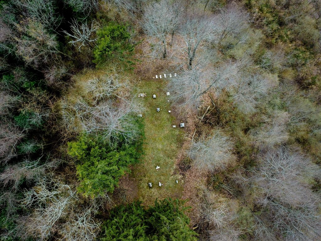
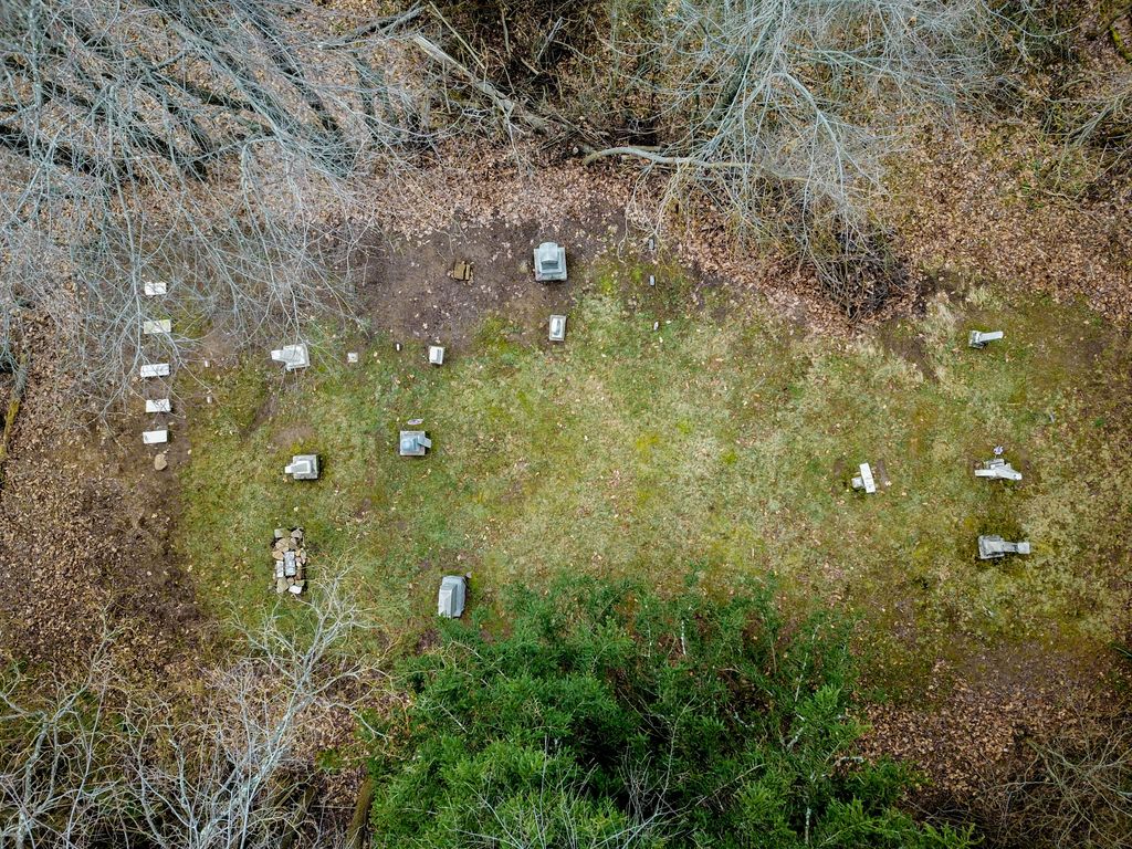
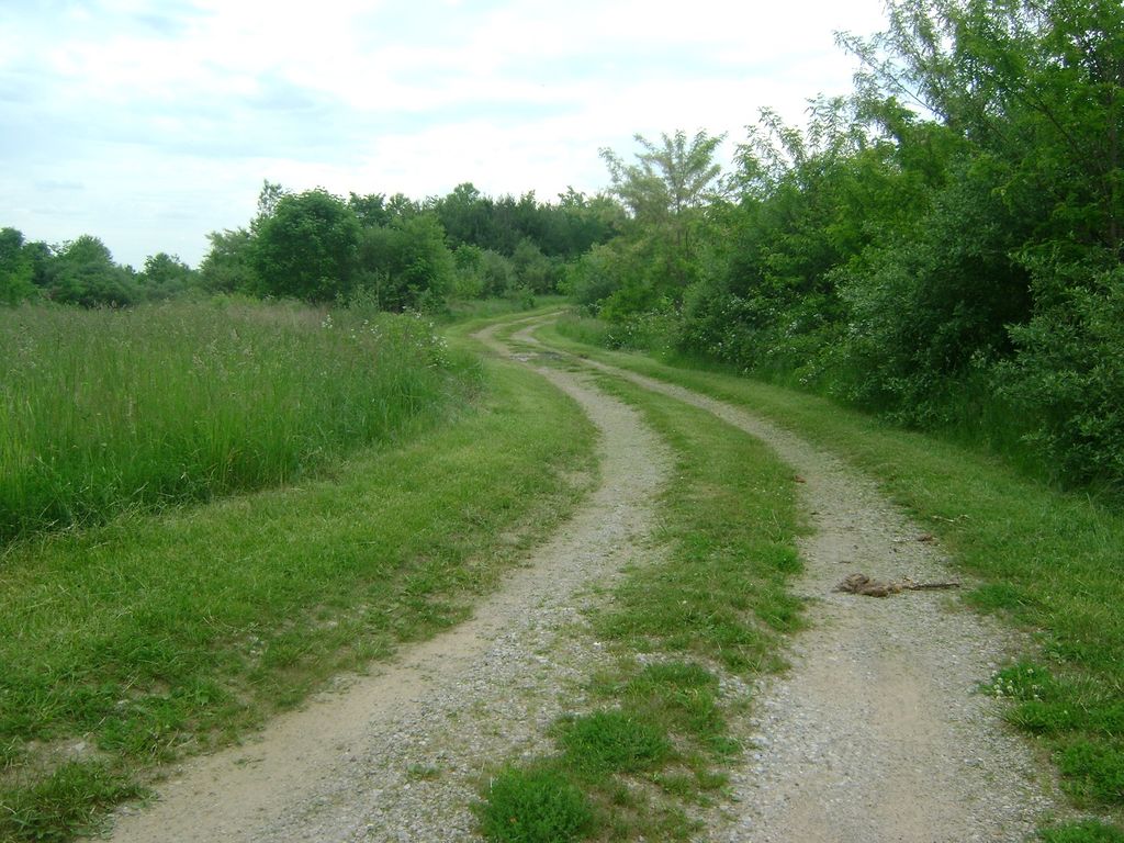
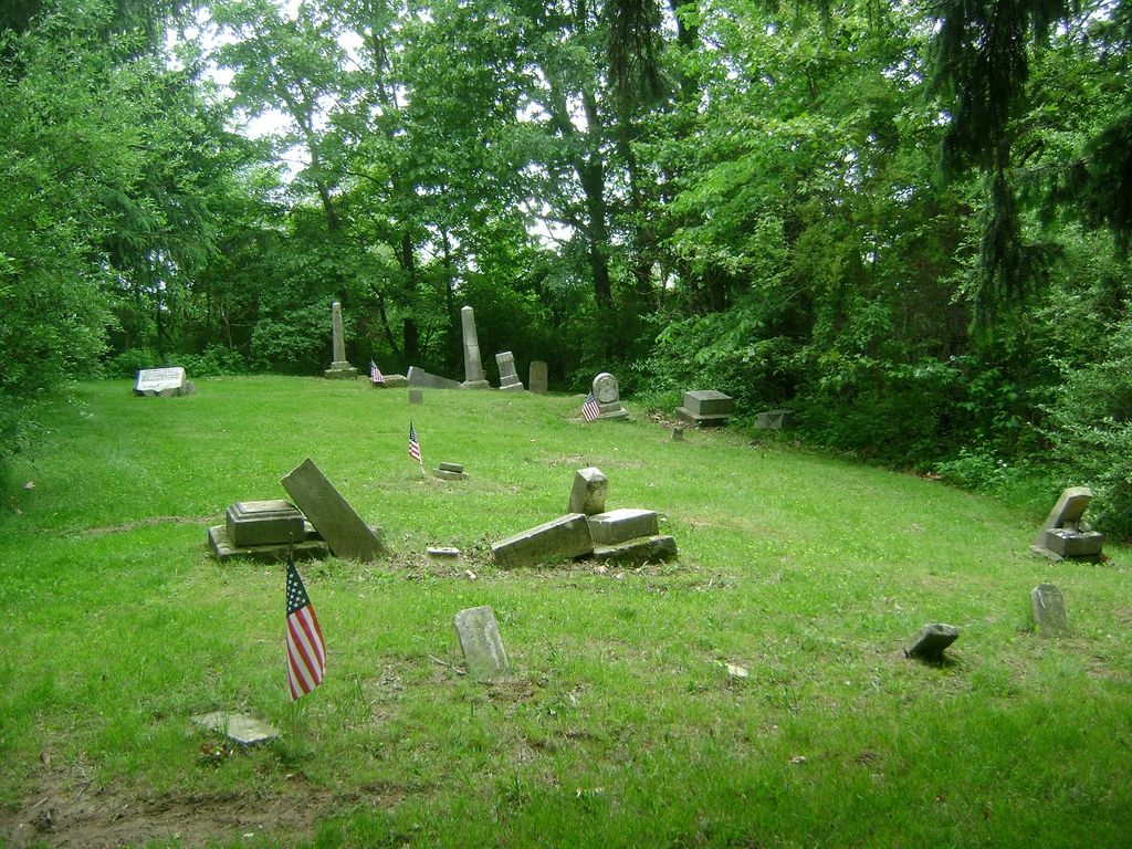
| Description | : | The lane & cemetery are mowed & the cemetery is small & old & most stones are in bad shape. No signs for the cemetery at all. The cemetery is located back a mowed lane on the north side of County Road 54 about 0.3 miles south of its intersection with Ohio State Route 541. The cemetery is located in Bedford Township, Coshocton County, Ohio, and is # 2190 (McCurdy Cemetery) in "Ohio Cemeteries 1803-2003", compiled by the Ohio Genealogical Society. According to the "History of Coshocton County, Ohio: Its Past and Present 1740 - 1881." Compiled by N. N. Hill, Jr.... Read More |
frequently asked questions (FAQ):
-
Where is McCurdy Family Cemetery?
McCurdy Family Cemetery is located at 19463 – 20214 County Road 54 Tunnel Hill, Coshocton County ,Ohio , 43844USA.
-
McCurdy Family Cemetery cemetery's updated grave count on graveviews.com?
3 memorials
-
Where are the coordinates of the McCurdy Family Cemetery?
Latitude: 40.2508370
Longitude: -82.0165580
Nearby Cemetories:
1. Union Cemetery
Tunnel Hill, Coshocton County, USA
Coordinate: 40.2400932, -82.0478745
2. Branch Methodist Church Cemetery
Coshocton, Coshocton County, USA
Coordinate: 40.2396610, -81.9840410
3. Foster-Lowary-McCullough Cemetery
Coshocton County, USA
Coordinate: 40.2708400, -81.9761450
4. Smith-McCoy Cemetery
Roscoe, Coshocton County, USA
Coordinate: 40.2508450, -81.9642690
5. West Bedford Cemetery #2
Bedford Township, Coshocton County, USA
Coordinate: 40.2543110, -82.0736220
6. West Bedford Cemetery #1
Bedford Township, Coshocton County, USA
Coordinate: 40.2636000, -82.0739000
7. Presbyterian Church Cemetery
Wakatomika, Coshocton County, USA
Coordinate: 40.2052690, -82.0204030
8. James and William Thompson Cemetery
Wakatomika, Coshocton County, USA
Coordinate: 40.2094170, -82.0530280
9. Pleasant Hill Baptist Cemetery
Coshocton, Coshocton County, USA
Coordinate: 40.2547380, -81.9496810
10. Wakatomika Regular Baptist Cemetery
Wakatomika, Coshocton County, USA
Coordinate: 40.2013780, -82.0469260
11. Blooming Grove Cemetery
Randle, Coshocton County, USA
Coordinate: 40.3017006, -81.9843979
12. Antioch Cemetery
Coshocton County, USA
Coordinate: 40.3046989, -81.9933014
13. Milfork Baptist Church Cemetery
New Moscow, Coshocton County, USA
Coordinate: 40.2083080, -81.9540880
14. Slaughter Cemetery
New Moscow, Coshocton County, USA
Coordinate: 40.2138990, -81.9462800
15. Chalfant Cemetery
Wakatomika, Coshocton County, USA
Coordinate: 40.1828499, -82.0181885
16. Jefferson Presbyterian Cemetery
Warsaw, Coshocton County, USA
Coordinate: 40.3200690, -82.0165291
17. Mikesell Cemetery
West Bedford, Coshocton County, USA
Coordinate: 40.2882500, -82.0963240
18. Christian Chapel Cemetery
Coshocton County, USA
Coordinate: 40.2271470, -81.9263480
19. Miller Cemetery
Wakatomika, Coshocton County, USA
Coordinate: 40.1976260, -82.0849510
20. Valley View Cemetery
Warsaw, Coshocton County, USA
Coordinate: 40.3255997, -82.0139008
21. Mohawk Methodist Church Cemetery
Mohawk Village, Coshocton County, USA
Coordinate: 40.3182290, -82.0724610
22. West Carlisle Cemetery
Coshocton, Coshocton County, USA
Coordinate: 40.2308100, -82.1177700
23. Cox Cemetery
Coshocton County, USA
Coordinate: 40.1883011, -81.9511032
24. Goshen Cemetery
Warsaw, Coshocton County, USA
Coordinate: 40.2728004, -82.1193008