
| Memorials | : | 4 |
| Location | : | Roscoe, Coshocton County, USA |
| Coordinate | : | 40.2508450, -81.9642690 |
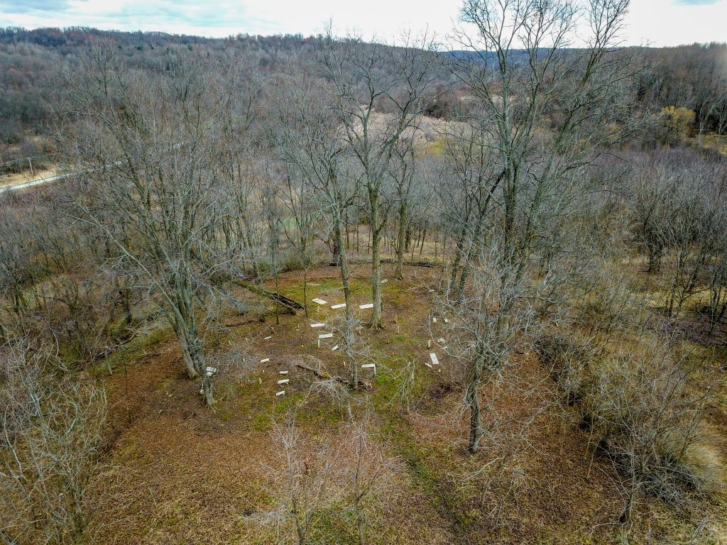
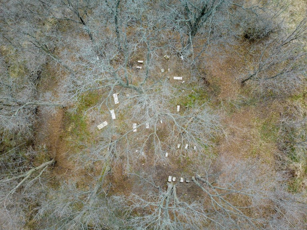
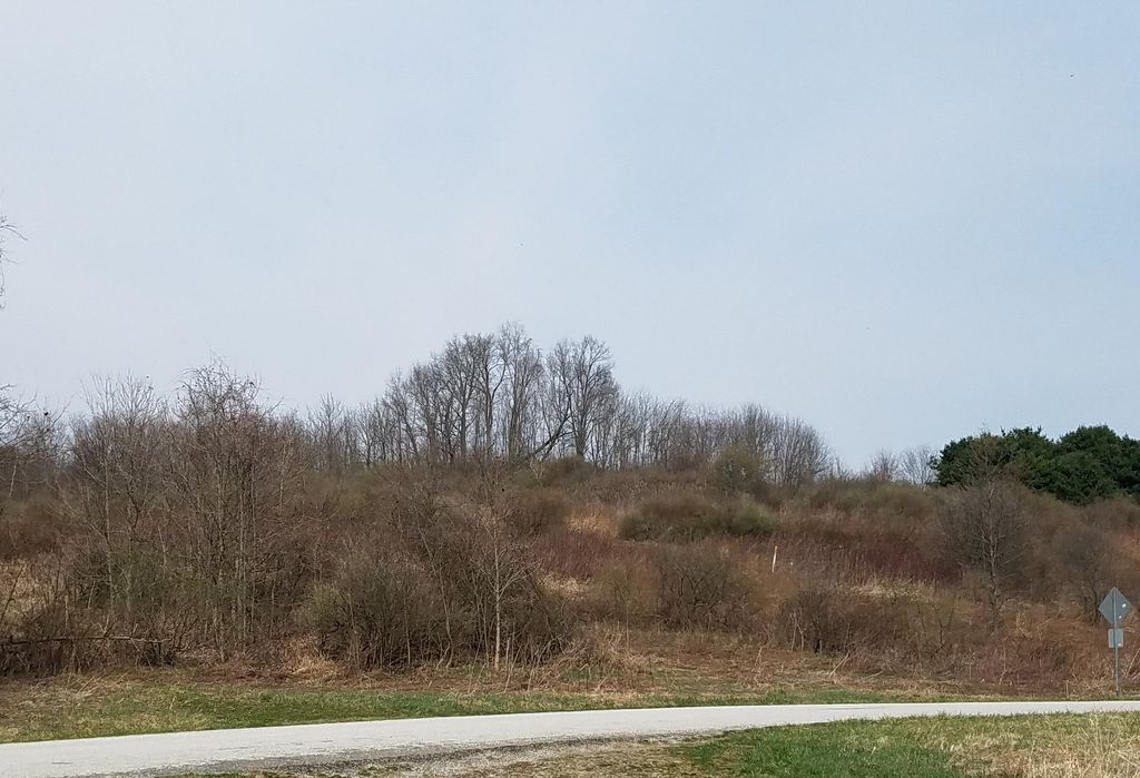
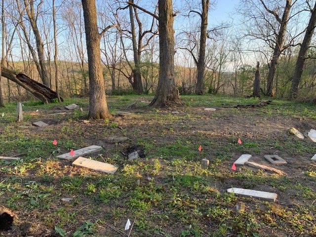
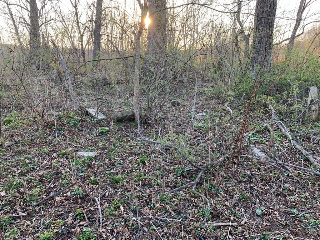
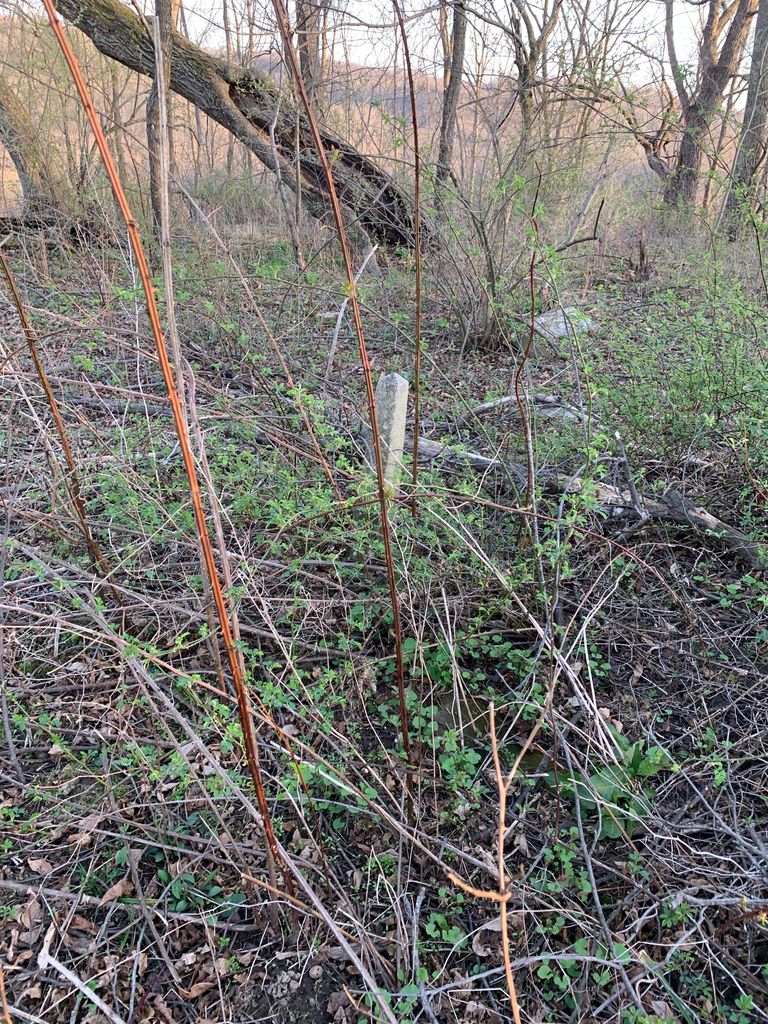
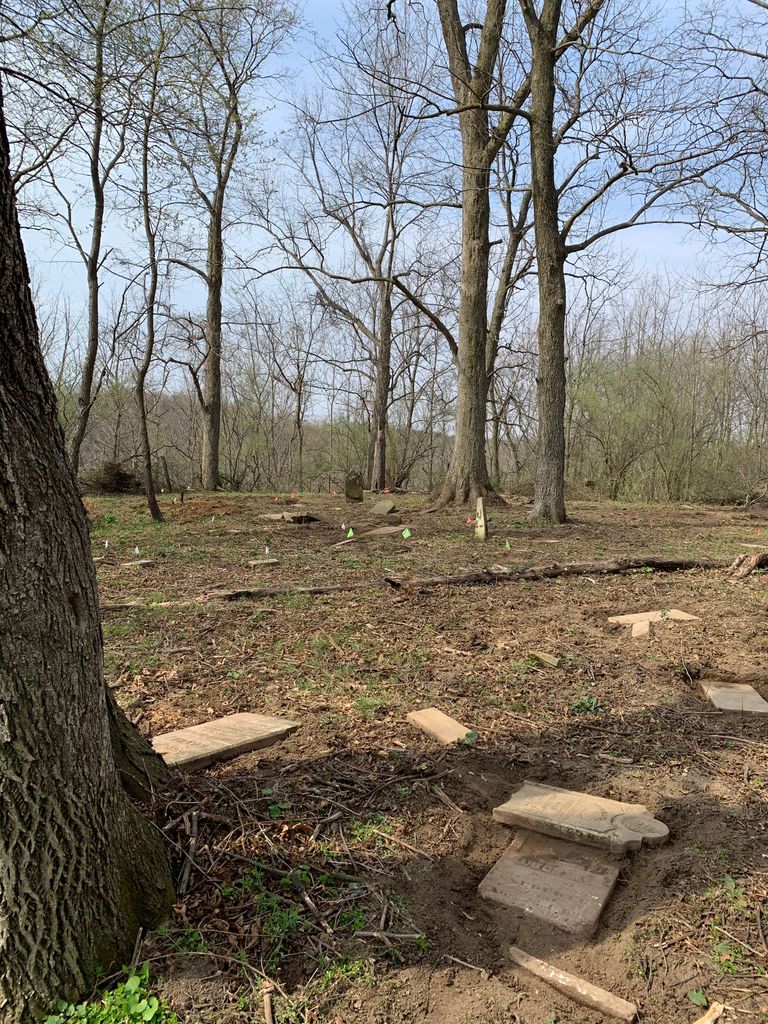
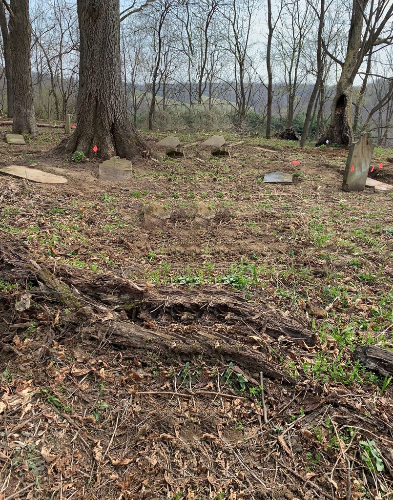
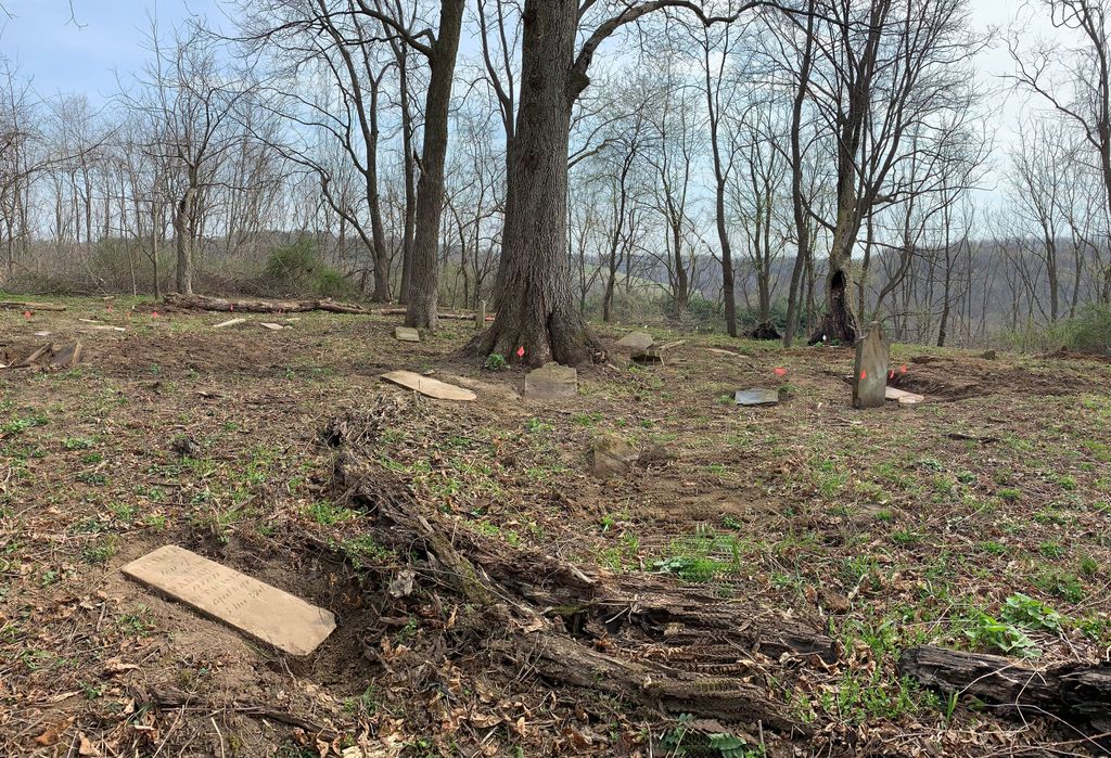
| Description | : | Cemetery is on land formerly owned by Peabody Coal Co. & now owned by ODNR. Have to get permission to be on their property. The cemetery is not easily accessible. Rough terrain across a field. The cemetery is in bad shape. Overgrown, groundhog holes, brush and the stones are in really bad shape. The cemetery is located in Jackson Township on the south side of Ohio State Route 541 west of County Road 297. An old gravel road exists on the south side of Ohio State Route 541 about 0.3 miles west of its intersection with County Road 297. Signs are... Read More |
frequently asked questions (FAQ):
-
Where is Smith-McCoy Cemetery?
Smith-McCoy Cemetery is located at Ohio State Route 541 Roscoe, Coshocton County ,Ohio , 43812USA.
-
Smith-McCoy Cemetery cemetery's updated grave count on graveviews.com?
4 memorials
-
Where are the coordinates of the Smith-McCoy Cemetery?
Latitude: 40.2508450
Longitude: -81.9642690
Nearby Cemetories:
1. Pleasant Hill Baptist Cemetery
Coshocton, Coshocton County, USA
Coordinate: 40.2547380, -81.9496810
2. Branch Methodist Church Cemetery
Coshocton, Coshocton County, USA
Coordinate: 40.2396610, -81.9840410
3. Foster-Lowary-McCullough Cemetery
Coshocton County, USA
Coordinate: 40.2708400, -81.9761450
4. Christian Chapel Cemetery
Coshocton County, USA
Coordinate: 40.2271470, -81.9263480
5. Slaughter Cemetery
New Moscow, Coshocton County, USA
Coordinate: 40.2138990, -81.9462800
6. McCurdy Family Cemetery
Tunnel Hill, Coshocton County, USA
Coordinate: 40.2508370, -82.0165580
7. Warner Methodist Cemetery
Conesville, Coshocton County, USA
Coordinate: 40.2389520, -81.9109620
8. Milfork Baptist Church Cemetery
New Moscow, Coshocton County, USA
Coordinate: 40.2083080, -81.9540880
9. Blooming Grove Cemetery
Randle, Coshocton County, USA
Coordinate: 40.3017006, -81.9843979
10. Pepper Cemetery
Conesville, Coshocton County, USA
Coordinate: 40.1992870, -81.9336780
11. Antioch Cemetery
Coshocton County, USA
Coordinate: 40.3046989, -81.9933014
12. Presbyterian Church Cemetery
Wakatomika, Coshocton County, USA
Coordinate: 40.2052690, -82.0204030
13. Cox Cemetery
Coshocton County, USA
Coordinate: 40.1883011, -81.9511032
14. Union Cemetery
Tunnel Hill, Coshocton County, USA
Coordinate: 40.2400932, -82.0478745
15. Prairie Chapel Church Cemetery
Coshocton, Coshocton County, USA
Coordinate: 40.3049000, -81.9124000
16. Unidentified Cemetery #1
Coshocton, Coshocton County, USA
Coordinate: 40.2753080, -81.8803050
17. Roscoe Cemetery
Coshocton, Coshocton County, USA
Coordinate: 40.2821000, -81.8841000
18. Caldersburg Cemetery
Roscoe, Coshocton County, USA
Coordinate: 40.2755390, -81.8798700
19. Tyndall Cemetery
Coshocton County, USA
Coordinate: 40.2167015, -81.8843994
20. Davis Cemetery
Conesville, Coshocton County, USA
Coordinate: 40.2154312, -81.8808899
21. James and William Thompson Cemetery
Wakatomika, Coshocton County, USA
Coordinate: 40.2094170, -82.0530280
22. Chalfant Cemetery
Wakatomika, Coshocton County, USA
Coordinate: 40.1828499, -82.0181885
23. Jefferson Presbyterian Cemetery
Warsaw, Coshocton County, USA
Coordinate: 40.3200690, -82.0165291
24. South Lawn Cemetery
Coshocton, Coshocton County, USA
Coordinate: 40.2560997, -81.8597031