
| Memorials | : | 16 |
| Location | : | Coshocton, Coshocton County, USA |
| Phone | : | 43812 |
| Coordinate | : | 40.2547380, -81.9496810 |
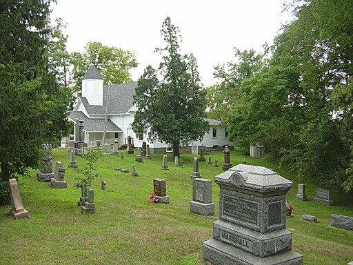
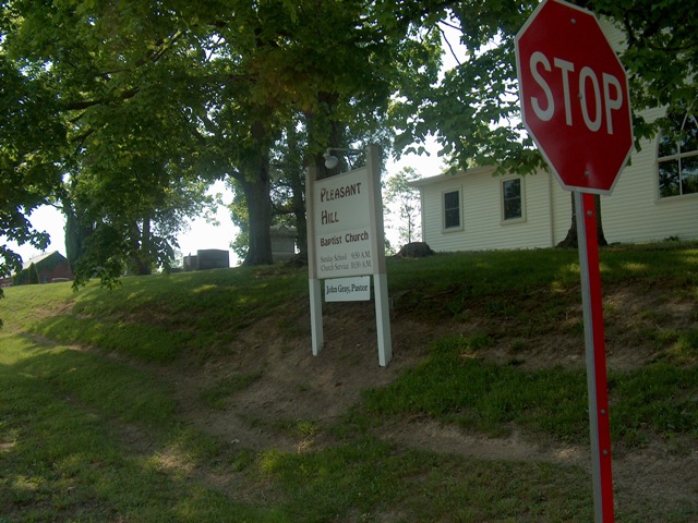
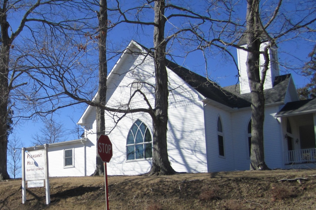
| Description | : | Located at State Route 541 and Township Highway 303. The cemetery is located in Jackson Township, Coshocton County, Ohio, and is # 2250 (Pleasant Hill Baptist Cemetery) in “Ohio Cemeteries 1803-2003”, compiled by the Ohio Genealogical Society. The U.S. Geological Survey (USGS) Geographic Names Information System (GNIS) feature ID for the cemetery is 1964130 (Pleasant Hill Baptist Cemetery). |
frequently asked questions (FAQ):
-
Where is Pleasant Hill Baptist Cemetery?
Pleasant Hill Baptist Cemetery is located at 43440 State Route 541 Coshocton, Coshocton County ,Ohio ,USA.
-
Pleasant Hill Baptist Cemetery cemetery's updated grave count on graveviews.com?
15 memorials
-
Where are the coordinates of the Pleasant Hill Baptist Cemetery?
Latitude: 40.2547380
Longitude: -81.9496810
Nearby Cemetories:
1. Smith-McCoy Cemetery
Roscoe, Coshocton County, USA
Coordinate: 40.2508450, -81.9642690
2. Foster-Lowary-McCullough Cemetery
Coshocton County, USA
Coordinate: 40.2708400, -81.9761450
3. Branch Methodist Church Cemetery
Coshocton, Coshocton County, USA
Coordinate: 40.2396610, -81.9840410
4. Christian Chapel Cemetery
Coshocton County, USA
Coordinate: 40.2271470, -81.9263480
5. Warner Methodist Cemetery
Conesville, Coshocton County, USA
Coordinate: 40.2389520, -81.9109620
6. Slaughter Cemetery
New Moscow, Coshocton County, USA
Coordinate: 40.2138990, -81.9462800
7. Milfork Baptist Church Cemetery
New Moscow, Coshocton County, USA
Coordinate: 40.2083080, -81.9540880
8. McCurdy Family Cemetery
Tunnel Hill, Coshocton County, USA
Coordinate: 40.2508370, -82.0165580
9. Blooming Grove Cemetery
Randle, Coshocton County, USA
Coordinate: 40.3017006, -81.9843979
10. Pepper Cemetery
Conesville, Coshocton County, USA
Coordinate: 40.1992870, -81.9336780
11. Unidentified Cemetery #1
Coshocton, Coshocton County, USA
Coordinate: 40.2753080, -81.8803050
12. Roscoe Cemetery
Coshocton, Coshocton County, USA
Coordinate: 40.2821000, -81.8841000
13. Caldersburg Cemetery
Roscoe, Coshocton County, USA
Coordinate: 40.2755390, -81.8798700
14. Prairie Chapel Church Cemetery
Coshocton, Coshocton County, USA
Coordinate: 40.3049000, -81.9124000
15. Antioch Cemetery
Coshocton County, USA
Coordinate: 40.3046989, -81.9933014
16. Tyndall Cemetery
Coshocton County, USA
Coordinate: 40.2167015, -81.8843994
17. Davis Cemetery
Conesville, Coshocton County, USA
Coordinate: 40.2154312, -81.8808899
18. Cox Cemetery
Coshocton County, USA
Coordinate: 40.1883011, -81.9511032
19. South Lawn Cemetery
Coshocton, Coshocton County, USA
Coordinate: 40.2560997, -81.8597031
20. Oak Ridge Cemetery
Coshocton, Coshocton County, USA
Coordinate: 40.2780991, -81.8610992
21. Machpelahs Burial Acres
Keene, Coshocton County, USA
Coordinate: 40.3208950, -81.9126210
22. Presbyterian Church Cemetery
Wakatomika, Coshocton County, USA
Coordinate: 40.2052690, -82.0204030
23. Union Cemetery
Tunnel Hill, Coshocton County, USA
Coordinate: 40.2400932, -82.0478745
24. William Robinson Family Cemetery
Conesville, Coshocton County, USA
Coordinate: 40.1808014, -81.9008026