
| Memorials | : | 116 |
| Location | : | Coshocton County, USA |
| Coordinate | : | 40.2271470, -81.9263480 |
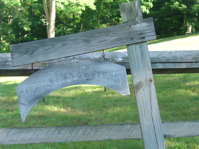
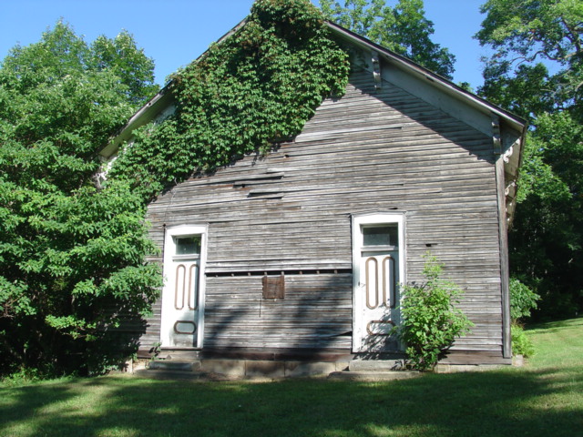
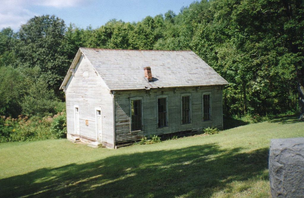
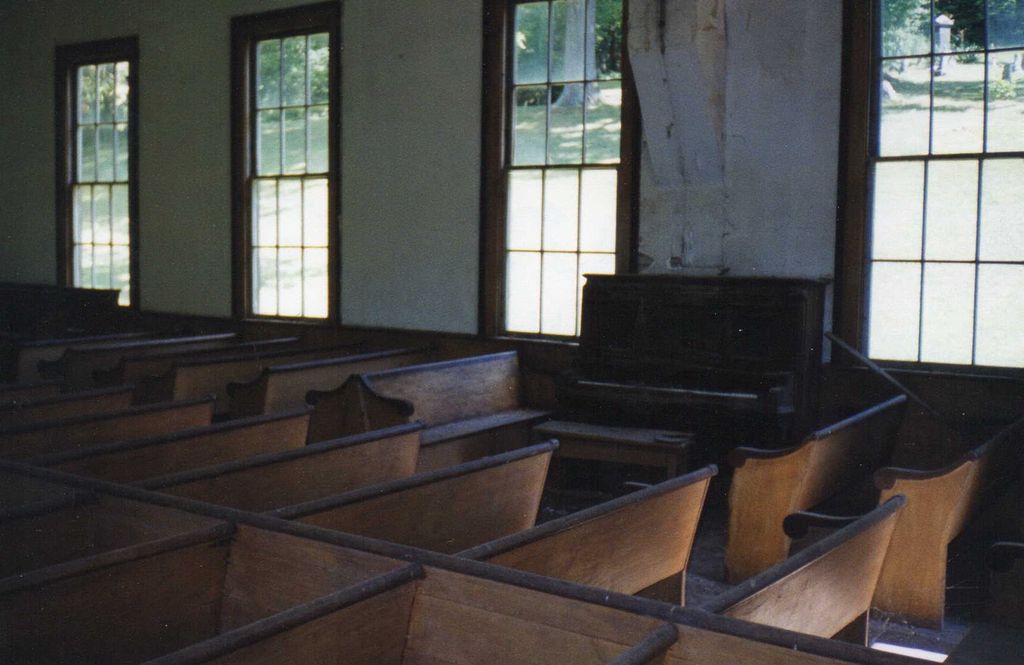
| Description | : | The cemetery is located on the northwest side of County Road 6 about 1.2 miles south of its intersection with Township Road 282. The cemetery is located in Virginia Township, Coshocton County, Ohio, and is # 2377 (Christian Chapel Cemetery) in “Ohio Cemeteries 1803-2003”, compiled by the Ohio Genealogical Society. The cemetery is registered with the Ohio Division of Real Estate and Professional Licensing (ODRE) as Christian Chapel with registration license number CGR.0000981533. The U.S. Geological Survey (USGS) Geographic Names Information System (GNIS) feature ID for the cemetery is 1964106 (Christian Chapel Cemetery). |
frequently asked questions (FAQ):
-
Where is Christian Chapel Cemetery?
Christian Chapel Cemetery is located at County Road 6 Coshocton County ,Ohio , 43812USA.
-
Christian Chapel Cemetery cemetery's updated grave count on graveviews.com?
116 memorials
-
Where are the coordinates of the Christian Chapel Cemetery?
Latitude: 40.2271470
Longitude: -81.9263480

Nearby Cemetories:
1. Warner Methodist Cemetery
Conesville, Coshocton County, USA
Coordinate: 40.2389520, -81.9109620
2. Slaughter Cemetery
New Moscow, Coshocton County, USA
Coordinate: 40.2138990, -81.9462800
3. Milfork Baptist Church Cemetery
New Moscow, Coshocton County, USA
Coordinate: 40.2083080, -81.9540880
4. Pepper Cemetery
Conesville, Coshocton County, USA
Coordinate: 40.1992870, -81.9336780
5. Pleasant Hill Baptist Cemetery
Coshocton, Coshocton County, USA
Coordinate: 40.2547380, -81.9496810
6. Tyndall Cemetery
Coshocton County, USA
Coordinate: 40.2167015, -81.8843994
7. Davis Cemetery
Conesville, Coshocton County, USA
Coordinate: 40.2154312, -81.8808899
8. Smith-McCoy Cemetery
Roscoe, Coshocton County, USA
Coordinate: 40.2508450, -81.9642690
9. Cox Cemetery
Coshocton County, USA
Coordinate: 40.1883011, -81.9511032
10. Branch Methodist Church Cemetery
Coshocton, Coshocton County, USA
Coordinate: 40.2396610, -81.9840410
11. William Robinson Family Cemetery
Conesville, Coshocton County, USA
Coordinate: 40.1808014, -81.9008026
12. Foster-Lowary-McCullough Cemetery
Coshocton County, USA
Coordinate: 40.2708400, -81.9761450
13. South Lawn Cemetery
Coshocton, Coshocton County, USA
Coordinate: 40.2560997, -81.8597031
14. Unidentified Cemetery #1
Coshocton, Coshocton County, USA
Coordinate: 40.2753080, -81.8803050
15. Caldersburg Cemetery
Roscoe, Coshocton County, USA
Coordinate: 40.2755390, -81.8798700
16. Roscoe Cemetery
Coshocton, Coshocton County, USA
Coordinate: 40.2821000, -81.8841000
17. Bethany Cemetery
Wills Creek, Coshocton County, USA
Coordinate: 40.1852989, -81.8591995
18. Franklin Cemetery
Franklin, Coshocton County, USA
Coordinate: 40.2000008, -81.8460999
19. Littick Cemetery
Franklin, Coshocton County, USA
Coordinate: 40.1991870, -81.8416490
20. Adams Mills Cemetery
Adams Mills, Muskingum County, USA
Coordinate: 40.1582300, -81.9464430
21. Oak Ridge Cemetery
Coshocton, Coshocton County, USA
Coordinate: 40.2780991, -81.8610992
22. McCurdy Family Cemetery
Tunnel Hill, Coshocton County, USA
Coordinate: 40.2508370, -82.0165580
23. Presbyterian Church Cemetery
Wakatomika, Coshocton County, USA
Coordinate: 40.2052690, -82.0204030
24. Prairie Chapel Church Cemetery
Coshocton, Coshocton County, USA
Coordinate: 40.3049000, -81.9124000