
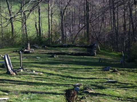
| Memorials | : | 4 |
| Location | : | Wells Township, Jefferson County, USA |
| Coordinate | : | 40.2644005, -80.7217026 |
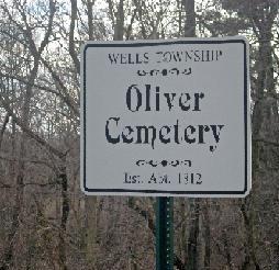
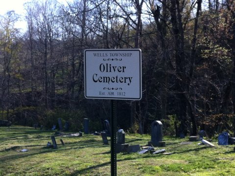
| Description | : | The cemetery is located on the west side of Graham Road (County Road 18) about 0.2 miles south of its intersection with Blues Run Road (Township Road 156). The cemetery is located in Wells Township, Jefferson County, Ohio, and is # 6125 (Lloyds Methodist Episcopal Cemetery / Oliver Methodist Episcopal Cemetery / Oliver Cemetery) in “Ohio Cemeteries 1803-2003”, compiled by the Ohio Genealogical Society. The U.S. Geological Survey (USGS) Geographic Names Information System (GNIS) feature ID for the cemetery is 1044165 (Oliver Cemetery). |
frequently asked questions (FAQ):
-
Where is Oliver Cemetery?
Oliver Cemetery is located at Graham Road (County Road 18) Wells Township, Jefferson County ,Ohio , 43943USA.
-
Oliver Cemetery cemetery's updated grave count on graveviews.com?
4 memorials
-
Where are the coordinates of the Oliver Cemetery?
Latitude: 40.2644005
Longitude: -80.7217026
Nearby Cemetories:
1. Tent Church Cemetery
New Alexandria, Jefferson County, USA
Coordinate: 40.2832985, -80.7202988
2. Hopewell Methodist Cemetery
Warren Township, Jefferson County, USA
Coordinate: 40.2236824, -80.7117462
3. Buckingham Cemetery
Wells Township, Jefferson County, USA
Coordinate: 40.2739230, -80.6662180
4. New Alexandria Cemetery
New Alexandria, Jefferson County, USA
Coordinate: 40.2949982, -80.6781006
5. Northern Cemetery
Smithfield, Jefferson County, USA
Coordinate: 40.2736805, -80.7817502
6. Everson Family Cemetery
Salt Run, Jefferson County, USA
Coordinate: 40.2492340, -80.6633810
7. Smithfield Quaker Cemetery
Smithfield, Jefferson County, USA
Coordinate: 40.2670010, -80.7844370
8. McGee-Stringers Cemetery
Wells Township, Jefferson County, USA
Coordinate: 40.2431440, -80.6590810
9. Bayless Cemetery
Rayland, Jefferson County, USA
Coordinate: 40.2122930, -80.7123024
10. Longs Methodist Episcopal Cemetery
Jefferson County, USA
Coordinate: 40.3203400, -80.7400100
11. Shaffer Chapel McIntyre AME Church Cemetery
Bloomingdale, Jefferson County, USA
Coordinate: 40.3050688, -80.7809165
12. McIntyre African Methodist Episcopal Cemetery
Smithfield, Jefferson County, USA
Coordinate: 40.3050688, -80.7809165
13. Wheeler Cemetery
Smithfield, Jefferson County, USA
Coordinate: 40.2453003, -80.7996979
14. Saint James Episcopal Cemetery
Cross Creek Township, Jefferson County, USA
Coordinate: 40.3211700, -80.7563400
15. Saint Adalbert Cemetery
Warren Township, Jefferson County, USA
Coordinate: 40.2033005, -80.7518997
16. Clendenen Cemetery
Beech Bottom, Brooke County, USA
Coordinate: 40.2100870, -80.6591180
17. Warrenton Cemetery
Rayland, Jefferson County, USA
Coordinate: 40.1937700, -80.6838900
18. Wells Cemetery
Beech Bottom, Brooke County, USA
Coordinate: 40.2221985, -80.6322021
19. Mount Moriah Cemetery
Bloomingdale, Jefferson County, USA
Coordinate: 40.3047640, -80.8137800
20. Brooke County Public Library Cremation Niches
Wellsburg, Brooke County, USA
Coordinate: 40.2725410, -80.6128480
21. Georges Run Cemetery
Steubenville, Jefferson County, USA
Coordinate: 40.3022920, -80.6189630
22. Hill Cemetery
Steubenville, Jefferson County, USA
Coordinate: 40.3233490, -80.6353580
23. Cross Creek Cemetery
Wintersville, Jefferson County, USA
Coordinate: 40.3492928, -80.6872635
24. Brooke Cemetery
Wellsburg, Brooke County, USA
Coordinate: 40.2874985, -80.6053009