
| Memorials | : | 0 |
| Location | : | Nes, Dongeradeel Municipality, Netherlands |
| Coordinate | : | 53.4053922, 6.0762312 |
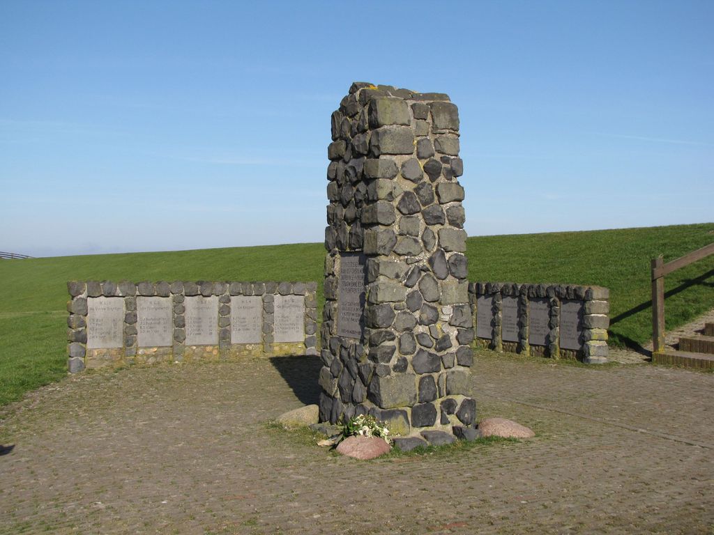
| Description | : | The fishing fleet disaster of Moddergat and Paesens on March 6, 1883. The fishermen of Moddergat and a few of neighboring village Paesens on the north coast of Friesland had had a long winter, with no income and with little to eat left for themselves and their families. The spring was early that year and the continuing beautiful weather tempted especially the young fishermen to sail out again. They were anxious and impatient and didn’t want to sit home with such attractive weather any longer and to suffer lack of food. On Friday, March 2, the ships were retrieved from... Read More |
frequently asked questions (FAQ):
-
Where is Moddergat Fishing Fleet Disaster Memorial?
Moddergat Fishing Fleet Disaster Memorial is located at De Oere Nes, Dongeradeel Municipality ,Friesland , 9142Netherlands.
-
Moddergat Fishing Fleet Disaster Memorial cemetery's updated grave count on graveviews.com?
0 memorials
-
Where are the coordinates of the Moddergat Fishing Fleet Disaster Memorial?
Latitude: 53.4053922
Longitude: 6.0762312

Nearby Cemetories:
1. Nes Protestant Churchyard
Nes, Dongeradeel Municipality, Netherlands
Coordinate: 53.3962300, 6.0481500
2. St. Ceciliatsjerke
Oosternijkerk, Dongeradeel Municipality, Netherlands
Coordinate: 53.3788210, 6.0531531
3. Wierum Protestant Churchyard
Wierum, Dongeradeel Municipality, Netherlands
Coordinate: 53.4021700, 6.0155300
4. Anjum Protestant Churchyard
Anjum, Dongeradeel Municipality, Netherlands
Coordinate: 53.3744900, 6.1246700
5. Kleastertsjerke Cemetery
Niawier, Dongeradeel Municipality, Netherlands
Coordinate: 53.3637650, 6.0499337
6. Sint-Vituskerk Churchyard
Wetzens, Dongeradeel Municipality, Netherlands
Coordinate: 53.3467450, 6.0345649
7. Begraafplaats Got Tjark
Schiermonnikoog, Schiermonnikoog Municipality, Netherlands
Coordinate: 53.4790604, 6.1605749
8. Kerkhof Dorpskerk
Engwierum, Dongeradeel Municipality, Netherlands
Coordinate: 53.3203340, 6.1362935
9. Schiermonnikoog Vredenhof Cemetery
Schiermonnikoog, Schiermonnikoog Municipality, Netherlands
Coordinate: 53.4859600, 6.1857400
10. Driesum Protestant Churchyard
Driezum, Dantumadeel Municipality, Netherlands
Coordinate: 53.2977400, 6.0460900
11. Raard Protestant Churchyard
Raard, Dongeradeel Municipality, Netherlands
Coordinate: 53.3254600, 5.9444900
12. Holwerd Protestant Churchyard
Holwerd, Dongeradeel Municipality, Netherlands
Coordinate: 53.3710500, 5.8972200
13. Rêsthôf Driezum
Driezum, Dantumadeel Municipality, Netherlands
Coordinate: 53.2948039, 6.0418101
14. Westergeest Protestant Churchyard
Westergeest, Kollumerland en Nieuwkruisland Municipality, Netherlands
Coordinate: 53.2902000, 6.0856800
15. Kloosterkapel begraafplaats
Sibrandahûs, Dantumadeel Municipality, Netherlands
Coordinate: 53.3111878, 5.9425346
16. Petruskerkhof
Lichtaard, Ferwerderadiel Municipality, Netherlands
Coordinate: 53.3263379, 5.9135862
17. Damwoude General Cemetery
Damwâld, Dantumadeel Municipality, Netherlands
Coordinate: 53.2857700, 5.9996900
18. Akkerwoude Protestant Churchyard
Akkerwoude, Dantumadeel Municipality, Netherlands
Coordinate: 53.2909300, 5.9779800
19. Begraafplaats Nijenhof
Oudwoude, Kollumerland en Nieuwkruisland Municipality, Netherlands
Coordinate: 53.2760214, 6.1267219
20. Kerkhof Alexanderkerk Rinsumageest
Rinsumageest, Dantumadeel Municipality, Netherlands
Coordinate: 53.2959488, 5.9429579
21. Vierhuizen Begraafplaats
Vierhuizen, De Marne Municipality, Netherlands
Coordinate: 53.3603100, 6.2934400
22. Tsjerkhôf Jannum
Jannum, Ferwerderadiel Municipality, Netherlands
Coordinate: 53.3126308, 5.9027619
23. Rêsthôf Broeksterwâld
Broeksterwoude, Dantumadeel Municipality, Netherlands
Coordinate: 53.2758766, 5.9907295
24. Blija Protestant Churchyard
Blija, Ferwerderadiel Municipality, Netherlands
Coordinate: 53.3511734, 5.8606162