
| Memorials | : | 8 |
| Location | : | Randolph County, USA |
| Coordinate | : | 33.3498650, -85.3439040 |
frequently asked questions (FAQ):
-
Where is Mount Carmel Cemetery?
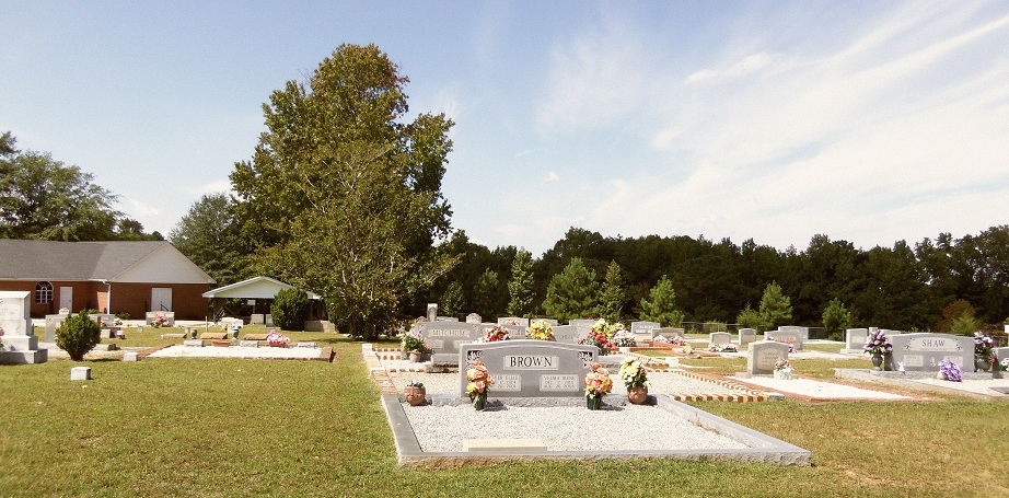
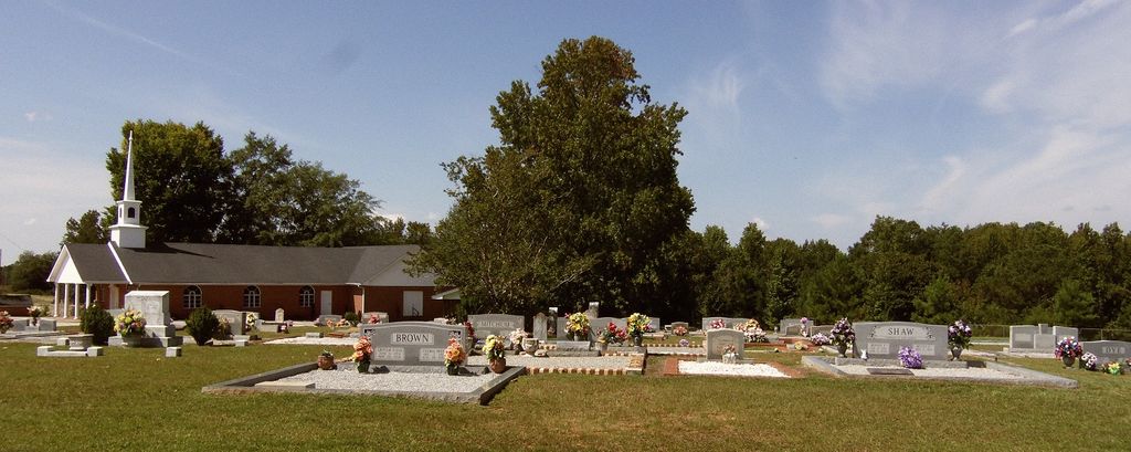
Mount Carmel Cemetery is located at Randolph County ,Alabama ,USA.
-
Mount Carmel Cemetery cemetery's updated grave count on graveviews.com?
8 memorials
-
Where are the coordinates of the Mount Carmel Cemetery?
Latitude: 33.3498650
Longitude: -85.3439040

Nearby Cemetories:
1. West Napoleon Church of Christ Cemetery
Napoleon, Randolph County, USA
Coordinate: 33.3244900, -85.3582600
2. East Napoleon Church of Christ Cemetery
Napoleon, Randolph County, USA
Coordinate: 33.3204560, -85.3494260
3. Liberty East Baptist Church Cemetery
Omaha, Randolph County, USA
Coordinate: 33.3401230, -85.3005940
4. Flat Rock Congregational Methodist Cemetery
Omaha, Randolph County, USA
Coordinate: 33.3365173, -85.2920609
5. Daniel Family Cemetery
Graham, Randolph County, USA
Coordinate: 33.3956100, -85.3200000
6. Providence Baptist Church Cemetery
Providence, Randolph County, USA
Coordinate: 33.3970110, -85.3712540
7. Rocky Branch Baptist Church Cemetery
New Hope, Randolph County, USA
Coordinate: 33.3217087, -85.3998795
8. Old Rocky Branch Cemetery
New Hope, Randolph County, USA
Coordinate: 33.3171997, -85.3977966
9. Haywood Cemetery
Haywood, Randolph County, USA
Coordinate: 33.3039700, -85.3899100
10. Daniel-McDow Cemetery
Graham, Randolph County, USA
Coordinate: 33.4088000, -85.3214800
11. Big Springs Cemetery
Roanoke, Randolph County, USA
Coordinate: 33.2873400, -85.3133160
12. Red Oak Cemetery
Heard County, USA
Coordinate: 33.3506012, -85.2621994
13. Liberty Grove Church Cemetery
Randolph County, USA
Coordinate: 33.3569020, -85.4286910
14. Noon Day Congregational Christian Church Cemetery
New Hope, Randolph County, USA
Coordinate: 33.3265800, -85.4250400
15. Highway Ridge Memorial Gardens
Randolph County, USA
Coordinate: 33.2778015, -85.3486023
16. Potash Church Of God Cemetery
Potash, Randolph County, USA
Coordinate: 33.2776900, -85.3489900
17. Highway First Congregational Cemetery
Roanoke, Randolph County, USA
Coordinate: 33.2768000, -85.3539700
18. High Point Church of God Cemetery
Franklin, Heard County, USA
Coordinate: 33.3163986, -85.2636032
19. Coats Cemetery
Heard County, USA
Coordinate: 33.3946991, -85.2652969
20. Greens Chapel Methodist Church Cemetery
Randolph County, USA
Coordinate: 33.2949510, -85.4256740
21. Ridgeway Cemetery
Heard County, USA
Coordinate: 33.3046989, -85.2493973
22. Macedonia Cemetery
Frolona, Heard County, USA
Coordinate: 33.3493996, -85.2347031
23. Ephesus Cemetery
Ephesus, Heard County, USA
Coordinate: 33.4016991, -85.2538986
24. Lancaster Cemetery
Frolona, Heard County, USA
Coordinate: 33.3516998, -85.2264023