
| Memorials | : | 1 |
| Location | : | Roanoke, Randolph County, USA |
| Coordinate | : | 33.2768000, -85.3539700 |
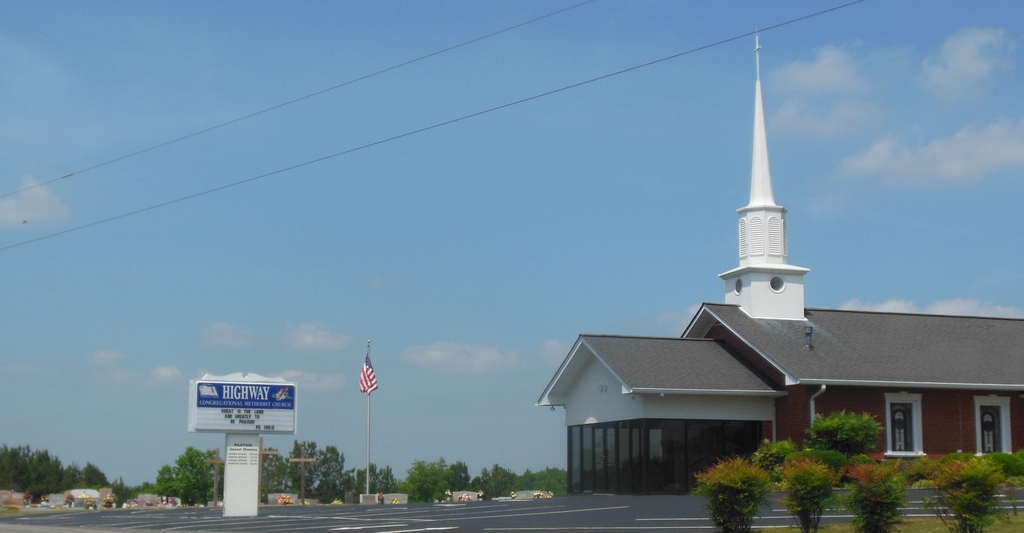
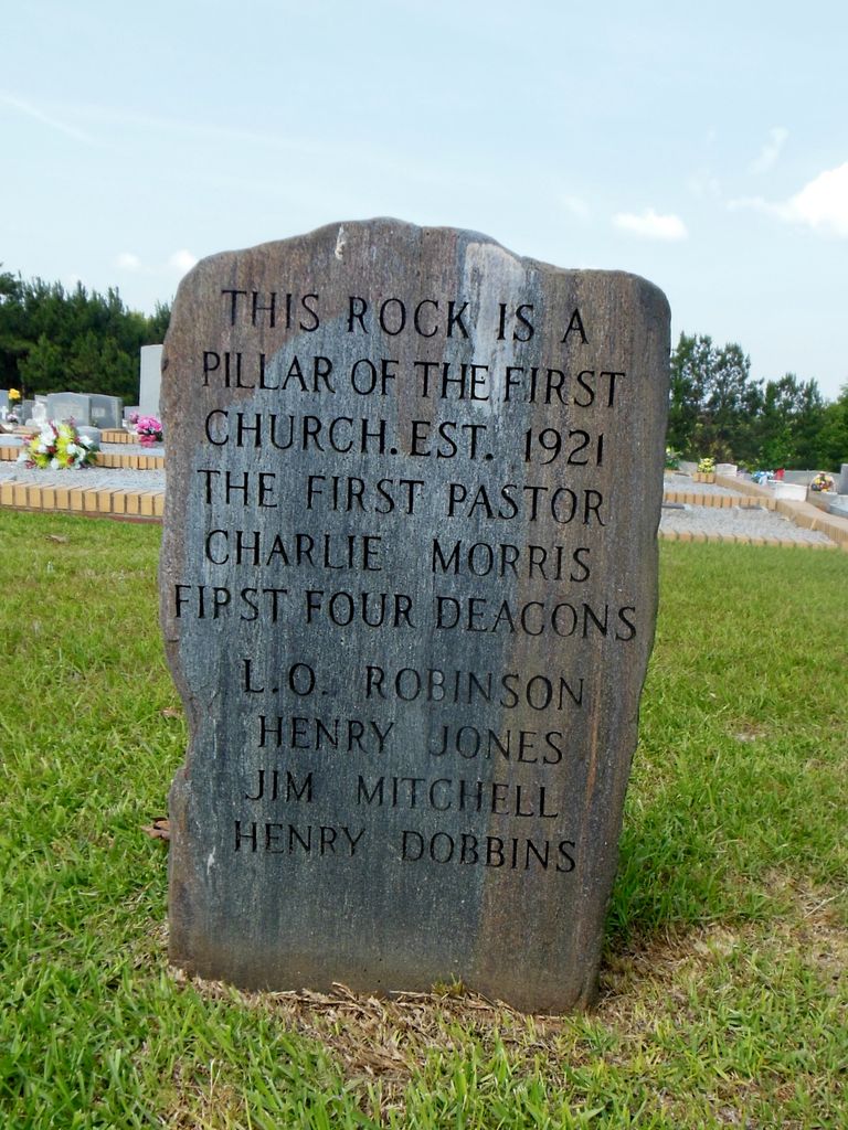
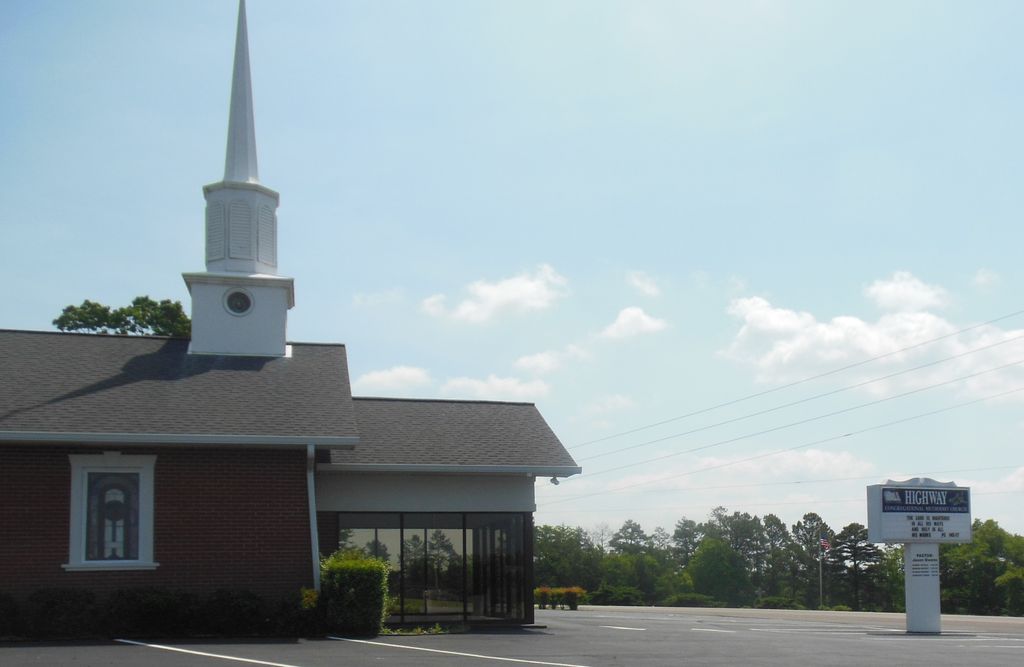
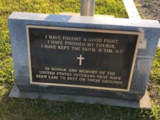
| Description | : | Highway First Congregational Methodist Church Cemetery Township 20, Range 12, Section 13 Randolph County, Alabama On County Road 65, Roanoke, Rt. #3 |
frequently asked questions (FAQ):
-
Where is Highway First Congregational Cemetery?
Highway First Congregational Cemetery is located at 9882 County Road 65 Roanoke, Randolph County ,Alabama ,USA.
-
Highway First Congregational Cemetery cemetery's updated grave count on graveviews.com?
1 memorials
-
Where are the coordinates of the Highway First Congregational Cemetery?
Latitude: 33.2768000
Longitude: -85.3539700
Nearby Cemetories:
1. Potash Church Of God Cemetery
Potash, Randolph County, USA
Coordinate: 33.2776900, -85.3489900
2. Highway Ridge Memorial Gardens
Randolph County, USA
Coordinate: 33.2778015, -85.3486023
3. Big Springs Cemetery
Roanoke, Randolph County, USA
Coordinate: 33.2873400, -85.3133160
4. Haywood Cemetery
Haywood, Randolph County, USA
Coordinate: 33.3039700, -85.3899100
5. East Napoleon Church of Christ Cemetery
Napoleon, Randolph County, USA
Coordinate: 33.3204560, -85.3494260
6. West Napoleon Church of Christ Cemetery
Napoleon, Randolph County, USA
Coordinate: 33.3244900, -85.3582600
7. Old Rocky Branch Cemetery
New Hope, Randolph County, USA
Coordinate: 33.3171997, -85.3977966
8. Wehadkee Missionary Baptist Church Cemetery
Roanoke, Randolph County, USA
Coordinate: 33.2237960, -85.3318520
9. Friendship Christian Cemetery
Roanoke, Randolph County, USA
Coordinate: 33.2585810, -85.4187610
10. Rocky Branch Baptist Church Cemetery
New Hope, Randolph County, USA
Coordinate: 33.3217087, -85.3998795
11. Greens Chapel Methodist Church Cemetery
Randolph County, USA
Coordinate: 33.2949510, -85.4256740
12. Pittman Family Cemetery
Randolph County, USA
Coordinate: 33.2203000, -85.3095300
13. Rock Stand Congregational Christian Church Cemeter
Roanoke, Randolph County, USA
Coordinate: 33.2242350, -85.4084310
14. Springfield Baptist Church Cemetery
Springfield, Randolph County, USA
Coordinate: 33.2129900, -85.3164140
15. Springfield Methodist Church Cemetery
Randolph County, USA
Coordinate: 33.2120830, -85.3185290
16. Mount Carmel Cemetery
Randolph County, USA
Coordinate: 33.3498650, -85.3439040
17. Beulah Baptist Church Cemetery
Roanoke, Randolph County, USA
Coordinate: 33.2667007, -85.2630997
18. Zion's Rest Primitive Baptist Church Cemetery
Roanoke, Randolph County, USA
Coordinate: 33.2024250, -85.3797090
19. Liberty East Baptist Church Cemetery
Omaha, Randolph County, USA
Coordinate: 33.3401230, -85.3005940
20. Noon Day Congregational Christian Church Cemetery
New Hope, Randolph County, USA
Coordinate: 33.3265800, -85.4250400
21. Flat Rock Congregational Methodist Cemetery
Omaha, Randolph County, USA
Coordinate: 33.3365173, -85.2920609
22. Old Lee Family Cemetery
Rock Mills, Randolph County, USA
Coordinate: 33.2188200, -85.2846000
23. High Point Church of God Cemetery
Franklin, Heard County, USA
Coordinate: 33.3163986, -85.2636032
24. Pike Family Cemetery
Randolph County, USA
Coordinate: 33.1960270, -85.3199710