
| Memorials | : | 1 |
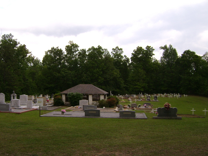
| Location | : | New Hope, Randolph County, USA |
| Coordinate | : | 33.3171997, -85.3977966 |
frequently asked questions (FAQ):
-
Where is Old Rocky Branch Cemetery?
Old Rocky Branch Cemetery is located at New Hope, Randolph County ,Alabama ,USA.
-
Old Rocky Branch Cemetery cemetery's updated grave count on graveviews.com?
1 memorials
-
Where are the coordinates of the Old Rocky Branch Cemetery?
Latitude: 33.3171997
Longitude: -85.3977966
Nearby Cemetories:
1. Rocky Branch Baptist Church Cemetery
New Hope, Randolph County, USA
Coordinate: 33.3217087, -85.3998795
2. Haywood Cemetery
Haywood, Randolph County, USA
Coordinate: 33.3039700, -85.3899100
3. Noon Day Congregational Christian Church Cemetery
New Hope, Randolph County, USA
Coordinate: 33.3265800, -85.4250400
4. Greens Chapel Methodist Church Cemetery
Randolph County, USA
Coordinate: 33.2949510, -85.4256740
5. West Napoleon Church of Christ Cemetery
Napoleon, Randolph County, USA
Coordinate: 33.3244900, -85.3582600
6. East Napoleon Church of Christ Cemetery
Napoleon, Randolph County, USA
Coordinate: 33.3204560, -85.3494260
7. Liberty Grove Church Cemetery
Randolph County, USA
Coordinate: 33.3569020, -85.4286910
8. Highway First Congregational Cemetery
Roanoke, Randolph County, USA
Coordinate: 33.2768000, -85.3539700
9. Mount Carmel Cemetery
Randolph County, USA
Coordinate: 33.3498650, -85.3439040
10. Potash Church Of God Cemetery
Potash, Randolph County, USA
Coordinate: 33.2776900, -85.3489900
11. Highway Ridge Memorial Gardens
Randolph County, USA
Coordinate: 33.2778015, -85.3486023
12. Friendship Christian Cemetery
Roanoke, Randolph County, USA
Coordinate: 33.2585810, -85.4187610
13. Hearn Gravesite
Randolph County, USA
Coordinate: 33.3098200, -85.4873080
14. Big Springs Cemetery
Roanoke, Randolph County, USA
Coordinate: 33.2873400, -85.3133160
15. Providence Baptist Church Cemetery
Providence, Randolph County, USA
Coordinate: 33.3970110, -85.3712540
16. Liberty East Baptist Church Cemetery
Omaha, Randolph County, USA
Coordinate: 33.3401230, -85.3005940
17. Flat Rock Congregational Methodist Cemetery
Omaha, Randolph County, USA
Coordinate: 33.3365173, -85.2920609
18. Rock Stand Congregational Christian Church Cemeter
Roanoke, Randolph County, USA
Coordinate: 33.2242350, -85.4084310
19. Levens Baptist Church Cemetery
Randolph County, USA
Coordinate: 33.3785000, -85.4836900
20. Mount Pisgah Methodist Church Cemetery
Randolph County, USA
Coordinate: 33.2616997, -85.4942017
21. Daniel Family Cemetery
Graham, Randolph County, USA
Coordinate: 33.3956100, -85.3200000
22. Rock Springs Cemetery
Roanoke, Randolph County, USA
Coordinate: 33.2221800, -85.4563210
23. Cavers Grove Congregational Christian Cemetery
Randolph County, USA
Coordinate: 33.3927920, -85.4896480
24. Old Cool Spring Cemetery
Randolph County, USA
Coordinate: 33.3992004, -85.4824982